


Refine your search for walks in Dolmen du Grès de Linas
Dolmen du Grès de Linas walks


 Visorando Member

Walks near Dolmen du Grès de Linas
 From Guillerval to Étampes via the Étang de Chalou-Moulineux

 11.08 mi
 +203 ft
 -427 ft
 5h 15
 Moderate
 Departure from Guillerval (Essonne)
A walk from station to station that alternates between paths through fields, along the edge of woods and through the woods themselves. For a while, the route runs alongside two rivers, the Louette and the Chalouette, a sub-tributary and a tributary of the Juine respectively. At the end of the route, the Church of Saint-Martin d’Étampes and its leaning bell tower add a superb touch of heritage.
Following the River Juine and its tributaries
 152.32 mi
+5,879 ft
-6,490 ft
20 days
Moderate
Departure from Angerville (Essonne) (Essonne)
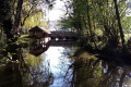
The River Juine rises on the Beauce plateau, flows through the town of Étampes and joins the River Essonne further on. This series of walks follows the course of this river. Several of the stages are linear routes running from station to station, whilst others are circular loops on the hillsides flanking the river.
From Angerville to Saclas via Méréville
 12.47 mi
+141 ft
-331 ft
5h 50
 Difficult
Departure from Angerville (Essonne) (Essonne)
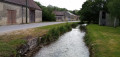
A long, straight walk offering a variety of scenery. After crossing a cultivated plateau, you follow the Juine valley, dotted with numerous watercress beds. After Méréville, the route takes you through woodland and then through linear villages.
Medieval walk in Étampes
 2.96 mi
+72 ft
-52 ft
1h 25
 Easy
Departure from Étampes (Essonne)
A former fortified royal town, Étampes boasts a superb heritage that this short urban walk invites you to discover, notably featuring four magnificent Gothic churches, including the Church of Saint-Martin with its bell tower leaning like the Leaning Tower of Pisa.
The heights and rivers of Étampes
 5.00 mi
+236 ft
-266 ft
2h 30
Easy
Departure from Étampes (Essonne)
This walk from station to station allows you to discover the heights of Étampes, with a beautiful view of the town, and to hike in the pleasant setting of the Louette and Chalouette valleys.
You can continue this hike by returning to the starting station (an additional 1.8 km) and take the opportunity to visit this small town, which is well worth a visit.
From Étampes to Étréchy through fields, woods and rocks
 7.68 mi
+397 ft
-456 ft
3h 55
Moderate
Departure from Étampes (Essonne)
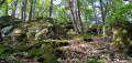
A hike that takes place on the slopes of the left bank of the Juine and on the plateau between the fields. The path through the Étréchy forest, between the boulders, is very pleasant.
From Dourdan to Rambouillet
21.04 mi
+640 ft
-476 ft
10h 35
 Very difficult
Departure from Dourdan (Essonne)
This stage is the last of the GR®1 and is over 30 km long. It crosses the western part of the Rambouillet Forest. The entire stage is through forest, except for the crossing of Saint-Léger-en-Yvelines. The route connects two towns with a rich history: Dourdan and Rambouillet. There are many straight lines on this route, which is mainly flat. There are a few notable ponds at the end of the route, such as the Étang de la Tour and the Étang d'Or.
Following the Orge
 80.26 mi
+3,734 ft
-3,868 ft
10 days
Moderate
Departure from Dourdan (Essonne)
The Orge river flows through the Essonne department, first from west to east and then diagonally from south-west to north-east. This route follows the valley as closely as possible, where it is accessible by train. The route alternates between paths along the river, including a promenade in the downstream section, passages through the undergrowth, residential areas and urban routes.
Following the Orge from Dourdan to Saint-Chéron
 9.18 mi
+407 ft
-554 ft
4h 35
Moderate
Departure from Dourdan (Essonne)
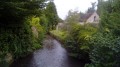
A hike from station to station in the upper Orge valley, following the river. Discover the rich heritage of Dourdan town centre (fortified castle, 12th-13th century church, wash houses, etc.) as well as beautiful churches along the way.
From Dourdan to Rambouillet through woods and forests
 13.31 mi
+440 ft
-318 ft
6h 30
Difficult
Departure from Dourdan (Essonne)
A hike from station to station, crossing the Dourdan Forest, the Bois de Saint-Benoît, the Bois de Pinceloup and the southern part of the Rambouillet Forest. Several lakes adorn the route and the church of Saint-Arnoult-en-Yvelines adds a superb touch of heritage.