Around Saint-Hilaire

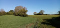
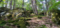
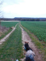
A bit of woodland, plenty of fields, the Beauceron countryside, the village of Saint-Hilaire, and two lovely climbs. That’s what’s in store for you.

Details

n°1235414
Creation:
Last update:
Last review:
  • Walking
    Activity: Walking
  • ↔
    Distance: 5.31 mi
  • ◔
    Average duration: 2h 45 
  • ▲
    Difficulty: Easy

  • ⚐
    Back to start: Yes
  • ↗
    Ascent: + 371 ft
  • ↘
    Descent: - 361 ft

  • ▲
    Highest point: 482 ft
  • ▼
    Lowest point: 269 ft
  • ⚐ Country: France
  • ⚐ City: Étampes (91150)
  • ⚑
    Start/End: N 48.428042° / E 2.117418°
  • ❏
    IGN map(s): Ref. 2216ET
  • Hour-by-hour weather

Photos

Description of the walk

Start from the small car park on the Sentier de Valnay at the junction with Rue de Pierrefitte.

(S/E) Take the cycle path (former railway line) to the right with the hillside (or Rue de Pierrefitte) behind you.

(1) At the first junction, turn right, following theGR®111signposts (note the Pierrefitte Menhir on the right, on private property). At the crossroads, head straight ahead (slightly to the left) onto the Chemin des Maures. Turn left onto theGR® and enjoy a lovely climb (passing under a power line).

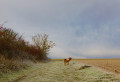
(2) On the plateau, stay on theGR® across the fields and note the beautiful view of the Louette valley on your left. You’ll reach a T-junction (you can turn right here for a return trip to the Château de Champrond).

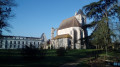
(3) Turn left, still on theGR®111B. At the Fork in the road, turn right and enjoy a lovely descent. The path gives way to a tarmac road (Rue du Montoir de la Croix). At the bottom, follow the Route de la Pierre Levée to the right. Cross the next junction (Rue du Prieuré) and, at the Fork in the road, keep to the right along this street (ruins of the chapel).

(4) After the barrier, at the Fork in the road, take the path slightly to the left which climbs steeply. Back on the plateau, go straight on.

(5) Turn right and follow a small road. At the three-way junction, turn left onto the side lane.

(6) After about 200m, cross the D821 (take care) and take a field path opposite (east). Cross a small road and continue along the path opposite. At the next junction, go straight on and pass under the high-voltage power lines. At the next junction (elevation 141), continue straight ahead.

(7) At the next junction, follow aPR® path (yellow markings) to the left.

(8) At the fork in the road, turn right. Shortly afterwards, ignore a path branching off to the right and enjoy a lovely descent. Cross Rue de Pierrefitte and return to the starting point (S/E).


Waypoints

  1. S/E : mi 0 - alt. 272 ft - Small car park (junction with Rue de Pierrefitte) - Louette (rivière)
  2. 1 : mi 0.55 - alt. 269 ft - Pierrefitte menhir
  3. 2 : mi 0.98 - alt. 423 ft - Plateau
  4. 3 : mi 1.76 - alt. 476 ft - Château de Champrond
  5. 4 : mi 2.27 - alt. 338 ft - Ruined chapel
  6. 5 : mi 2.62 - alt. 479 ft - Turn right
  7. 6 : mi 3.21 - alt. 469 ft - D821 road
  8. 7 : mi 4.82 - alt. 469 ft - Junction
  9. 8 : mi 5.09 - alt. 410 ft - Fork in the road
  10. S/E : mi 5.31 - alt. 272 ft - Small car park (junction with Rue de Pierrefitte)

Notes

If you can’t find a space in the small car park, head to Valnay Castle where you’re sure to find one.

Three-quarters of the route is exposed to the elements: do remember to wear a hat or a beanie depending on the season, as it can be quite windy in this area.

Always be cautious and plan ahead when you're outdoors. Visorando and the author of this route cannot be held responsible for any accidents occurring on this route.

The GR® and PR® markings are the intellectual property of the Fédération Française de Randonnée Pédestre.

Reviews and comments

4.2 / 5
Based on 2 reviews

Reliability of the description
4 / 5
Ease of following the route
4.5 / 5
Route interest
4 / 5
boucles d'or
boucles d'or

Overall rating : 3.7 / 5

Date of your route : Jan 24, 2021
Reliability of the description : ★★★☆☆ Average
Ease of following the route : ★★★★☆ Good
Route interest : ★★★★☆ Good
Very busy route : No

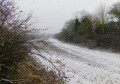
A hike undertaken in rather unusual weather conditions. There was a lovely frost first thing in the morning, and we ended up with wind and snow.
As for the description, I find it a bit brief.
At point (1), it’s not the first junction, but the second.
At point (3), it would be worth clarifying that this isn’t the first T-junction you come to. In fact, there’s one before it, where you can also turn left. We actually went the wrong way at this point, as the rest of the description was correct. We realised our mistake once we’d reached a road, which we had to follow to get back on track at Rue du Montoir de la Croix.
At point (4), there is no longer a barrier.
At point (5), please specify that the side lane is a cycle path; that way, we can be sure not to go astray.
To get to point (7), at no point in the description do you specify that you need to turn right.
In the end, we ended up covering 10.10 km. So yes, we did reach point (3), but not to the extent of walking nearly 2 km further.
The route isn’t very busy, except for the first section along the cycle path (walkers, runners, cyclists, etc.)

Machine-translated

ovil
ovil

Overall rating : 4.7 / 5

Date of your route : Dec 22, 2020
Reliability of the description : ★★★★★ Very good
Ease of following the route : ★★★★★ Very good
Route interest : ★★★★☆ Good
Very busy route : No

We have combined this walk with the one entitled ‘The Heights and Rivers of Etampes’.
The walk took place on a warm but damp winter’s day.
The GR 111 signposting no longer exists; it has been replaced by the yellow and red signposting of the GRP “Les Vallées de l’Essonne”.
At present, the path across the fields from point 6 to the power line is quite muddy; after that, it becomes grassy.
From point 2 onwards, the hillside has been developed into an ecological conservation area with paths and information boards.

Machine-translated

Other walks in the area

For more walks, use our search engine .

The GPS track and description are the property of this route's author. Please do not copy them without permission.