Country:
 City:
City:


Starting point and access: Angerville railway station.
- TER - Commuter service between Paris-Austerlitz and Orléans.
Take the exit at the rear of the train, platform 1 (the one for the Paris to Orléans direction), and go down the stairs leading to the car park. If arriving from the opposite direction, platform 2, take the corresponding exit (there is no designated crossing to get across the tracks), turn right twice to go under the railway bridge, then turn right again to reach the car park and the starting point.
Up to Pont de Luçon (18), apart from one exception to avoid too much tarmac (5) and a detour through Méréville (12), the route follows theGRP®® des Vallées de l’Essonne.
Red and yellow markings
Up to the Juine (7), signposting is sparse due to a lack of mounting points; it is mainly found on posts at major junctions.
(S) Follow Chemin Jousset south-eastwards, cross the small car park and walk alongside the railway line at a slight distance on your right. The road turns left at No. 20 and, when it turns right immediately afterwards, carry on straight ahead along a tarmac path which quickly becomes grassy. Walk alongside a housing estate on your left.
(1) Cross the D6 (take care, as there is no pedestrian crossing) and continue straight on along a field track. At the fork in the road at the edge of a woodland, turn right towards another woodland. Walk alongside this woodland on your left and, at the junction at the corner, go straight on. At the next junction, carry on straight ahead. Turn right onto the track at the edge of a woodland and walk alongside it on your left.
(2) At the T-junction, turn left. Carry on straight ahead, ignoring two turnings on the left, and alternate between paths through the fields and along a hedge or woodland. At the end of the track, turn right towards Méréville.
(3) At the next junction, turn left onto a very overgrown path and follow the edge of a woodland on your left. The path, which is clearly not maintained, soon gives way to a track or a simple strip of earth at the edge of the field on the right (please take care not to damage the crops). This is, however, theGRP®® route, as indicated by the signposts on site. At the end of the field, continue straight on between the woodland on the left and wasteland on the right, along a barely marked path. At the end, climb a slope to reach a small road (if the slope seems too steep, look for an easier way up on the right after a large tree and then turn left onto the road).
(4) Cross the road carefully, go through a metal gate and follow a local path through a private woodland (numerous signs instruct you not to leave the path). Go through a second metal gate and emerge onto a small road.
No signposting
(5) Follow the road to the left, preferably on its right-hand verge (let theGRP®® head off to the right). After about 200 m, at the start of a bend in the road, take thefirst path on the right. Continue straight on along this good path between fields on the left and a tree-lined hedge on the right.
Red and yellow markings
(6) At the end of the hedge, carry on straight ahead (due east) between the fields and rejoin the GRP®®. Walk along a gently sloping path and ignore all side paths. The path then descends more steeply through a shaded area. Turn left onto the path, which soon gives way to a tarmac road. Cross the Juine via a small bridge and you’ll immediately reach a T-junction.
Red and yellow + blue and yellow markings
(7) Follow the road to the left. At the Stop sign, cross Rue des Malmors on the right-hand side, walk a few metres further and turn right onto Rue de Beauvillard (the arrow clearly indicates to take thesecond right). When the road bends left towards a house, continue straight on along a shaded path. Walk downhill, ignoring a grassy path coming from the right, and you’ll reach a three-way junction.
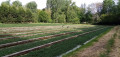
(8) Then turn off to the right. The path alternates between sections through the woodland and along the edge of watercress beds (on the left-hand side). At the next three-way junction (marker 93), follow the path on the right for about fifty metres.
Red and Yellow + Blue markings
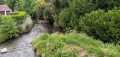
(9) Turn left onto a path closed to motor vehicles. Walk alongside a watercress bed on your left, then continue through the woodland. Walk alongside the River Juine on your left, noting the greenhouses and watercress beds beyond. After a wooden gate, head uphill and rejoin the tarmac road.
(10) At the T-junction, turn right onto Rue des Moulins and, after a few metres, turn left onto Rue des Grenouillères.
Red and yellow markings
At No. 202, head down the Chemin des Cressonnières to the left. Walk past a few houses and fences. Ignore a path branching off to the left towards a watercress bed, then another branching off to the right into a woodland at the corner of a house. Walk past more watercress beds on your left and continue through the woodland. Return to the tarmac road and climb a steep slope.
Red and Yellow + Blue Markings
At the top, you’ll come out onto a road; follow it to the left and downhill.
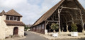
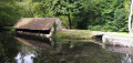
(11) At the end, follow the D18 to the left and cross the Juine (wash house). Note the wall of the Méréville Departmental Estate on the other side. At the Fork in the road, cross the road at the pedestrian crossing and follow Rue Curie towards the market halls. Take thefirst right, Rue Danton, and you’ll come out onto a square at the foot of the imposing old market hall.
Blue signposts
(12) Then take thefirst left, Rue Corpechot. At the end, first turn right then left to enter Passage Corpechot. Cross a street and continue along the passage opposite, slightly to the left. Walk down the passage until you come out onto an avenue; follow it to the right and pass in front of the town hall.
Red, Yellow and Blue Markings
(13) Continue along Avenue du Général de Gaulle (signposted ‘boulevard’ on site). At the end, follow the D18 to the right, slightly uphill towards Étampes. When the road bends to the left, carry on straight ahead on the C4 towards Guillerval. Head uphill with the wall of the Méréville Departmental Estate on your right.
(14) At the foot of the sign marking the exit from Méréville, take a path on the right, still following the wall. At a three-way junction at the edge of a wood, turn right and enter the wood, still following the wall. Walk downhill until you reach a sharp bend to the left.
(15) Then take the first path on the left (ignore the second one on the left, which runs parallel to the first at the start but descends quite steeply). Follow this path for some time as it descends gently through woodland with few clear views.
(16) You’ll come out onto a gravel track; follow it to the left, passing a rural lodge on your right. After less than a hundred metres, at the foot of an electricity pole, turn right onto a path that leads downhill. Walk alongside some gardens, then head uphill and come out onto a small road (with a geological site opposite). Follow the road to the right and downhill; you’ll soon reach a junction at a place called Boigny.
Red and yellow markings
(17) From here, the route follows tarmac roads throughout. If you wish to avoid this section and shorten the walk by about 3.5 km, follow the alternative route described in the practical information. Otherwise, as shown on the map, continue straight on along the Chemin de Bossenval. Pass through the linear villages of Boigny and Bossenval in turn, noting a few fine houses along the way. Enter Saclas via Rue du Pont de Luçon.
No signposting
(18) At the junction, there are two options:
- Turn left onto theGRP®® (see the alternative route described in the practical information).
- Carry on straight ahead along Rue Pasteur, taking the pedestrian path marked on the right-hand side of the road, followed by a good-quality pavement. Cross Rue de l’Orme on the left and continue along Rue de Gittonville, a quiet little road. Cross Chaussée des Gouvières on the right and carry on along Rue Julien Bidonchon.
Red and yellow + yellow markings
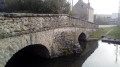
(19) At the Stop sign, turn right and head downhill. At the next Stop sign, go straight on. Cross Rue des Moulins on your right and continue until you reach a bridge over the Juine.
No signposting
(20) Two options here:
- For a stop by a small lake, follow the alternative route described in the practical information.
- Otherwise, as shown on the map, cross the bridge over the river. At the Stop sign, turn left onto Rue Joliot Curie.
Red and yellow + yellow signposting
On the left-hand side, you’ll come across a path blocked by a barrier; carry on straight ahead until you reach the corner by Saclas Town Hall. Then turn right onto Rue du 19 mars 1962, and you’ll soon reach the bus stop and the Town Hall car park (E).
To get back home:
- Bus – Line 332 towards Étampes station (connection with the RER C) or Méréville.
The bus stop (with a shelter) is situated a few metres past the bus stop (without a shelter) for lines 316, 317 and 318.
 Visorando Member
 Moderate
 Easy
Easy