


Refine your search for walks in Col de Lachaud (927m)
Col de Lachaud (927m) walks


 Montagne de la Lance from Venterol
 Visorando Member
 17.90 mi
 +6,260 ft
 -6,263 ft
 6 hrs
6 hrs
 Very difficult
 Departure from Venterol (Drôme) (Drôme)
A very long, challenging circular route around the Montagne de la Lance, easily recognisable by its long, curved shape.
A 360° panoramic view from its summit at over 1,300 metres. To the west, a view over the Rhône valley (Tricastin, Donzère wind turbines); to the east, a wilder, more mountainous landscape featuring the Southern Pre-Alps, notably the Montagne d’Angèle and Mont Cougard; also the Diois region with the Trois Becs to the north; and finally, Mont Ventoux and the Dentelles de Montmirail to the south.
 L’Adret de la Lionne – Dieulefit-Bourdeaux region
 Local authority11.01 mi
+2,805 ft
-2,825 ft
4 hrs
Very difficult
Departure from Teyssières (Drôme)
Local authority11.01 mi
+2,805 ft
-2,825 ft
4 hrs
Very difficult
Departure from Teyssières (Drôme)
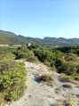
This challenging route, exceptional for its elevation gain and technical trails, will take you from the lavender fields of Teyssières to the summit of Cougoir, at 1,220 metres. The 360° panorama will allow you to enjoy a sweeping view of the Pays de Dieulefit and the valleys of the Drôme Provençale.
 Difficult