Country:

 City:


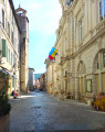
Departure from the village square.
(S) Take the D130 towards Teyssières, then, after about 150 m, turn left onto the small road, Chemin de la Combe de Maret. Head towards the hamlet of Ravoux, and continue walking towards the bottom of the valley. After 4 km, pass the Ponçon farm and continue along the stony track beside the stream. After another 1 km, pass by a ruin (Les Augiers) and then reach the Ferme du Col at the Col de Blanc.
(1) Take the path on the left. After 500 m, take the hairpin bend to the right and climb up to the ridge at an altitude of 1,070 m.
(2) At the signpost, begin the descent to the right. Descend 250 m to a junction with a gravelled track suitable for vehicles.
(3) Follow it to the right and climb up to the paragliding launch site.
(4) Leave the track and take the path on the left towards Vesc. Follow the ridge for the most part and descend to a cross-country path.
(5) Turn right and continue along the northern slope of the mountain.
(6) At the road, turn left, then take the first road on the right. Head up to the church, then join the departmental road at the end of Rue de l’Église.
(7) Take the road on the right as far as the entrance to the campsite, then turn left onto Rue Étienne de Vesc. Walk through the village, past the town hall, and carry on to the fountain in Place George Barnier.
(8) Take the street on the right, Rue de l’Apothicaire, then immediately turn left onto Rue des Anciennes Étables. At the end, turn left and continue to the end of Rue de l’Abbé Soulier, then walk a few metres to the left.
(9) At the junction, carry on to the right onto the D223, Route de Comps, and leave the village. Follow the road uphill, go round a hairpin bend to the left, then turn left onto Chemin de Guinard. You’ll come to a sharp bend to the left at the bottom of the descent.
(10) Take the path that climbs to the right towards the Col de Vesc. At the three-way junction that follows, keep to the right and continue uphill until you reach a cross-path.
(11) Carry on to the right, pass a ruin and head straight on until you reach a road. Turn left onto this road (the Col de Vesc is about 200 m to the right) and you’ll arrive at the junction with the D191.
(12) Leave the tarmac and follow the path leading uphill opposite. Head almost in a straight line until you come to a path on the left marked by a cairn.
(13) Turn left onto the well-marked path which descends to a road.
(14) Follow it to the right, cross a plateau with meadows on either side, then enter the forest and walk for about fifty metres until you come to a path on the left.
(15) Take this path and head down to a road. Continue down the slope to the left, then turn right onto Chemin de l’Église.
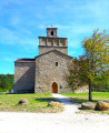
(16) Do take a moment to walk round this magnificent church, then carry on along the path which descends steeply.
(17) At the bottom of the slope, take the path opposite. Ignore a path that climbs to the right and continue along the mountainside. Pass through two metal gates and carry on straight ahead along the track. When you reach the first houses, you’ll come to a tarmac road.
(18) At the junction, keep to the right, then take the next alleyway on the left. Just before the barrier, take the path on the right until you reach another tarmac road. Walk down it and take the first street on the right.
(19) At the end of Rue Fontette, turn left and carry on straight ahead. Pass between the Town Hall and the belfry and continue straight on along Rue du Bourg.
(20) At the fountain and the temple, keep to the right, follow the road downhill, cross the bridge over the Jabron and you’ll arrive at the coach station (E).
 Visorando Member
 Easy

 Moderate