Country:

 City:


To reach the start, follow the D330 between La Paillette and Vesc and turn off onto the first small road on the right (just before a bridge). Follow this for 3 km and, where the tarmac ends, park near the DFCI water tank.
Take care not to obstruct the work of the fire service by parking between the road and the water tank.
(S/E) Follow the road downhill to the three-way junction. Turn right, uphill, onto Chemin d’Auvergne. Ignore Chemin de Germaine on the right and head for the start of a path on the left at the hairpin bend that follows.
(1) Leave the track and follow the path on the left, which turns into a footpath about a hundred metres further on. Cross a gully and continue along the mountainside, keeping a sheep fence on your left, until you reach a three-way junction.
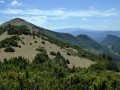
(2) Continue along the right-hand branch until you reach a fork at the shoulder of Montagne de Ruy.
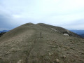
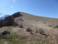
(3) Head up to the right (yellow-red markings), pass a flat section by curving to the left and reach the ridge. The path continues to climb, more or less following the ridge, and joins a track suitable for vehicles with a paragliding launch site.
(4) Continue along the track, following the ridge until you reach a right-hand bend, where you’ll find the start of a very inconspicuous path on the left. Take this path, which continues to climb along the ridge, and arrive at the Grand Ruy, which also has a paragliding launch site.
(5) Carry on along the track until you reach the hairpin bend.
(6) Leave the track and head down the slope, following the ridge. The path is very faint, if not non-existent, on a steep slope but without any technical difficulty.
An old sheep fence also serves as a guide; follow it to your left. Pass quickly past a hunting lookout on your right (a garden chair perched on a tree) and continue down this steep slope to the plateau at Col Gauthier. Note a second lookout (a water reservoir) about twenty metres to the right, then continue along the ridge and, a few metres further on, take a small path to the next fork.
(7) Turn right, descend to the bottom of the valley and join a track suitable for vehicles at a hairpin bend. Cross the stream and continue straight down until you reach the tarmac road with the DFCI water tank (S/E).



 Visorando Member

 Moderate
 Easy