Pic de Peyre Eyraute

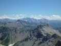
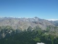
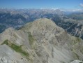
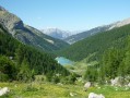
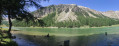
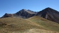
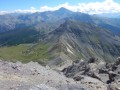
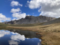
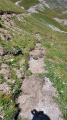
A summit situated above the village of Les Ayes and Lac de l’Orceyrette, offering a breathtaking 360° panorama of the Écrins, the Cerces and the Queyras. A challenging ascent leading to a very scenic ridge.

Details

281976
Creation:
Last update:
Last review:
  • Walking
    Activity: Walking
  • ↔
    Distance: 4.78 mi
  • ◔
    Duration according to the author: 5 hrs 
  • ▲
    Difficulty: Very difficult

  • ⚐
    Back to start: Yes
  • ↗
    Ascent: + 2,890 ft
  • ↘
    Descent: - 2,890 ft

  • ▲
    Highest point: 9,439 ft
  • ▼
    Lowest point: 6,549 ft

Photos

Description of the walk

Access: From Briançon, head to Villar-St-Pancrace via the D36 (south of Briançon) then take the small road to Les Ayes. Drive through the hamlet and follow the track to Lac de l’Orceyrette. Continue up the track and park at the second hairpin bend. It is possible to park by the lake (in which case you will need to add 100m of elevation gain).

(S/E) From the hairpin bend, follow the path south-west, then west, then north-west towards the Chalets de l’Orceyrette. Join the track leading to the Chalets de l’Orcière (a short cut). Take the path (the track) towards the chalets. Reach them.

(1) Climb north-northeast through the grassy slopes to reach the ridge line. Then follow the ridge line to the rock pinnacle.

(2) Go round it on the left: descend the small chimney and climb straight back up to reach the ridge. Continue along the ridge to the summit.

(3) For the return journey, there are two options: follow the outward route in reverse (S/E).

Alternative route: you can cut across to the right before the rock outcrop via the scree slope to reach the Chalets de l’Orcière more quickly, then follow the outward route in reverse.

Waypoints

  1. S/E : mi 0 - alt. 6,549 ft - Parking
  2. 1 : mi 1.25 - alt. 7,388 ft - End of the path, start of the off-trail section
  3. 2 : mi 2.03 - alt. 8,668 ft - Gendarme
  4. 3 : mi 2.39 - alt. 9,413 ft - Pic de Peyre Eyraute
  5. S/E : mi 4.78 - alt. 6,549 ft - Parking

Notes

I’ve made a video that captures the atmosphere of this route and clearly shows the passage over the gendarme.

What can I say about this route?
The slopes are very steep and therefore require a good level of fitness.
The somewhat exposed ridge may put off hikers who are prone to vertigo.

For the off-trail section, I have reconstructed the route on Google Earth. At the time, I wasn’t using a GPS. This off-trail route gives an idea of the route but is therefore approximate. However, for this section concerning the ascent, the description is sufficient.

Reviews and comments

5 / 5
Based on 3 reviews

Reliability of the description
5 / 5
Ease of following the route
5 / 5
Route interest
5 / 5
Pytheas
Pytheas

Overall rating : 5 / 5

Date of your route : Nov 08, 2024
Reliability of the description : ★★★★★ Very good
Ease of following the route : ★★★★★ Very good
Route interest : ★★★★★ Very good
Very busy route : No

Hi
Taken this Friday, 8 November.
Still no snow and the larch trees still have their needles; it’s magnificent around Lake Orceyrette.

The route is easy to follow as there are sheep tracks pretty much everywhere up to the ridge. The easiest way is to take the track to the Chalets d’Orcière. For the quickest route, follow the suggested guide.
I agree with the guidebook regarding the steep slopes and altitude, which can be tough going depending on the individual.

On the other hand, the ridge isn’t that exposed and you’re generally below it.

Without dawdling on the ascent, with a 20-minute break at the summit and a descent via the scree slopes followed by a run, it took me 2½ hours round trip from the hairpin bend mentioned (the one closest to the stream, just past the chalet).

However, I regret taking the scree slopes, as the marmots are hibernating. So best avoided.

The view is a wonderful reward!!!

Machine-translated

Chauvelinus
Chauvelinus

Overall rating : 5 / 5

Date of your route : Oct 25, 2021
Reliability of the description : ★★★★★ Very good
Ease of following the route : ★★★★★ Very good
Route interest : ★★★★★ Very good
Very busy route : No

A hike off the marked trail, but with a well-trodden path along much of the ridge. Stunning views from the summit. A popular route: 8 people at the summit today (All Saints’ Day holidays), but not overly crowded. We set off from Plan Peyron, which meant a 1,064m climb. A lovely hike that’s well worth doing again.

Machine-translated

carletto francis
carletto francis

Overall rating : 5 / 5

Date of your route : Oct 16, 2018
Reliability of the description : ★★★★★ Very good
Ease of following the route : ★★★★★ Very good
Route interest : ★★★★★ Very good

A very beautiful, challenging hike offering exceptional views from the summit

The route is fairly straightforward, but you need to be careful on certain sections

Going round the ‘gendarme’ on the left isn’t very difficult; to get past it more easily, you simply need to climb down it

A short rope (10m) might reassure those who are a bit hesitant
For the return journey, the descent through the scree is of only limited interest – nothing out of the ordinary
Personally, I prefer the ridge route

You do need to be in good physical shape to fully appreciate the views

The autumnal landscapes around Lake Orceyrette offer an unforgettable moment of poetry
A camera is essential (never mind the weight)

Machine-translated

Other walks in the area

For more walks, use our search engine .

The GPS track and description are the property of this route's author. Please do not copy them without permission.