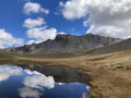
Pic de l’Aiguiller via the Rocher du Roux.

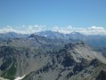
A challenging hike to one of the most panoramic viewpoints in the Briançonnais region.
The climb to the Rocher du Roux, which is of moderate difficulty, is in itself a very beautiful route.
The route includes sections off the beaten track, where I recommend using the Visorando app.
See the ‘Practical Information’ section.

Details

n°281572
Creation:
Last update:
Last review:
  • Walking
    Activity: Walking
  • ↔
    Distance: 5.57 mi
  • ◔
    Average duration: 4h 50 
  • ▲
    Difficulty: Difficult

  • ⚐
    Back to start: Yes
  • ↗
    Ascent: + 2,572 ft
  • ↘
    Descent: - 2,572 ft

  • ▲
    Highest point: 8,907 ft
  • ▼
    Lowest point: 6,332 ft

Photos

Description of the walk

Access: from Briançon, head towards Villar-Saint-Pancrace to the south of the town, then head towards the mountain centre and turn left onto the track towards the hamlet of Les Ayes.
At the junction with the signposts, turn right towards ‘Les Ayes via the forest’ in the direction of the hamlet of Mélézin. The track on the left also leads to the hamlet but has numerous potholes.
At the next junction, turn left and follow the track to the Chalets des Ayes.
This track is easily passable by car and allows any vehicle to reach the hamlet.
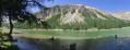
After passing through the hamlet, take the track towards Lac de l’Orceyrette and park by the lake.
Another parking option: if you have a vehicle with higher ground clearance, continue along the track, climbing above the lake, then at the junction take the track on the left. After a 2.5 km climb, you’ll reach the Chalets de l’Alp. Park on the left-hand side of the track at the hairpin bend just before the sheepfold.

(S/E) From Lac de l’Orceyrette, follow the road to the Chalets de l’Alp.
Walk up the lane towards the Chalets de l’Alp until you reach the first chalet on the right.

(1) Leave the lane and head due east, passing to the left of the chalet.
Continue in the same direction until you reach the last chalet. (This one has a distinctive larch roof.)
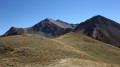
Climb generally north-eastwards to the Rocher du Roux, which you will need to go round to the right. Follow a small cairn-marked path (not shown on the IGN map) which leads to the foot of the rock and then runs along its right-hand side.

(2) Continue in the same direction to the base of the large sloping ridge descending from the Pic de l’Aiguiller.
Climb this slope as best you can, gradually moving closer to its left-hand side without getting too near it. A distance of 5 to 6 metres is ideal. Its edge is slightly winding, which helps to keep you out of the line of exposure.
You’ll emerge onto a narrow ridge, which you follow gently southwards for 80 metres to the summit.

(3) Return in the opposite direction via the same route to the car park (S/E).

Waypoints

  1. S/E : mi 0 - alt. 6,335 ft - Lac de l'Orceyrette
  2. 1 : mi 1.58 - alt. 7,201 ft - Allée des Chalets de l’Iap. Return
  3. 2 : mi 2.37 - alt. 8,114 ft - Rocher du Roux
  4. 3 : mi 2.79 - alt. 8,907 ft - Summit of the - Pic de l'Aiguiller (2725m)
  5. S/E : mi 5.57 - alt. 6,335 ft - Lac de l’Orceyrette

Notes

I’ve made a video, complete with the names of the peaks, which shows the route and the atmosphere of the walk.

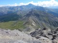
It’s a hike that’s partly off-trail, involving a climb up a steep slope, which rounds off the panorama with a magnificent view of the Écrins.
Although it can be done with a map and compass, navigating using GPS or the Visorando app will be easier.
Suitable for experienced hikers accustomed to this type of terrain and with a head for heights.
I would rate the difficulty as upper medium.
However, access to the Rocher du Roux presents no difficulty.
From the Chalets de l’Alp, allow 3 hours to complete this 5 km route.

Note: I do not recommend continuing along the ridge towards the Pic des Chalanches. This section of the ridge becomes very narrow and highly exposed on loose rock.
On the way down, don’t forget to visit the Rocher du Roux if you didn’t see it on the way up. It’s an
ideal spot for a picnic and to take in the views. This rock is large enough to accommodate a group of walkers.

Reviews and comments

4.7 / 5
Based on 1 review

Reliability of the description
5 / 5
Ease of following the route
5 / 5
Route interest
4 / 5
Britanicus100
Britanicus100

Thank you for your comment. Yes, the Vallouret ridge is good too. I’m very familiar with the section leading to the Taure chalets
which is featured in the guide I wrote on the Crête des Brusas.
I didn’t want to make it too long, but for those who want to do more, it’s a good idea. Thank you.

Machine-translated

thomdul
thomdul

Overall rating : 4.7 / 5

Date of your route : Aug 03, 2016
Reliability of the description : ★★★★★ Very good
Ease of following the route : ★★★★★ Very good
Route interest : ★★★★☆ Good

A lovely walk leading to a superb viewpoint overlooking the main peaks (Viso, Thabor, Ecrins, etc.).
Whilst chatting to a resident of the Alp chalets along the route, he suggested we make it a circular route rather than a return trip (hence the obvious appeal of the route, as it can be improved by adding a circular route).
Once at the summit, continue along the ridge for as long as possible (not for very long, as it soon becomes dangerous – rocky and unstable). Head down towards the beautiful, very prominent grassy ridge visible below (the Crête de Vallouret). The descent is very steep, but if you keep slightly to the left, there’s some vegetation to prevent you from slipping. Once on the ridge, follow it until you catch sight of the main path, which you should join as best you can (marked on the IGN map – towards elevation 2444). Turn left towards the Chalets de la Taure. There, take the path that heads right and, at the first junction, turn left to join the Swiss stone pine nature trail. You’ll arrive at marker No. IX. Descend through a beautiful forest along a lovely little path. At marker No. XII, you’ll come across a wider track (not shown on the IGN map), possibly an old forest track. Take this to the left to reach the lake a little more quickly. Once at the bottom, you’ll find yourself back on the path that runs alongside the stream and leads quickly to the lake to complete the circular route.
I can send you the GPX file if required.
Thanks for the route suggestion.

Machine-translated

Other walks in the area

For more walks, use our search engine .

The GPS track and description are the property of this route's author. Please do not copy them without permission.