


 Country:
 City:
City:


Start from the car park at the Complexe des Ajoncs d’Or, on the left at the start of Rue des Sapins, near the junction with Rue de la Fieffe and Rue de l’Épine (D16).
(S/E) Walk past the building on your left and take the small path that winds down in an ‘S’ shape behind the sign detailing the route.
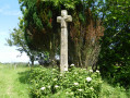
When you reach the road, turn right onto the grassy track. Join the road and take the sunken path on the left about a hundred metres past the wayside cross. Follow it as it winds its way round the bends.
(1) When you reach a wide track, follow it to the left for about 70 metres and turn onto a path on the left.
When you reach a road, turn left. After 250 metres, turn right onto a north-facing path.
(2) Take the D16 county road to the right and follow it to the access road to the hamlet of Moulanou. Head into the hamlet.
(3) In this hamlet, turn right and cross the road that cuts through the botanical garden (see below, during the walk). Continue along this path until you reach a Y-junction.
(4) Carry on to the left and, at the end of the path, turn right towards La Giraudais. Turn right and follow a sunken path until you come to the start of a footpath on the left.
(5) Follow the path to the left and continue to the right along the road, then very quickly turn right towards the Petite Giraudais.
After the shed on your left, join the access road and immediately turn right onto the path.
(5) Continue to the left. Cross the Giraudais again and, at the right-hand bend, follow the track to the left.
(4) Leave the route you took on the way there and carry on straight ahead until you reach the road. First turn right then left for 20 metres and continue straight ahead.
(6) After Grand Couveloup, stay on the road and follow it to Champ Hec. At the hamlet, turn right.
(7) At the 90° left-hand bend, leave the road and take the path continuing in a due south direction.
As you approach a high-voltage power line, follow the path to the right. Cross the hamlet of La Thiolais and reach a small road. Take this road on the right.
(8) Opposite the Route des Loges, turn left onto the grassy path.
(9) At the crossroads, with the carved Hôtelières Cross on your left, carry on straight ahead.
As you approach a small road, ignore the path (not shown on the map) that turns left towards the Ardennes and take the path on the right. Cross the road and continue straight ahead.
(10) At the fork, turn right and cross La Foire, keeping to the right (watch out for the dog).
After the hamlet, the path veers to the left and heads west.
Note the pond on your right and reach La Ville-en-Bois, where the path becomes a road.
Carry on straight ahead to reach the car park (S/E).

 Visorando Member
 Easy
Easy 

 Local authority
