Circular Civray to the Chaffaud Caves

Circular walk to the east of Civray, following a route that runs alongside the Charente before a picturesque walk where you’ll discover a beautiful church, sarcophagi and prehistoric caves. An easy walk suitable for families.

Details

18394957
Creation:
Last update:
Last review:
  • Walking
    Activity: Walking
  • ↔
    Distance: 8.70 mi
  • ◔
    Average duration: 4h 10 
  • ▲
    Difficulty: Moderate

  • ⚐
    Back to start: Yes
  • ↗
    Ascent: + 213 ft
  • ↘
    Descent: - 203 ft

  • ▲
    Highest point: 482 ft
  • ▼
    Lowest point: 358 ft

Description of the walk

Park in the car park at the Espace François Mitterrand, Rue du Pont de Barres.

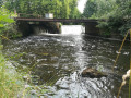
(S/E) Walk down to the banks of the Charente to join a signposted path, then turn left to follow the river along the right bank. Go round a small copse opposite a playground, then turn right below the departmental road. Pass under it through a tunnel and continue to a footbridge crossing a branch of the river.

(1) Take this footbridge and carry on to a second footbridge on the right. Cross this one too, then continue along the left bank of the Charente on a gravel path until you reach a small concrete bridge spanning the river.

(2) Cross this bridge and walk through the leisure area on the left to reach a wooden footbridge. After the footbridge, take the road on the right which climbs alongside the campsite.

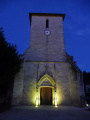
(3) At the top of the hill, turn right onto the Route de Loing and follow it to the village of Savigné. At the Stop sign, stay on the pavement on the right alongside the D148 (Route de Limoges) for about fifty metres, then turn right onto the road called Grande Rue, which leads down into the Érable neighbourhood. Continue until you reach the church at the bottom on the right.

(4) Opposite the church, turn left from the square by the war memorial and head back up towards the cemetery via Rue de la Poste. At the end of the street, cross the D148 at the pedestrian crossing, which is slightly offset to the right, and take Rue de la Sablière opposite. At the first junction, at number 1 on the street, turn onto the path that branches off diagonally to the right.

(5) At the end of this path, take the small road on the right and continue for a few dozen metres until you reach a slight bend to the right. Then take a small path on the left between the trees, which leads to the old railway line. Turn right and follow it.

(6) Pass under the stone bridge and then past the old Savigné station. Continue for 700 metres until you reach a junction.

(7) Take the road on the right and carry on until you reach the entrance to the hamlet. Opposite a farmyard, follow the road to the right for about 150 metres, then turn left at the corner of a large building. Carry on until you reach a three-way junction and turn right. Carry on to the D148; cross carefully to reach the opposite side, heading towards the restaurant “Le Relais du Pays Civraisien”.

(8) After about 50 metres, follow the signposting to the left to reach the Grottes du Chaffaud. The path forms a circular loop of about 1 km.

(9) Take the footbridges to cross the Charente. At the end of the second footbridge, continue straight ahead along a path that climbs between two barbed-wire fences. At the end, turn right onto the road until you reach the house marked No. 4, then turn left. About 40 metres past the house, take the road on the right and continue along the path that follows on from it.

(10) At the metal shelter, cross the road and take the path opposite for about 600 metres, then turn right onto the path at the edge of a wooded area. After about 100 metres, leave the path on your right and continue straight on until you reach the D36 at the entrance to the village of Montazais.

(11) Opposite a white house with blue shutters, take the D36 to the left, then the first path on the right (signpost 24) following the sign for ‘Sur les pas d’André Theuriet’. Follow the path to the next tarmac road.

(12) Turn left. About sixty metres further on, leave the track on your right and continue along the road. At the next three-way junction, turn right onto Route de Montazais. At the end of the road, turn left and continue along Route des Âges until you reach the ‘Give Way’ sign.

(13) Cross the D1 and follow the road opposite, called Rue du Pré du Moulin. At the ‘Stop’ sign, turn right onto Rue du Puits Carré.

(14) At the ‘Stop’ sign, carry on straight ahead towards the town centre, cross the two bridges spanning the branches of the Charente and continue along Rue du Pont des Barres. After the Hôtel du Commerce, take the first right to reach the Espace François Mitterrand car park (S/E).

Waypoints

  1. S/E : mi 0 - alt. 361 ft - Espace François Mitterrand car park
  2. 1 : mi 0.34 - alt. 361 ft - Footbridge - Charente (fleuve)
  3. 2 : mi 0.86 - alt. 364 ft - Concrete bridge
  4. 3 : mi 1.18 - alt. 436 ft - At the top of the hill, turn right
  5. 4 : mi 2.24 - alt. 390 ft - Savigné Church
  6. 5 : mi 2.68 - alt. 417 ft - Turn right
  7. 6 : mi 3.1 - alt. 456 ft - SNCF bridge
  8. 7 : mi 3.78 - alt. 443 ft - Junction, on the right
  9. 8 : mi 4.67 - alt. 440 ft - Access to the Chaffaud Caves
  10. 9 : mi 5.25 - alt. 377 ft - Wooden footbridge
  11. 10 : mi 5.87 - alt. 430 ft - Small tin shelter
  12. 11 : mi 6.73 - alt. 440 ft - Montazais
  13. 12 : mi 7.51 - alt. 443 ft - Tarmac road, on the left
  14. 13 : mi 8.22 - alt. 433 ft - D1
  15. 14 : mi 8.59 - alt. 371 ft - Rue du Puits Carré, Stop
  16. S/E : mi 8.7 - alt. 361 ft - Espace François Mitterrand car park

Notes

(8) You can avoid the circular cave loop if you don’t feel up to it by not taking the path. In that case, carry on straight ahead to the banks of the Charente (9).

Worth a visit

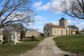
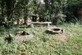
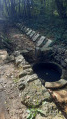
(4) Savigné Church. Note the beautiful architecture, as well as the gravestones and sarcophagi on display nearby.

(6) Stone bridge, a testament to late 19th-century railway architecture.
The station is situated on the former railway line that linked Saint-Saviol to Lussac-les-Châteaux. This 64-kilometre-long single-track line was opened in several stages by the Compagnie PO (Paris-Orléans), with the section between Saint-Saviol – Civray – Charroux (17 km) on 15 November 1886. The station, built in 1880, was fitted with a telegraph service in 1902. Commercial activity was significant, and the railway opened up new prospects at the turn of the century.

Reviews and comments

4.3 / 5
Based on 3 reviews

Reliability of the description
4.3 / 5
Ease of following the route
4.3 / 5
Route interest
4.3 / 5
FOURNYMICHELLE1
FOURNYMICHELLE1

Overall rating : 4 / 5

Date of your route : Jun 13, 2025
Reliability of the description : ★★★★☆ Good
Ease of following the route : ★★★★☆ Good
Route interest : ★★★★☆ Good
Very busy route : Yes

The caves are still closed, but it's a beautiful hike. The part that crosses areas of large farms is mostly on tree-lined paths.

Machine-translated

lefadelavienne
lefadelavienne

Overall rating : 4 / 5

Date of your route : Jun 30, 2024
Reliability of the description : ★★★★☆ Good
Ease of following the route : ★★★★☆ Good
Route interest : ★★★★☆ Good
Very busy route : No

A lovely walk with some beautiful spots. The Chaffaud Caves are more accessible (for safety reasons) but make for a splendid picnic spot on the banks of the Charente.

Machine-translated

Christiane Laure
Christiane Laure

Overall rating : 5 / 5

Date of your route : Sep 19, 2023
Reliability of the description : ★★★★★ Very good
Ease of following the route : ★★★★★ Very good
Route interest : ★★★★★ Very good
Very busy route : No

A very pleasant walk, with few visitors out of season.
Detailed descriptions; we’d like to add a few clarifications.
Re point 7: rather than following the D148 just after crossing it to reach the ‘Relais du Pays Civraisien’ restaurant, it is better to head down to the lower level and take the path on the right (which is safer).
At point 8: it is no longer possible to complete the 1 km circular route to see the Chaffaud caves in their entirety. You can only get as close as the path allows (they are cordoned off for safety reasons) before continuing the walk towards the Charente.
At point 9: at the top of the passage, there is a gate (which may not always have been there); please make sure you close it properly behind you.

Machine-translated

Other walks in the area

For more walks, use our search engine .

The GPS track and description are the property of this route's author. Please do not copy them without permission.