The Orchid Trail

There are still a few orchids!
Moderator’s warning dated 10/05/2021. Warning! No recent updates for this walk. See reviews.

Details

5144
Creation:
Last update:
Last review:
  • Walking
    Activity: Walking
  • ↔
    Distance: 9.85 mi
  • ◔
    Average duration: 4h 45 
  • ▲
    Difficulty: Moderate

  • ⚐
    Back to start: Yes
  • ↗
    Ascent: + 249 ft
  • ↘
    Descent: - 266 ft

  • ▲
    Highest point: 476 ft
  • ▼
    Lowest point: 367 ft
  • ⚐ Country: France
  • ⚐ City: Vaux (Vienne) (86700)
  • ⚑
    Start/End: N 46.288568° / E 0.201797°
  • ❏
    IGN map(s): Ref. 1728SB, 1729SB
  • Hour-by-hour weather

Photos

Description of the walk

(S/E) Set off from the place known as “Chez Gachat” along the road heading south-east.
After 300m, cross the road and take the Chemin des Fontaines 20m further on to the right, heading towards “La Forêt”.

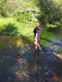
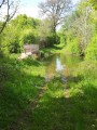
(1) Turn right, then left, and carry on to the river (which is dry for 11 months out of 12); 150 metres past the river, turn right towards “La Babinière”.

(2) At the crossroads, turn right, then take the path on the left to continue along the edge of the woodland until you reach the road. Turn right towards “Mouchedune”. Continue to the right towards “Rochèvre”.

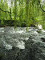
(3) Take the small path on the right; after 100m, turn left until you reach the next crossroads, then turn right. Carry on to the river, which you should follow to the left until you reach the D7c.

(4) After crossing it, take the path on the right after 50 metres, which runs alongside the lay-by. Continue for 100 metres and, at the crossroads, take the middle path; once you reach the village of “Bordes”, follow the road on the right.
Carry on along this road, ignoring the paths on both the right and left, and enter ‘Prémillant’.

(5) Turn left. Carry on straight ahead along this road, heading south-west.
Cross the D7 at Les Quatre Cerisiers and carry on straight ahead. Ignore a road on the right and you’ll reach “Mémageon”.

(6) Take the road on the right as you arrive and, at the end, take the small path on the right. After the wooden bridge, turn right and carry on to the crossroads. Turn right and enter the village of “Le Roty”, go up the road on the left, then after 200m turn left.

(7) Take the path on the left, following the edge of the woodland until you reach the road. Turn right until you reach the D7, which you should take on the left.

(8) At a wide bend, take the small road on the right towards “Les Vignes”. Continue left until you reach “La Morcière”, then turn left.

(9) After 300m, turn right towards “Les Souches” and then “Chez Rebis”.
At the crossroads, turn left. At Bois de Grolard, take the path on the left, then turn right to reach “Chez Gachat”. At the crossroads, turn right to return to the starting point (S/E).


Waypoints

  1. S/E : mi 0 - alt. 456 ft - At Gachat’s
  2. 1 : mi 0.51 - alt. 449 ft - La Forêt, turn right after the - Bouleure (rivière) - Affluent de la Dive du Sud
  3. 2 : mi 1.39 - alt. 453 ft - La Babinière, on the right
  4. 3 : mi 2.16 - alt. 443 ft - Rochèvre, path on the right
  5. 4 : mi 3.41 - alt. 387 ft - D7c, turn left then right
  6. 5 : mi 4.25 - alt. 456 ft - Prémillant, on the left
  7. 6 : mi 5.61 - alt. 446 ft - Mémageon, on the right
  8. 7 : mi 6.75 - alt. 446 ft - Path on the left
  9. 8 : mi 7.6 - alt. 417 ft - Turn right onto the road
  10. 9 : mi 8.5 - alt. 466 ft - Turn right onto the road
  11. S/E : mi 9.85 - alt. 456 ft - At Gachat’s

Notes

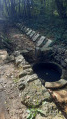
Caution!!!! In the small village of La Forêt, there is an old quarry with a hole over 10 metres deep that is not very visible on the left as you walk down the path; there are no safety measures, such as fencing or guardrails… Caution!!!!

Worth a visit

There are still a few orchids at Mémageon; unfortunately, people are picking them – it’s scandalous!!!

Reviews and comments

3.4 / 5
Based on 4 reviews

Reliability of the description
3.3 / 5
Ease of following the route
3.5 / 5
Route interest
3.5 / 5
User 22500197

Overall rating : 4 / 5

Date of your route : Jun 11, 2025
Reliability of the description : ★★★☆☆ Average
Ease of following the route : ★★★★☆ Good
Route interest : ★★★★★ Very good
Very busy route : No

Hello,
At the start, after 300 metres, the path is 20 metres to the left, not to the right.
La Bouleure is usually flooded but shallow, so be careful and plan alternative routes.
Otherwise, the hike is pleasant and the surrounding countryside is enchanting.

Machine-translated

lescompagnons
lescompagnons

Overall rating : 3 / 5

Date of your route : May 10, 2021
Reliability of the description : ★★★★☆ Good
Ease of following the route : ★★★★☆ Good
Route interest : ★☆☆☆☆ Very disappointing
Very busy route : No

A very disappointing route; no signposting – you get lost right from the start; the route is poorly maintained and should be removed from your website

Machine-translated

francisgrib
francisgrib

Overall rating : 3 / 5

Date of your route : Jan 25, 2020
Reliability of the description : ★★☆☆☆ Disappointing
Ease of following the route : ★★★☆☆ Average
Route interest : ★★★★☆ Good

The directions are vague, but you can still manage; however, the river crossing described as possible 11 months out of 12 seems a bit optimistic… you’ll need to have a backup route planned, as there’s no easy way round it except to retrace your steps and, at La Forêt, head straight to Chez Rebis and take the route in the opposite direction towards Les Souches to reach point No. 4.
(The other option is to head back to La Forêt, go up to Vaux and then down to La Babinière (though, according to the locals, this seems to make the walk considerably longer).

Machine-translated

jcmonchy1955
jcmonchy1955

Overall rating : 3.7 / 5

Date of your route : Apr 09, 2018
Reliability of the description : ★★★★☆ Good
Ease of following the route : ★★★☆☆ Average
Route interest : ★★★★☆ Good

Hello '
At the start, after 300 metres, the path is 20 metres to the left, not to the right.
Kind regards

Machine-translated

gachat
gachat

It’s simply that I preferred to walk along the riverbank – everyone does as they please!!!

Machine-translated

gazok54
gazok54 ★
• Edited:

Hi
Gachat should amend his route description once he’s sure of the route
Regards,

Machine-translated

gachat
gachat

Instead of turning right towards the river, turn left, walk for about 300 metres, then on the right you’ll find a small, very inconspicuous but lovely path through the Bois de Mont (IGN map 1728 E) which takes you to the bridge on the D7.

Machine-translated

andreo
andreo

Yes, but what should we do then? Because the guidebook tells us to follow the river, but at a certain point we can’t go any further because it’s overgrown with brambles and tall grass
Thanks

Machine-translated

gachat
gachat

If you cross the river, you will be on private land.

Machine-translated

andreo
andreo

A good walk – not too difficult, but with a few inaccuracies in the guidebook
Note: when you reach the river, don’t turn left but cross it and then turn left to join the D7
Otherwise, the signposting is quite good
Have a safe journey

Machine-translated

Other walks in the area

For more walks, use our search engine .

The GPS track and description are the property of this route's author. Please do not copy them without permission.