Country:
 City:


Parking is available outside the care homes, along the road in a makeshift car park.
(S/E) Leave the car park by taking the road northwards, walking alongside the care home. Just before the bridge over the Minette, head down the path on the left and walk alongside the river. Follow the path as it winds along the river.
After crossing a low wall (a specially adapted crossing), climb the few steps and you’ll reach a country lane.
(1) Turn left and walk for about fifty metres before you come to a path on the left. Take this path and, after two 90° bends, you’ll reach the first houses in La Monneraie. Follow the road and ignore a road on the left.
After a left-hand bend, the road descends and then climbs again to reach La Basse Vinais.
(2) Turn right, then left after 100 metres. Continue along the path on the right until you reach La Danserie (large gate). Cross the Ruisseau de Frénousse via the footbridge and you’ll arrive near the Château des Flégés pond, visible on your left.
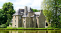
(3) Ignore the main path heading off to the right (the return route) and turn left onto a well-marked but poorly maintained path. This leads to the entrance to the château (private property). Once you reach the road, turn right and follow it until you reach the junction with the D18.
(4) Cross carefully and walk along the wooden railing to the right. When it ends, take the path on the left which descends towards La Minette. The path ends in a very uneven flight of steps leading to Ladhérie.
(5) Go round the nursery owner’s property by turning left. Pass between two buildings and follow the path downwards. Follow it as it curves to the right and head back up towards the north to reach Baillé. Cross the road with great care and make your way to the Place de l’Église.
(6) With the church on your right, continue along the north-bound path. Follow it as it curves to the right and reach Panlivard. Continue straight on along a sunken path (which may be flooded after a spell of rain). Carry on to the right (also very damp in places) and reach the D102.
(7) Cross the road with care and continue to the left along the very shaded path. After a few hundred metres, the path splits in two: to the left, ‘Le Chemin des Flégés – long route’; to the right, ‘Le Chemin des Flégés – short route’. Take the path on the right and head towards La Touche.
(8) At the road, turn left. Please note that the signpost indicates a right turn, but this is the route leading to the village of Baillé.
Walk past the Beau Logis and continue along the sunken lane, which may be flooded. You’ll reach a junction you’ve already passed on the way there.
(3) Turn left and follow the same route as on the way out, but in the opposite direction. At the Route de la Danserie, turn left and then right.
(2) At La Basse Vinais, continue to the left. At La Monneraie, first turn right then left and follow the path to the left (signposted ‘Route de la Minette’). Head towards the country road.
(1) Go down the steps on the right to rejoin the Minette and follow it to the bridge over the road. Turn right and follow the road back to the car park where you started (S/E).

 Visorando Member

 Easy