La Minette and Les Noës around Saint-Sauveur-des-Landes

Small streams and wet meadows along sunken paths and covered walkways: a chance to explore the Saint-Sauveur-des-Landes area.

Details

n°794676
Creation:
Last update:
Last review:
  • Walking
    Activity: Walking
  • ↔
    Distance: 10.47 mi
  • ◔
    Average duration: 5h 05 
  • ▲
    Difficulty: Moderate

  • ⚐
    Back to start: Yes
  • ↗
    Ascent: + 295 ft
  • ↘
    Descent: - 302 ft

  • ▲
    Highest point: 433 ft
  • ▼
    Lowest point: 292 ft

Photos

Description of the walk

Park in the cemetery car park, situated on the left-hand side after No. 25 Rue Saint-Hilaire

(S/E) Leave the car park by turning right onto Rue Saint-Hilaire towards the village centre. Turn left into Rue de la Vigne between Nos. 12 and 10 on Rue Saint-Hilaire and follow it as it curves to the right.
Please note that at present (February 2020) Rue de la Vigne is closed for roadworks. You must therefore continue straight on to the roundabout, turn left into Rue du Coglais and continue to the roundabout. Keep slightly to the left.

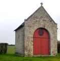
Before the roundabout, take a moment to admire, on your right, a 17th-century bread oven and bakery used by the inhabitants of the village of “La Vigne” and restored in 2004 by a training workshop.
At the roundabout, turn left onto Rue du Coglais and continue to the Champ de Lion junction.

(1) Continue along Rue du Coglais until you reach the edge of the village.

(2) Turn right, towards the sports grounds. Walk between the tennis court and the football pitch. Go through the hedge and turn onto the path on the left. Then take the path on the right, running alongside the forest. It ends at the D105.

Turn left onto the D105 and follow it until you pass under the A86 motorway bridge.
This is the least pleasant part of the route, but there is no alternative path
After the bridge, carry on for a further 150 metres.

(3) Turn left towards Tronçay. Pass through this hamlet and, at the end of the road, turn left and continue for about a hundred metres,

(4) Turn right onto a very pleasant forest lane. Follow the lane as it takes a hairpin bend to the left. As you go downhill, you’ll reach the banks of the Minette. Walk alongside the stream, keeping it on your right. Pass under the motorway once more and follow the path which, as it moves away from the Minette, runs alongside a hedge marking the boundary of the Moulin du Bas Teillay estate. After a bend to the left, the path leads onto a road.

(5) Turn right onto this road and turn left at the Monneraie junction. Very soon, a footpath has been created on the left-hand side of the road, allowing you to continue in complete safety.
Carry on along this parallel path.

(6) Carry on straight ahead until you reach the Haut Champ du Lion junction, which you passed earlier.
N.B. At this point, there are three options. Only the route marked on the map is described here, with a detour via the Champ Lion pond, where there are picnic tables for a lunch break (see the two other, shorter options in the ‘Practical information’ section).

(2) Continue straight on again until you reach the Champ du Lion crossroads, which you have also passed through previously.

(1) Turn right and carry on straight ahead to go round the Étang du Champ Lion, keeping it on your right. Once you’ve gone round it, take the access road on the left and return to the crossroads.

(1) Turn left, and head towards the junction and then the crossroads you passed earlier.

(6) Turn left and follow this path westwards until you reach a fork.

(7) Turn right. The path curves to the right then veers left, heading north.

(8) Take the path on the left. Be careful not to miss it; it is marked by barbed-wire fences. Follow it round a bend to the right and then along a meadow. It leads onto a road.

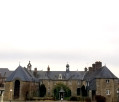
Take the path on the right that runs alongside the road so you can walk safely. Cross the road leading to La Bouverie. Carry on straight ahead at the next junction to get a closer look at the façades of Chaudeboeuf Castle.

(9) Retrace your steps and turn right at the crossroads. When you reach La Barbotais, take the road on the left. Pass the hamlet of Heurteloup and continue along the path.

(10) Follow the sign indicating you should turn right to walk alongside the stream until you reach a road.
Follow this road, turning right. Pass the hamlet of Sainte-Hélène on your right and, 50 metres further on, take the path on the left. Follow it all the way along; it veers left, running alongside the D18 for 100 metres.

(11) Cross the D18 and continue straight ahead onto a forest track. At the T-junction at the end, turn left, cross over and immediately take the path on the right, following it all the way.

(12) Turn left, then, at the first junction, opposite the Butte Haine farm, turn right and enter the village of Saint-Sauveur.

(13) At the Stop sign, turn left and head towards the town centre via Rue de la Salorge. Turn right towards the church, then turn left twice to reach the car park. (S/E).


Waypoints

  1. S/E : mi 0 - alt. 364 ft - Town Hall car park
  2. 1 : mi 0.71 - alt. 407 ft - Champ Lion crossroads
  3. 2 : mi 0.8 - alt. 420 ft - Haut Champ du Lion junction
  4. 3 : mi 1.73 - alt. 367 ft - To the left, towards Tronçay
  5. 4 : mi 2.09 - alt. 387 ft - Path on the right towards the - Minette (rivière) - Affluent du Couesnon
  6. 5 : mi 2.95 - alt. 322 ft - Road on the right
  7. 6 : mi 3.62 - alt. 394 ft - Junction for the alternative routes
  8. 7 : mi 5.96 - alt. 305 ft - To the right (shortcut to the left)
  9. 8 : mi 6.25 - alt. 328 ft - Path between fences, on the left
  10. 9 : mi 7.04 - alt. 344 ft - Chaude Boeuf Castle
  11. 10 : mi 7.69 - alt. 292 ft - Path on the right (sign)
  12. 11 : mi 8.68 - alt. 371 ft - Cross the D18
  13. 12 : mi 9.31 - alt. 371 ft - At the end of the path, turn left
  14. 13 : mi 10.05 - alt. 361 ft - At the Stop sign, turn left
  15. S/E : mi 10.47 - alt. 364 ft - Town Hall car park

Notes

This walk combines two routes: the first, the “Route de la Minette”, can be done in the morning (5.9 km), with a lunch break planned at the Étang du Champ Lion (walk round the pond: 1.8 km); the second route, the “Route des Noës”, is done in the afternoon (8.5 km). Allow at least 4 hours for walking (excluding the lunch break): 1½ hours in the morning and 2½ hours in the afternoon.

Alternative routes at this point (6):
1°) Carry on straight ahead to the car park. This route is shown on the map as the “Circuit de la Minette”.
2) Turn right, head straight for the point (7) and continue along the “Circuit des Noës”.

Worth a visit

The Minette rises near the hamlet of La Barberie on the border between the municipalities of Romagné and Saint-Germain-en-Coglès. After a course of 25.1 kilometres, it flows into the Couesnon at the site of the former Brais mine in the municipality of Vieux-Vy-sur-Couesnon. It gave its name to the aqueduct that has supplied the city of Rennes with drinking water since 1882.

Chaudeboeuf Castle was built in the 17th century. In 1863, the last owners donated it to the Congregation of the Adorers of Divine Justice to establish a hospice there. It remains a hospice to this day.

Reviews and comments

3.4 / 5
Based on 3 reviews

Reliability of the description
3.3 / 5
Ease of following the route
2.7 / 5
Route interest
4.3 / 5
randoplaisirloyat
randoplaisirloyat

Overall rating : 2.7 / 5

Date of your route : Aug 19, 2026
Reliability of the description : ★★★☆☆ Average
Ease of following the route : ★☆☆☆☆ Very disappointing
Route interest : ★★★★☆ Good
Very busy route : No

Due to the lack of signposting and waymarks, this route is a bit of a bore for someone new to walking – which is a shame.

Machine-translated

domivasseur2935
domivasseur2935

Overall rating : 4 / 5

Date of your route : Jan 01, 2026
Reliability of the description : ★★★★☆ Good
Ease of following the route : ★★★★☆ Good
Route interest : ★★★★☆ Good
Very busy route : No

Picnic tables only around the Champ Lion pond
Tip: park in the Town Hall car park (starting point for hikes) as the route from the cemetery is uninteresting.
Point 1: I recommend walking around the pond on the way up rather than on the way back (unless you plan to have a picnic there): this avoids a return trip.
Point 2: the path is on the edge of the forest but "in" the forest, not in the field
Point 5: the footpath is on the right, not on the left.
Point 10: the sign has disappeared: as soon as you leave the houses of Heurteloup, take a small grassy path on the right to "stick" to the stream as soon as possible.
The signposting is very patchy: Visorando directions + map essential

Machine-translated

Laurence44810
Laurence44810

Overall rating : 3.7 / 5

Date of your route : Feb 10, 2020
Reliability of the description : ★★★☆☆ Average
Ease of following the route : ★★★☆☆ Average
Route interest : ★★★★★ Very good

A must-do for this route, as the signposting is extremely temporary! Otherwise, a lovely walk

Machine-translated

Other walks in the area

For more walks, use our search engine .

The GPS track and description are the property of this route's author. Please do not copy them without permission.