


Refine your search for walks in Brutz (rivière) - Affluent du Semnon
Brutz (rivière) - Affluent du Semnon walks


 Route de Rougé
 Visorando Member
 7.42 mi
 +279 ft
 -269 ft
 3h 40
3h 40
 Moderate
 Departure from Rougé (Loire-Atlantique)
Rougé takes its name from the colour of the soil. Set off to explore the iron route, which partly follows the old railway line through the Brutz valley, crossing landscapes of moorland and hedgerows. You will see the site of the old iron mines, which were worked by the Celts and Gallo-Romans. You will notice the red colour of some of the paths, a sign of the presence of iron ore in the region. The same is true, in places, of the water in the streams.
The Grée route in Fercé
 7.17 mi
+167 ft
-164 ft
3h 25
Moderate
Departure from Fercé (Loire-Atlantique)
7.17 mi
+167 ft
-164 ft
3h 25
Moderate
Departure from Fercé (Loire-Atlantique)
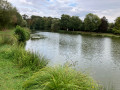
A lovely walk, almost entirely along beautiful, shaded paths. Starting from a pond, you’ll make your way to the highest point in the Loire-Atlantique department. You’ll cross vast agricultural landscapes bordered by beautiful hedgerows and enjoy the bountiful natural surroundings.