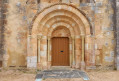
The Plessis Trail to Levet

This walk combines the heart of Levet with its lush green surroundings. You can make the most of it by having a picnic near the playground (tennis courts) or by the shaded pond.

Details

21563856
Creation:
Last update:
Last review:
  • Walking
    Activity: Walking
  • ↔
    Distance: 2.80 mi
  • ◔
    Average duration: 1h 20 
  • ▲
    Difficulty: Easy

  • ⚐
    Back to start: Yes
  • ↗
    Ascent: + 7 ft
  • ↘
    Descent: - 7 ft

  • ▲
    Highest point: 571 ft
  • ▼
    Lowest point: 558 ft
  • ⚐ Country: France
  • ⚐ City: Levet (18340)
  • ⚑
    Start/End: N 46.925523° / E 2.406644°
  • ❏
    IGN map(s): Ref. 2325SB
  • Hour-by-hour weather

Description of the walk

Park in the town hall square.

(S/E) Turn right, cross Avenue Nationale at the pedestrian crossing and take Rue de l’Ancienne Gare, between the restaurant White Cross and the hairdresser’s.
Continue by turning right onto Rue des Écoles. You’ll come out onto Rue Charles VII. First turn right then left to cross it, and head towards the tennis courts.
Carry on straight ahead, passing a playground and picnic area (on your right) whilst keeping the path on your left, and you’ll reach Rue Charles de Mangou.

(1) Carry on to the left along the Route de Saint-Germain-des-Bois (D28), ignoring the first street on the left. Opposite a warehouse on the left, turn right to reach the lake.

(2) Walk round the pond in a clockwise direction, returning via the picnic tables along the entrance

(2). Carry on straight ahead and cross the stadium via a path between two football pitches. Go through the gate and continue straight ahead, then keep left (past a bench sheltered by a tree) until you reach a footbridge.

(3) Take the footbridge, then, before the second one, turn left to reach the Chaussée de César. Follow it to the right until you reach the D2144.

(4) Cross the road from right to left (it’s dangerous to try to cross straight across!) to reach the Route de Châteauneuf-sur-Cher (D940) and follow it until you reach the first road on the right.

(5) Turn right, pass a motorhome parking area and head back towards the town hall via the first one-way street on the right (S/E).

Waypoints

  1. S/E : mi 0 - alt. 564 ft - Town Hall Square - Église Saint-Martin (Levet)
  2. 1 : mi 0.57 - alt. 561 ft - Rue Charles de Mangou
  3. 2 : mi 1 - alt. 564 ft - Pond
  4. 3 : mi 1.93 - alt. 561 ft - Footbridge over the - Rampenne (cours d'eau) - Affluent de l'Auron
  5. 4 : mi 2.11 - alt. 564 ft - Junction with the D2144
  6. 5 : mi 2.39 - alt. 571 ft - Chemin du Crôt à Thibault
  7. S/E : mi 2.8 - alt. 564 ft - Town Hall Square - Église Saint-Martin (Levet)

Notes

Shops in the immediate vicinity of the town hall (bakery, grocery shop, butcher’s, bar and restaurant).

Étang des Charpeignes (1).
Playground and picnic area near the tennis courts.
Picnic area by the lake.

Lignières Berry Tourisme Tourist Office
32 Grande Rue, 18160 Lignières
02 48 60 20 41

Tourist Information Office
2 Rue Brune, 18190 CHATEAUNEUF-SUR-CHER
02 48 60 88 67

accueil@lignieresenberry-tourisme.fr
www.lignieresenberry-tourisme.fr

Worth a visit

A few kilometres away:

La Chapelle des Roses: Listed in the supplementary inventory, this pretty 11th-century chapel stands on a Gallo-Roman site. You can see the remains of a Roman temple wall next to the well and on burial stones, which were discovered whilst digging trenches to bury power cables. These stones were used to cover wooden coffins. On the north wall, you can see sockets that were used to erect scaffolding. Under the roof next to the door is a stone from the church’s porch.
During Heritage Days, musical and artistic events are planned.
www.lachapelledeserruelles.fr

Serruelles Aerodrome
This community-run aerodrome is used for sporting, leisure and tourism activities. It is open to public air traffic. You can also take flying lessons or book a maiden flight.
http://aeroclubchateauneuf.fr

Reviews and comments

4.8 / 5
Based on 2 reviews

Reliability of the description
5 / 5
Ease of following the route
5 / 5
Route interest
4.5 / 5
Ibizette
Ibizette

Overall rating : 4.7 / 5

Date of your route : Sep 05, 2024
Reliability of the description : ★★★★★ Very good
Ease of following the route : ★★★★★ Very good
Route interest : ★★★★☆ Good
Very busy route : No

Walking at a brisk pace, but without pushing myself, I completed this walk in 40 minutes. I didn’t come across anyone, but it was between 1 pm and 2 pm on a weekday.

Machine-translated

Tice
Tice

Overall rating : 5 / 5

Date of your route : Mar 18, 2023
Reliability of the description : ★★★★★ Very good
Ease of following the route : ★★★★★ Very good
Route interest : ★★★★★ Very good
Very busy route : No

A lovely little walk

Machine-translated

Other walks in the area

For more walks, use our search engine .

The GPS track and description are the property of this route's author. Please do not copy them without permission.