Between Vorly and Plaimpied via the Canal de Berry

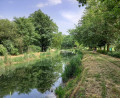
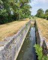
A route through the Berry region of Champagne, with a lovely detour into the Auron Valley, whilst following the Canal de Berry. A chance to enjoy the local flora and fauna as well as the charm of two locks. Near Plaimpied, the Marais gardens dot the route. A visit to the Abbey Church of Saint-Martin, overlooking the canal valley, is well worth a detour.
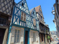
Whether at the start or the finish, in Vorly, a stop in front of the listed gateway to the 12th-century Church of Saint-Saturnin is a must.

Details

21943446
Creation:
Last update:
Last review:
  • Walking
    Activity: Walking
  • ↔
    Distance: 10.03 mi
  • ◔
    Average duration: 4h 45 
  • ▲
    Difficulty: Moderate

  • ⚐
    Back to start: Yes
  • ↗
    Ascent: + 135 ft
  • ↘
    Descent: - 135 ft

  • ▲
    Highest point: 584 ft
  • ▼
    Lowest point: 449 ft
  • ⚐ Country: France
  • ⚐ City: Vorly (18340)
  • ⚑
    Start/End: N 46.945312° / E 2.464418°
  • ❏
    IGN map(s): Ref. 2324SB, 2325SB
  • Hour-by-hour weather

Photos

Description of the walk

Park in the car park behind Saint-Saturnin Church along the D34 or behind the town hall, also on the D34.

(S/E) At the junction behind the church, follow the road to the left, leaving the war memorial on your right, in the centre of the junction. A few metres further on, carry straight on, then turn left onto the
Route Communale des Brosses. Follow this pleasant little road, lined initially by hedgerows before entering the woods.

(1) Carry on through the woods along a completely straight road until you reach the D106 further on.

(2) Cross it and carry on straight ahead to reach the hamlet of Le Colombier, which lies downhill. Turn left at the junction to reach thefirst lock and the Canal du Berry.
Take the path on the left, just before the bridge that crosses over the lock. Follow the canal on your right, skirting the pond in the village of Saint-Just, and continue along the towpath.

(3) Ignore the path on the left, continue along the canal, then turn left to reach Rue des Marais. Turn right onto this street, then turn left onto Impasse des Marais. You will then reach the roundabout on Route de Dun.

(4) Cross the road carefully and head straight ahead into Rue Pablo Picasso. At the next bend, leave this street and take the path opposite, which is actually a wide strip of grass between two properties. Carry on straight ahead. You’ll pass the Plaimpied City-Stade on your right.

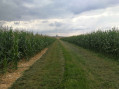
(5) Turn left onto the path that runs along the back of the detached houses. After 350 m, this path turns left, then enters the fields. You’ll soon reach a T-junction.

(6) Turn right onto the track running through the middle of the fields. Follow this straight track to the end until you reach another junction. Turn left and follow this new track. You’ll then pass alongside a heavily wooded residential area. Keep to the right, skirting the edge of this area, until you reach the junction with the D46.

(7) Turn left onto the D46 and continue to the junction with a farm track at Bois du Bouchet.

(8) Leave the road and turn left onto this track. Along a completely straight stretch, you’ll first pass under some power lines before coming out onto the road leading to the hamlet of Le Bouchet.

(9) Turn left onto it and follow the road. Continue along the track as you leave the hamlet and you’ll reach the D34 road.

(10) Turn left onto this road and enter the village of Vorly. Pass the stadium, then turn right to reach the car park by the town hall or the church (S/E).

Waypoints

  1. S/E : mi 0 - alt. 584 ft - Vorly Town Hall car park
  2. 1 : mi 0.77 - alt. 568 ft - Edge of the Mangoux woods
  3. 2 : mi 2.7 - alt. 561 ft - D106. Towards the - Canal de Fontblisse
  4. 3 : mi 4.38 - alt. 459 ft - Second lock, near the - Aurons (rivière)
  5. 4 : mi 5.27 - alt. 512 ft - Roundabout
  6. 5 : mi 5.55 - alt. 531 ft - Path to the left
  7. 6 : mi 5.93 - alt. 545 ft - T-junction
  8. 7 : mi 6.93 - alt. 561 ft - D46
  9. 8 : mi 7.67 - alt. 541 ft - Bois du Bouchet crossroads
  10. 9 : mi 8.73 - alt. 577 ft - The hamlet of Le Bouchet
  11. 10 : mi 9.51 - alt. 581 ft - D34
  12. S/E : mi 10.03 - alt. 584 ft - Vorly Town Hall car park

Notes

Between (2) and Saint-Just Pond: a popular spot for anglers, especially at weekends.

(S/E) On arrival, in the garden of the former Vorly vicarage, a drinking fountain is available next to a public bench.

Worth a visit

Between (2) and (4): listen out for the various birds along the canal: in spring, the songs of the golden oriole and the cuckoo stand out from the more familiar bird songs.

(4) Take the time to explore the Abbey Church of Saint-Martin in Plaimpied by continuing straight on to point (4).

Reviews and comments

4.3 / 5
Based on 2 reviews

Reliability of the description
4.5 / 5
Ease of following the route
4.5 / 5
Route interest
4 / 5
Chambrin Muriel
Chambrin Muriel

Overall rating : 5 / 5

Date of your route : May 28, 2024
Reliability of the description : ★★★★★ Very good
Ease of following the route : ★★★★★ Very good
Route interest : ★★★★★ Very good
Very busy route : Yes

A lovely walk
Exploring the towpath routes along the Berry Canal

Machine-translated

Maaarie44
Maaarie44

Overall rating : 3.7 / 5

Date of your route : Jul 24, 2023
Reliability of the description : ★★★★☆ Good
Ease of following the route : ★★★★☆ Good
Route interest : ★★★☆☆ Average
Very busy route : No

A walk that becomes really pleasant along the canal and towards Plaimpied. I highly recommend this section.
However, there’s far too much walking along the road for my liking, right from the start up to the canal and at the end – it’s a shame!
Part of the walk takes you along paths through the fields. By the end of July, they’ve already been harvested.

Machine-translated

Other walks in the area

For more walks, use our search engine .

The GPS track and description are the property of this route's author. Please do not copy them without permission.