The Chemin du Curé d’Ars

On foot or by bike, with family or friends, follow the 16 km signposted trail taken by the Holy Curé of Ars to travel from Ars to Montmerle-sur-Saône.
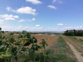
Enjoy the gentle landscape in lush green surroundings and, whilst taking a break, let yourself be charmed by the delightful villages of Chaleins and Lurcy.
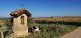
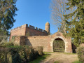
Feel free to take a little detour beyond the main route! (Cibeins Park, Fléchères Castle, Amareins Chapel...).

Line walk: plan your return journey.

Details

5551794
Creation:
Last update:
Last review:
  • Walking
    Activity: Walking
  • ↔
    Distance: 10.47 mi
  • ◔
    Average duration: 5h 00 
  • ▲
    Difficulty: Moderate

  • ⚐
    Back to start: No
  • ↗
    Ascent: + 243 ft
  • ↘
    Descent: - 404 ft

  • ▲
    Highest point: 860 ft
  • ▼
    Lowest point: 591 ft
  • ⚐ Country: France
  • ⚐ City: Ars-sur-Formans (01480)
  • ⚑
    Start: N 45.993502° / E 4.820832°
  • ⚑
    End: N 46.084824° / E 4.754867°
  • ❏
    IGN map(s): Ref. 2929ET, 3029SB, 3030SB
  • Hour-by-hour weather

Description of the walk

Starting point: the car park opposite the Ars-sur-Formans medical centre, about 200 metres from the basilica.

(S) Leaving the car park opposite the medical centre, turn left and walk up Rue Jean-Marie Vianney to the roundabout. Then turn left onto the D904.

(1) After passing Allée Sainte-Philomène and Allée des Ardillots, turn right onto Chemin des Ardillots. Cross the D936 with care and continue straight on until you reach the side road.

(2) Turn right onto Chemin de la Souche. Cross the D44 with care and continue along the path opposite.

(3) Stay on the same track, then turn left onto Chemin des Chanées at the second junction. Continue due north, passing under a power line. Stay on Chemin des Chanées, continue straight on along Route de Villeneuve and then along Route de Messimy.

(4) Then turn left onto the Chemin du Chavaleins and continue along this path until you reach the junction with the Chemin de Villette.

(5) Turn right onto this track, ignore a track on your left and you’ll come to another cross-track.

(6) Turn left and carry on until thethird junction on the right.

(7) Turn right onto the Sentier à l’Âne, which leads to the D28g.

(8) Turn left onto the Route de Chaleins and, after about a hundred metres, turn right onto the Sentier du Désert.

(9) At the end of this path, turn right, cross the Route de Saint-Trivier (D75a) with care and carry on straight ahead along the Sentier des Chênes. You’ll reach the tarmac road at the first houses and continue straight ahead. At the junction, turn right onto the Chemin Neuf and pass through Lurcy.

(10) Walk past the church, ignore the first junction on the right-hand side and you’ll soon come to a second one.

(11) Then turn right onto the Chemin du Cailleton. Stay on this path until you reach the junction with the Chemin des Gourlandes.

(12) Turn left onto this track and follow it, ignoring any side tracks. In Montmerle-sur-Saône, cross the D933 with care and continue to the first junction on your right.

(13) Pass through the Sablons housing estate, cross several roads and veer right opposite the police station. Continue straight on heading due north, then turn left to cross the D17b and join the Chemin Vert.

(14) Turn left onto this road and carry on until you reach a roundabout.

(15) At the end of the Chemin Vert, take the first exit on the left at the roundabout, then turn left at the next junction and join the Chemin des Minimes on your right.

(16) At the end of this path, turn right and continue to the next junction.

(17) Turn left into the Parc des Minimes, then finish your route in front of the Chapelle des Minimes (E).

Waypoints

  1. S : mi 0 - alt. 817 ft - Car park opposite the medical centre - Basilique Sainte-Philomène (Ars-sur-Formans)
  2. 1 : mi 0.24 - alt. 846 ft - Chemin des Ardillots junction
  3. 2 : mi 1.24 - alt. 856 ft - Junction with the cross-country path
  4. 3 : mi 1.89 - alt. 850 ft - Chemin des Chanées junction
  5. 4 : mi 3.46 - alt. 764 ft - Junction - Église Saint-Julien (Chaleins)
  6. 5 : mi 3.83 - alt. 761 ft - Turn right at the junction
  7. 6 : mi 4.61 - alt. 768 ft - Junction with the cross-country path
  8. 7 : mi 5.22 - alt. 735 ft - Chemin de l’Âne junction
  9. 8 : mi 5.64 - alt. 722 ft - Junction with the D28g
  10. 9 : mi 6.32 - alt. 712 ft - Road junction after the - Mâtre (ruisseau) - Affluent de la Saône
  11. 10 : mi 7.15 - alt. 666 ft - Église Saint-Étienne (Lurcy)
  12. 11 : mi 7.25 - alt. 659 ft - Starting from Lurcy
  13. 12 : mi 8.08 - alt. 617 ft - Junction with Chemin des Gourlandes
  14. 13 : mi 8.95 - alt. 610 ft - T-junction at the Sablons housing estate
  15. 14 : mi 9.7 - alt. 728 ft - Chemin Vert
  16. 15 : mi 9.99 - alt. 709 ft - Roundabout
  17. 16 : mi 10.25 - alt. 705 ft - Turn right at the junction
  18. 17 : mi 10.34 - alt. 692 ft - Turn left at the junction towards the - Chapelle des Minimes (Montmerle-sur-Saône)
  19. E : mi 10.47 - alt. 679 ft - Chapelle des Minimes. Near the - La Saône

Notes

N.B. This is a round-trip walk. Please organise at least two vehicles to ensure you can return.

Worth a visit

Along the way, let yourself be charmed by the Dombes and the Val de Saône.

- Ars-sur-Formans: made famous by the Holy Curé, this peaceful little village in the Dombes attracts nearly 450,000 pilgrims and tourists from all over the world every year.
Come and discover this unmissable destination: the imposing Basilica, the Holy Curé’s House, the Chapel of the Heart, the Church of Notre-Dame-de-la-Miséricorde, the Monument of the Encounter, and the moving wax museum created by Grévin.
Soak up the humility of this extraordinary figure, J.M. Vianney, who became the patron saint of all parish priests and lived in Ars from 1818 until his death in 1859.

- Chaleins: Let yourself be charmed by the tranquillity and gentle way of life in this lovely rural village and enjoy the local heritage on offer.
The Church of Saint-Julien, built in the 19th century, stands out in the heart of the village with its imposing proportions and ring of buttresses.
During your stroll, take the time to admire the dovecotes built of rammed earth and to observe the typical porches of the old farmhouses with their square courtyards.

- Montmerle-sur-Saône: Designated a ‘green resort’, Montmerle-sur-Saône enjoys a stunning setting on the banks of the Saône. Come and stroll along the Saône quays and stop off in the village centre, where the shops and restaurants will give you a warm welcome.
Enjoy your visit to the Chapel and the Tour des Minimes and take in the magnificent panoramic view over the Saône Valley and the Monts du Beaujolais.

- Treat yourself to a gourmet break to discover the flavours of the Dombes and the Saône Valley.
As you wander around or stop off at a local market, meet the local producers.
Savour the local specialities: carp fillets, frogs’ legs, Val de Saône fried fish, cardoon gratin… and discover authentic, traditional cuisine given a modern twist by the chefs.

Reviews and comments

4.5 / 5
Based on 2 reviews

Reliability of the description
4.5 / 5
Ease of following the route
4.5 / 5
Route interest
4.5 / 5
isabar
isabar

Overall rating : 4 / 5

Date of your route : May 11, 2026
Reliability of the description : ★★★★☆ Good
Ease of following the route : ★★★★☆ Good
Route interest : ★★★★☆ Good
Very busy route : No

There’s a lot of tarmac in the first part of the walk. Then it’s a footpath from Lurcy.

Machine-translated

Florence BUFFAT
Florence BUFFAT

Overall rating : 5 / 5

Date of your route : Apr 04, 2021
Reliability of the description : ★★★★★ Very good
Ease of following the route : ★★★★★ Very good
Route interest : ★★★★★ Very good
Very busy route : No

A lovely mountain bike route. It follows tarmac roads several times, so it’s better to do it on a mountain bike rather than on foot. Beautiful views of the Beaujolais hills.

Machine-translated

Other walks in the area

For more walks, use our search engine .

The GPS track and description are the property of this route's author. Please do not copy them without permission.