Country:
 City:
City:


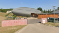
Park in the leisure grounds/stadium car park. The route is signposted with hiking posts; yellow markings will soon be added to this walk.
(S/E) After the stadium car park, turn left, walk through the village, then turn right (south).
Take the opportunity to explore the church and the fertility stone.
(1) At Vignol, turn left towards La Pierre Brune and Rancé. At the T-junction, turn left. Then continue straight on at the next junction, turn right at the following crossroads and walk through Toussieux. After the stream, take a path heading due east to La Pierre Brune.
(2) Turn left, heading due north, until you reach the D 66d. La Pierre Brune isn’t far away; if you’d like to see it, head towards Chapouilleux and look carefully in the fields on your left, then retrace your steps.
(3) Carry on almost straight ahead towards the wash house. A stop at the wash house is a must here. Restored in 2007, it has been faithfully recreated and bears witness to the village’s past. Once at the wash house, turn right towards Rancé. When you reach the Creuse, veer slightly to the right towards Limanda.
(4) At Limanda, continue along the D66d, through the fields, to the village centre of Rancé, crossing over the railway line and then turning right at the bend. Carry on to the church.
(5) In Rancé, discover the oldest and most significant monument to the village’s history: the Romanesque church, which has been remodelled several times. Then turn right towards Étang Ratier. Next, take the first path on the left and you’ll come to a fork in the road.
(6) Turn left, still heading towards Étang Ratier. At the first crossroads, turn right, then left at the three-way junction. Continue along dirt tracks, passing through hamlets and woods and skirting the ponds.
At Étang Ratier, carry on towards the Bois de Soux.
(7) At the Bois de Soux, turn right towards Fond de Juis. Cross a stream and head straight on along a track to Fond de Juis.
(8) At Fond de Juis, stop by the drain (drain valve) of the pond and admire the unique sight of ducks and birds performing graceful dances on the water. Then follow the path towards Les Grandes Terres. Keep to the right at the road, then turn left until you reach the railway line.
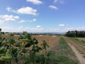
(9) At Les Grandes Terres, cross the railway line and continue towards Ars-sur-Formans. Ignore a path on the right to enjoy a view further on.
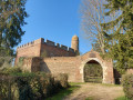
(10) Carry on along the path. “Ahead of you lie the Monts du Beaujolais, then a distinctive building on your right: the Donjon de Juis. A listed historic monument, this 14th-century castle, built largely of red brick, forms an almost perfect square, with its four sides crowned by merlons. It is visible from the surrounding area thanks to a cylindrical corner turret.” Keep straight on at the crossroads and you’ll reach a fork in the road at Champ Perret.
(11) Turn right, towards Ars-sur-Formans, until you reach the first crossroads and its signpost.
(12) At the hiking signpost, turn left towards the Monument de la Rencontre. Carry straight on at the bend. After crossing some farmland, cut across a road and you’ll reach a crossroads.
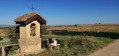
(13) The Monument de la Rencontre d’Ars is nearby: if you’d like to see it, leave the route for a short detour of a few metres. Then rejoin the route, turning left towards the oratory. Keep heading in that direction until you reach the famous oratory.
(14) It was built in honour of the Holy Curé of Ars. Carry on straight ahead towards Fourvière.
(15) Carry on straight ahead, towards La Croix.
(16) At La Croix, turn right towards Toussieux, then take a path down to the left. Carry on to the Thiorière crossroads.
(17) Carry on straight ahead until you reach the hiking signpost.
(18) Turn left, towards Toussieux. Carry on until you reach the second road on the right.
(19) Turn right, towards Toussieux and Vignol. At the end of the road, first turn right then left to return to the starting crossroads.
(1) In Vignol, turn left and head towards Toussieux and the leisure grounds car park (S/E).

 Visorando Member

 Tourist office
 Easy
Easy