Ars walking route

Set off on a nature walk through fields and woodland, where peace and quiet and birdsong await you.

Details

6471910
Creation:
Last update:
Last review:
  • Walking
    Activity: Walking
  • ↔
    Distance: 10.41 mi
  • ◔
    Average duration: 5h 10 
  • ▲
    Difficulty: Moderate

  • ⚐
    Back to start: Yes
  • ↗
    Ascent: + 433 ft
  • ↘
    Descent: - 443 ft

  • ▲
    Highest point: 873 ft
  • ▼
    Lowest point: 643 ft

Photos

Description of the walk

Park at the Freihalden car park, opposite the Ars-sur-Fromans medical centre. This route is signposted with hiking posts; painted markings will be added shortly.

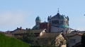
(S/E) From the car park, turn right onto Rue Jean-Marie Vianney, heading towards the basilica. Admire the Basilica of Saint-Sixte, a jewel of Neo-Byzantine architecture. Continue straight on at the first junction. Turn left at the second junction and you’ll arrive at the Tourist Office.

Carry on straight ahead as you head down through the village. “On your right, you’ll see the meadow where the 20th-century semi-underground church, Notre-Dame de la Miséricorde, stands. Then, on your left, you’ll come across the Wax Museum, ‘The Life of the Holy Curé of Ar’, where 35 wax figures created by Grévin will amaze you with their realism.” After the small bridge over the Formans, at the cross, turn right, then right twice more. At the tennis courts, turn left towards the Monument de la Rencontre.

(2) Walk past the Monument de la Rencontre, which commemorates Jean-Marie Vianney’s arrival in Ars in 1818 and his encounter with the young shepherd. Then continue straight on towards Fourvières. Keep going until you reach the oratory.

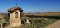
(3) You’ll reach the oratory, built in honour of the Holy Curé of Ars. Carry on to Fourvières.

(4) Turn right towards Saint-Didier-de-Formans. After 200 metres, turn left and carry on to the end of the road.

(5) Carry on straight ahead, then turn right towards Les Bruyères de Sainte-Euphémie. Keep to the right, cross a road and you’ll reach a junction at Les Bruyères de Sainte-Euphémie

(6) Turn right, towards Le Baderand and Trévoux, until you reach the telecoms mast. Turn left onto the Route de la Torine.

(7) Carry on straight ahead until you reach the departmental road; cross it carefully, then turn left and continue for 50 metres until you reach Les Plagnes.

(8) At Les Plagnes, carry on to the right, towards Le Baderand and Saint-Didier-de-Formans. Further on, take thefirst right. Continue along the track and then carry on along the road. Keep to the right at the first Fork in the road and you’ll arrive at Le Baderand.

(9) Carry on straight ahead across the fields towards Le Foulon (the old mill). The water mills of Le Formans, in Saint-Didier-de-Formans, were in full operation from the 17th century onwards.

(10) Cross the Formans via a small footbridge, pass close to an old mill and come out onto the road. Turn left, then take thefirst right onto Chemin du Château. Continue to the chapel.

(11) Stop in front of the Old Village Chapel, which is currently being restored, then turn right onto Chemin des Vignes du Château, heading towards Les Terres and Ars-sur-Formans.

(12) At Les Terres, take Chemin de la Murette straight ahead, then turn right, heading due north, towards Ars-sur-Formans.

(13) When you reach Murette, turn right and continue through the farmland. Keep going straight on until you reach the Tour du Boujard.

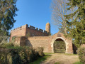
(14) Look out for the Tour du Boujard, a troubadour-style tower built in 1856. Carry on until you reach the road at Champ de la Croix.

(15) Turn right onto the Chemin du Boujard, cross the D 28 with care and you’ll arrive at the Domaine de Cibeins.

(16) Walk past the estate’s Cibeins Model Farm, which comprises a complex of buildings and a Romantic-style park featuring numerous water features and majestic trees. Today, this estate—now an agricultural college—bears the name of its founder, Édouard Herriot.
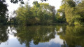
Walk through the cool undergrowth alongside the stream to reach the Bois de la Dame lake in Ars-sur-Formans.

(17) Head back up to the centre of the village of Saint-Curé, continuing straight on until you reach the crossroads near the tourist office.

(1) Turn left and you’ll find the car park (S/E).

Waypoints

  1. S/E : mi 0 - alt. 820 ft - Car park at the Ars-sur-Formans Medical Centre
  2. 1 : mi 0.16 - alt. 804 ft - Tourist Office – Wax Museum: ‘The Life of the Saint Curé’
  3. 2 : mi 0.6 - alt. 853 ft - Monument to the Encounter
  4. 3 : mi 2.03 - alt. 817 ft - The Oratory
  5. 4 : mi 2.33 - alt. 801 ft - Fourvières
  6. 5 : mi 2.95 - alt. 741 ft - La Thiorière
  7. 6 : mi 3.69 - alt. 846 ft - Les Bruyères Sainte Euphémie
  8. 7 : mi 4.19 - alt. 830 ft - La Thorine
  9. 8 : mi 4.29 - alt. 843 ft - Les Plagnes
  10. 9 : mi 5.17 - alt. 659 ft - Le Baderand
  11. 10 : mi 5.45 - alt. 643 ft - The Formans mills in Saint-Didier-de-Formans
  12. 11 : mi 6.06 - alt. 699 ft - Vieux Bourg Chapel
  13. 12 : mi 6.3 - alt. 722 ft - Les Terres
  14. 13 : mi 6.76 - alt. 810 ft - Low wall
  15. 14 : mi 7.77 - alt. 804 ft - View of the Tour du Boujard
  16. 15 : mi 8.11 - alt. 794 ft - Le Champ de la Croix
  17. 16 : mi 8.79 - alt. 738 ft - Model farm, Château de Cibeins and its grounds
  18. 17 : mi 9.93 - alt. 774 ft - Ars-sur-Formans lake
  19. S/E : mi 10.41 - alt. 820 ft - Car park at the Ars-sur-Formans Medical Centre

Notes

Cibeins Castle and its grounds: shelter under the school’s large covered courtyard (on the pond side).
Ars-sur-Formans lake: picnic tables around the fishing pond.

Worth a visit

Reviews and comments

4.8 / 5
Based on 2 reviews

Reliability of the description
5 / 5
Ease of following the route
5 / 5
Route interest
4.5 / 5
-Clara-
-Clara-

Overall rating : 4.7 / 5

Date of your route : Oct 07, 2023
Reliability of the description : ★★★★★ Very good
Ease of following the route : ★★★★★ Very good
Route interest : ★★★★☆ Good
Very busy route : Yes

A really enjoyable walk offering the chance to explore the area around Ars.
The scenery is quite varied: farmland, a forest path (and a short stretch of road); a special mention goes to the agricultural college in Cibeins, which was a lovely surprise to walk through. The highlight of the walk is, of course, a visit to the basilica.
I can confirm there’s very little shade on half the route, so it’s best not to do this in the height of summer. The route description is very easy to follow with the map.
What made me deduct a star from the route’s overall rating was the noise pollution (inevitable near roads) and the several sections where you walk under high-voltage power lines.
Otherwise, I’d recommend it; I had a really good time, and the locals are very friendly.

Machine-translated

TotoB
TotoB

Overall rating : 5 / 5

Date of your route : Oct 01, 2021
Reliability of the description : ★★★★★ Very good
Ease of following the route : ★★★★★ Very good
Route interest : ★★★★★ Very good
Very busy route : No

A lovely, easy walk. You’re right – it’s best not to do it in the height of summer as there’s very little shade.
That said, yes, there are tarmac sections, but it’s not too bad and there are some lovely sights along the way (you can’t have it all...).

Machine-translated

OT Ars Trévoux
OT Ars Trévoux

Hello,
Thank you for your comment.
I’ve often done this route on foot or by bike across the fields, but usually in spring or autumn when the weather is cooler.
If you’re looking for other, more shaded routes, you can contact me by email at the ARS TREVOUX Tourist Office: j.benoit@ars-trevoux.com and I’ll suggest some other routes.
Have a lovely afternoon,
Kind regards,
JOELLE BENOIT
OTSI ARS TREVOUX

Machine-translated

cutelle franck
cutelle franck

A lovely walk, but far too much of it on the road and not much shade – a shame

Machine-translated

Other walks in the area

For more walks, use our search engine .

The GPS track and description are the property of this route's author. Please do not copy them without permission.