Country:

 City:


Starting point: Rignac swimming pool car park
(S/E) Take the fitness route (La Peyrade park). Keep going straight on until you reach the road. Continue straight ahead, then keep to the right. After the stream, keep to the left and you’ll reach the Route de Mancelle. Follow it to the left, then turn right onto the D997 until you reach the roundabout.
(1) Head straight on towards La Cassagne, turn left then cross the Rignac–Le Luc road. Cut across a departmental road and pass La Bouldoire. Turn right onto a dirt track just as the road bends sharply to the left. Soon, turn left onto a sunken track that descends towards the Route de Lespiérate.
(2) Exit behind the low wall, cross the road, turn left and head up a dirt track. Follow the signposted route. Take a sharp right-hand bend, then another to the left to reach the D43 and then the Ferme des Plos.
(3) Turn right onto the tarmac road to Le Garric and, after 50 metres, take the path on the left running alongside a meadow, then a sunken track (with views of Rignac and the surrounding area), and head towards Le Batut and the D53, keeping to the right and then to the left.
(4) At the departmental road, keep to the right for 50 metres and turn right again as you come out of the bend. Walk up a short slope, then down towards the Alzou.
(5) Cross the river via the D 253 and head right towards Escandolières (walk on the right-hand side of the road where the verge is wider).
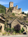
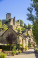
(6) Take the first path on the left and head uphill through the woods, then along the edge of a meadow. At the junction with a wide path, turn right (view of Bournazel, its castle and its Puechs). The path then climbs to the left and joins a tarmac road; head right along this towards Le Cayrou.
(7) Turn left and, after 50 m, turn right (follow the sign for ‘lodge’). After the houses, at the small cross, ignore the sign for ‘lodge’ and head down towards the Cayrou fountain; continue along the path for 500 m (ruins of a lime kiln), then at the junction, turn left, heading due west, until you reach the D 595.
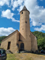
(8) Follow the signposts to the right then to the left, and arrive at the entrance to Bournazel via the Rulhe–Cransac road. Carry on straight ahead, passing the entrance to the castle, then, further up, the town hall. Ignore the junction by the town hall and continue towards the Rulhe–Cransac road on the right until you reach the Chapelle du Fraysse. An alternative route is possible (see ‘Practical information’ section).
(9) After the Fraysse Chapel, at the car park, take the road on the left. At the bend in the road (elevation 503), take the slightly uphill path straight ahead. At the junction (truffle oaks), continue straight on along a pleasant, shaded path. Keep to the right until you reach the Route du Garric de Roussennac.
(10) Turn left towards the hamlet, then left again until you reach the D658. Turn right and, after 50 metres, turn left towards Bezannes. At the cross near La Grange, take the path on the right; turn left a little further on to join a road, then turn left until you reach the stream.
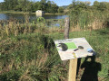
(11) Leave the road and turn right onto the path leading to the Roudillou pond. At the mill, rejoin the road. Follow it until you reach a sharp left-hand bend.
(12) Stay on the road and pass the Rébadie junction on your left. Continue to the right as far as Laumière.
(13) At the entrance to the hamlet, turn left, then left again onto a sunken, shaded track. Further on, cross the Alzou.
(14) At La Badoque, carry on straight ahead to Le Bousquet.
(15) Keep to the left as you pass through the village. Carry on straight ahead at the crossroads by the cross and return to Rignac.
(16) Keep left at the end of the street. Then continue straight on along Rue de la Fontaine. Turn right at the end of the street and head towards the secondary school. First turn left then right to return to the starting point (S/E)

 Tourist office
 Moderate

 Easy
 Visorando Member