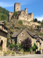
Exploring the Roudillou ponds at Bournazel and Lagarrigue
Set off on a thrilling and enriching walk. This ecological and heritage wealth, the result of history and nature, earned these ponds their designation as a Natura 2000 site by the European Union at the very beginning of the century. Twenty years later, the SMBV2A and Rural Concept have been tasked with preserving these habitats. Together with the ponds’ owners, managers and users, they are helping to maintain these fragile ecosystems. Keep your eyes open and treat the environment with respect – you might be in for some lovely surprises.
Starting point: Moulin du Roudillou car park (from Roussennac, head towards Étang de Roudillou).
(S/E) Leave the car park and turn left onto the road until you reach a Fork in the road.
(1) Head up to the left along a farm track, turn off towards the hamlet of La Bessière, and head left to join the D53.
(2) Turn left onto the D53 towards Bournazel for 50 metres, then take the first turn right then left to join the Route de la Visinie. At the first house, head down to the right along a footpath to reach Cavagnac. Beautiful views of the lake. Arriveat the Étang du Ségala.
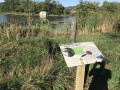
(3) There is an information board for the Étangs du Ségala Natura 2000 site. Continue along the road (D53) and turn left onto the small tarmac road. Pass the path to Bezanes on your right.
(4) Head down a farm track to the left. Further on, leave the track to your left and enter the forest via a footpath. Cross the footbridge. Continue to the mill at the Heath pond.
(5) There is another sign marking the Natura 2000 site. Walk back up the road, passing Lagarrigue Haute on your left, and head left. Follow the road downhill and, further down, pass Lagarrigue Basse on your left.
(6) Leave the road and turn left onto a path leading towards the wetland. Follow the path to the car park, skirting the Roudillou (S/E).
Waypoints
S/E : mi 0 - alt. 1,555 ft - Moulin du Roudillou car park
1 : mi 0.35 - alt. 1,535 ft - Junction after the stream
2 : mi 1.56 - alt. 1,722 ft - D53
3 : mi 2.12 - alt. 1,617 ft - Cavagnac
4 : mi 2.48 - alt. 1,621 ft - Forest track
5 : mi 2.84 - alt. 1,575 ft - Signboard presenting the Natura 2000 site
6 : mi 3.14 - alt. 1,562 ft - Junction towards the wetland
S/E : mi 3.61 - alt. 1,552 ft - Moulin du Roudillou car park
Notes
Alternative route at (5): to return to the car park, follow the path through the woods. There is a ford at Roudillou. Please note: this route is only accessible in summer.
Worth a visit
Bournazel Pond is home to: - The Southern Bladderwort (Utricularia australis): an aquatic carnivorous plant that feeds on small aquatic insects using its tiny jaws, known scientifically as utricles. It flowers in the pond in late summer, adorning the water’s surface with a bright yellow colour. - The basket rush (Schoenoplectus lacustris): a very tall rush that was once cultivated on Bournazel Pond and used for thatching chairs and armchairs. - Broad-leaved Sagittaria (Sagitaria latifolia): a very beautiful aquatic plant, which grows only on the banks of Bournazel Pond throughout the department. - The European otter (Lutra lutra): a very elusive mammal, the otter is nevertheless relatively common in the Rignac area. It feeds on fish and amphibians, but above all on the numerous crayfish found in the lakes and rivers of the area. - The Yellow Meadow-rue (Thalictrum flavum), a protected plant that grows in the tall-herb communities along the banks of Bournazel Pond. - Goose cinquefoil (Potentilla anserina), a common plant in France but rare in Aveyron. It is indicative of the oceanic climate found in the department of Aveyron. The old trees in the area, meanwhile, are home to the Great Capricorn Beetle and the Stag Beetle. These are two protected saproxylic insects that feed on dead wood. It is not, therefore, these insects that cause the trees to die, but rather the trees’ dying condition that attracts the insects to them.
Reviews and comments
3.7 / 5
Based on 6 reviews
Reliability of the description 3.8 / 5
Ease of following the route 3.7 / 5
Route interest 3.6 / 5
auriat
Overall rating :
3.7 / 5
Date of your route : Aug 31, 2026 Reliability of the description : ★★★★☆ Good Ease of following the route : ★★★★☆ Good Route interest : ★★★☆☆ Average Very busy route : No
A interesting route… views of Bournazel… a pleasant walk back along the stream…
Machine-translated
Lemarcheur
I haven’t done the walk yet, but judging by the start, I’ll be doing it very soon.
Machine-translated
User 29346383
Overall rating :
4.3 / 5
Date of your route : Jun 14, 2026 Reliability of the description : ★★★★☆ Good Ease of following the route : ★★★★★ Very good Route interest : ★★★★☆ Good Very busy route : No
We didn’t come across any hikers on the routes in June.
Machine-translated
Office de tourisme du Pays Rignacois
Hello, we will pass on your message to the person responsible for the signposting. We apologise for any inconvenience caused.
Machine-translated
babeth007chat
Overall rating :
2.5 / 5
Date of your route : Feb 16, 2025 Reliability of the description : ★★★☆☆ Average Ease of following the route : ★★☆☆☆ Disappointing Route interest : Not used / Not applicable Very busy route : No
I can only echo what JYB78 said: no signposting, uncertainty about the route,
as we were with young children, we decided to turn back after some hesitation.
Machine-translated
AmbeyracMoo
Overall rating :
4.7 / 5
Date of your route : Feb 02, 2025 Reliability of the description : ★★★★★ Very good Ease of following the route : ★★★★★ Very good Route interest : ★★★★☆ Good Very busy route : No
A lovely walk
Machine-translated
Kim Christophe
• Edited:
Overall rating :
4 / 5
Date of your route : Jun 03, 2024 Reliability of the description : ★★★★☆ Good Ease of following the route : ★★★★☆ Good Route interest : ★★★★☆ Good Very busy route : No
A short walk to enjoy after lunch at Marie’s in Grand Vabre, in the Aveyron.
Machine-translated
JYB78
• Edited:
Overall rating :
2.7 / 5
Date of your route : Jun 02, 2024 Reliability of the description : ★★★☆☆ Average Ease of following the route : ★★☆☆☆ Disappointing Route interest : ★★★☆☆ Average Very busy route : No
No signposting; uncertainty about the route due to a discrepancy between the map and the diagram; it’s a shame the signposts weren’t used as reference points.
To open this route on your smartphone, you must have the Visorando app installed. If not, got to the Apple Store (iPhone) or Google Play Store (Android) to download the app.



 Country:

 City:
City:





 A short walk to enjoy after lunch at Marie’s in Grand Vabre, in the Aveyron.
 Tourist office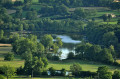
 Moderate

 Visorando Member