The ‘Chemin des Deux Tilleuls’ in Rignac

This walk was created in 2010 by Year 3 pupils at Rignac State School with the help of their teachers, in collaboration with the Departmental Hiking Committee and with the support of the Rignac Community of Communes and Rignac Town Hall.

Details

43265367
Creation:
Last update:
Last review:
  • Walking
    Activity: Walking
  • ↔
    Distance: 5.57 mi
  • ◔
    Average duration: 3h 00 
  • ▲
    Difficulty: Easy

  • ⚐
    Back to start: Yes
  • ↗
    Ascent: + 479 ft
  • ↘
    Descent: - 469 ft

  • ▲
    Highest point: 2,054 ft
  • ▼
    Lowest point: 1,601 ft

Description of the walk

The starting point is at the Rignac swimming pool car park.

(S/E) Set off from Parc de la Peyrade, opposite the swimming pool. Continue along the road to the left towards Caussanel and carry on to the bridge and the country lane.

(1) Turn right just before the bridge and carry on to the cattle underpass.

(2) Take the cattle underpass. At the exit, take the track on the right (east). You may see horses and donkeys. When you reach the county road, turn left onto the D75. Pass the cross and you’ll come to a Fork in the road.

(3) Opposite La Maurinie, turn immediately right (west) onto the path that crosses the Bois des Pouches. Continue until you reach the D643.

(4) Turn left onto this road (south) as far as Le Gach.

(5) Near the old coaching inn, turn right towards Mirabel and Regardet (south). Continue until you reach a Fork in the road on the D75.

(6) Take the first path on the right (west) which climbs up to the White Cross.

(7) Follow the road all the way to the left, walking in single file, and pass in front of the regional chestnut conservatory. Continue to the crossroads towards Le Gravié.

(8) Pass to the left of the cross and head towards La Poujade. You’ll catch a glimpse of the hamlet of Regardet. Cross La Poujade and take the path on the right. Take in the view of the wash house and the strangely shaped chestnut trees. Once you reach the ridge, look down to see the hamlet of Mirabel, which overlooks the Aveyron. Head back down the path through the fields on the left (towards Le Rial) until you reach the departmental road.

(9) Turn left onto it. Walk past the water board. At the junction, ignore the sign for Rignac (straight ahead) and turn right, towards Lavernhe.

(10) At the cross, turn left, heading due north, and pass under the high-voltage power line. You may spot some draught horses. Stay on the road and cross over the D 994.

(1) Continue straight on and return to the starting point (S/E).

Waypoints

  1. S/E : mi 0 - alt. 1,601 ft - La Peyrade Park
  2. 1 : mi 0.35 - alt. 1,690 ft - Crossroads of the circular loop
  3. 2 : mi 0.56 - alt. 1,683 ft - Cattle underpass
  4. 3 : mi 1.09 - alt. 1,824 ft - T-junction on the D75
  5. 4 : mi 1.52 - alt. 1,890 ft - D643
  6. 5 : mi 2.01 - alt. 1,890 ft - Le Gach
  7. 6 : mi 2.23 - alt. 1,946 ft - T-junction on the D75
  8. 7 : mi 2.56 - alt. 2,041 ft - White Cross
  9. 8 : mi 2.87 - alt. 2,034 ft - Le Gravié
  10. 9 : mi 3.78 - alt. 1,847 ft - D75
  11. 10 : mi 4.35 - alt. 1,818 ft - Lavernhe
  12. S/E : mi 5.57 - alt. 1,601 ft - La Peyrade Park

Notes

- Wear suitable footwear.
- Take some food and drink with you.
- Walkers follow the route at their own risk. They remain responsible for any accidents they may suffer and for any damage they may cause to others (forest fires, damage to the environment, pollution, etc.).
- Stick to the marked paths and do not take shortcuts. If the route has been altered, follow the new signposting.
- Be considerate. We are not the only ones using the paths; be mindful of others.
- Take your rubbish away with you. Leave no trace of your visit; do not throw anything on the ground; carry a rubbish bag with you.
- Keep your dog on a lead, particularly near homes or livestock.
- Close gates and fences behind you, and walk around crops. Please respect the work of those who shape and preserve our environment.
- Observe the rules in certain areas.
- Do not light fires. Areas with dense vegetation (forests) or those that are too exposed (scrubland, dry heathland, etc.) can catch fire very quickly.
- Do not drink water from streams. Clear water does not necessarily mean it is safe to drink.
- Check hunting seasons; some routes may be dangerous.

Worth a visit

Along the way… the flora:

  • The oak

Oaks are hardwood trees. The edges of the leaves are lobed, serrated or smooth. The leaves are simple and alternate. Their resistance to insects and fungi (natural durability) is very high thanks to their high tannin content. The oldest oak in France is thought to date back to the time of Charlemagne. A forest of oaks is called an oak forest.

  • Holly

Common holly is an evergreen shrub, sometimes a small tree, of the Aquifoliaceae family, commonly cultivated for its ornamental value, particularly due to its bright red berries.

  • Ivy

Creeping or climbing ivy, also known as ‘common ivy’, is an evergreen vine in winter, belonging to the
Araliaceae family. It can be seen growing on trees or stone walls. It is also cultivated as an ornamental plant.

  • Lichen

Lichen is a plant that often grows on the north-facing side of trees. It covers walls and stones.
It is a plant formed by the combination of a fungus and an alga.
It can withstand extreme temperatures (cold and drought). It is estimated that there are around twenty thousand species of lichen.

  • The chestnut tree

The chestnut tree is a majestic tree (25–35 m) with long branches and large, serrated deciduous leaves (which can be up to 25 cm long and 4 to 8 cm wide). It flowers in June. Chestnut orchards produce chestnuts, which have been cultivated for millennia due to their high nutritional value.

Along the path… wildlife:

  • The roe deer

It is an agile and swift animal that can reach a height of 63 to 73 cm. They live for up to 15 years. An adult roe deer
has 32 teeth (20 in juveniles). Its paw prints are small and elongated, with two clearly
clearly defined. In spring, the roe deer feeds on the leaves of many deciduous trees (oak,
hornbeam, maple, dogwood, etc.). In winter, it feeds on ivy growing on tree trunks, brambles and heather.

  • The heron

A large, migratory wading bird with a long neck, it lives by the water’s edge where it catches various aquatic animals.

  • The Buzzard

This diurnal bird of prey, measuring around 50 centimetres, has a wingspan of over one metre. It feeds
on rodents, reptiles and small birds. It can live for twenty-five years. Its chicks hatch between March and May.

Along the way… the names of local places:

Les Pouches: well
La Pomarède: apple orchard
La Poujade: a slope, a mound
Mirabel: a lookout post
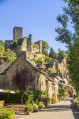
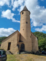
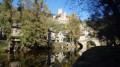
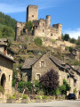
This hamlet is situated on the right bank of the River Aveyron. The castle dates from before the14th century, perhaps even the9th or10th century. All that remains of the castle today is the church tower, which was the castle’s belfry, and the vicarage, which was the castle’s granary.
Le Gach: a ford
The White Cross: the cross
La Châtaigneraie: to halt the disappearance of chestnut tree species and the knowledge associated with them, a regional chestnut tree conservatory has been established near Rignac. Its role is to safeguard, study and promote heritage chestnut varieties in the Midi-Pyrénées region.
La Maurinie: named after the owner, Maurin, with the suffix –ie.
Le Caussanel: limestone soil
Le Rial: good soil by the water’s edge

Reviews and comments

4.5 / 5
Based on 2 reviews

Reliability of the description
5 / 5
Ease of following the route
4 / 5
Route interest
4.5 / 5
Office de tourisme du Pays Rignacois

Thank you for your positive review. We hope you enjoy exploring all of our hiking trails!

Machine-translated

Morice
Morice

Overall rating : 4.7 / 5

Date of your route : Sep 22, 2025
Reliability of the description : ★★★★★ Very good
Ease of following the route : ★★★★☆ Good
Route interest : ★★★★★ Very good
Very busy route : No

A very pleasant circular with specific signage through the Rignac countryside

Machine-translated

Office de tourisme du Pays Rignacois

Thank you for your positive review! Enjoy your walks in the Rignac region!

Machine-translated

Schlome45
Schlome45

Overall rating : 4.3 / 5

Date of your route : Sep 15, 2025
Reliability of the description : ★★★★★ Very good
Ease of following the route : ★★★★☆ Good
Route interest : ★★★★☆ Good
Very busy route : No

Very well signposted route.

Machine-translated

Other walks in the area

For more walks, use our search engine .

The GPS track and description are the property of this route's author. Please do not copy them without permission.