The Grand Tour of Trémentines along the Èvre

A long walk around Trémentines, along the Èvre, starting with the Sentier Végétal de l'Èvre, then along paths and small roads that wind around farms, fields and properties, ending with the streets, alleys and cul-de-sacs of Trémentines.

Details

17917888
Creation:
Last update:
Last review:
  • Walking
    Activity: Walking
  • ↔
    Distance: 9.81 mi
  • ◔
    Average duration: 4h 45 
  • ▲
    Difficulty: Moderate

  • ⚐
    Back to start: Yes
  • ↗
    Ascent: + 279 ft
  • ↘
    Descent: - 256 ft

  • ▲
    Highest point: 587 ft
  • ▼
    Lowest point: 318 ft
  • ⚐ Country: France
  • ⚐ City: Trémentines (49340)
  • ⚑
    Start/End: N 47.117973° / W 0.791347°
  • ❏
    IGN map(s): Ref. 1423SB, 1424SB
  • Hour-by-hour weather

Photos

Description of the walk

Departure from the Vieux Pont car park.

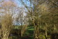
(S/E) Leave the car park and take the Sentier Végétal de l'Èvre. Cross a small wooden bridge and continue along the path that runs alongside the Èvre. Follow the "Au fil de l'Èvre" route, marked in yellow, and the one marked in red.

(1) When you reach the road, turn right into the tunnel that passes under the D 160. At the T-junction that immediately follows, turn left. After about 100 metres, leave the road and take a path on the right that runs alongside the Èvre. After a short return to the La Roche Verdon road, continue along the path beside the river.

(2) Return to the road (Chemin de la Chaussée) and turn right twice, heading towards the Forêterie farm at the foot of the ruins of the castle of the same name. Cross the Èvre and immediately take the path on the left. Follow the stream on your left for about 200 metres.

(3) Then turn right, leaving the banks of the Èvre. At the T-junction, follow the path on the left that goes around the castle (steep climb).

(4) At the end, turn right onto Route du Vieux Château. (Leave the "Au fil de l'Èvre" route). After about 400 m, turn left onto a grassy path. Follow this path northwards to the Étang de la Florancière.

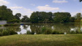
(5) Walk along the left-hand side of the pond. After about 250 m, the carriage road turns right. It is more pleasant to take the grassy path that runs alongside this carriage road. Ignore the paths on the right, head due east and leave the hamlet of Le Mesnil on your right.

(6) Come out onto the D 147 and follow it to the left, taking the grassy verge on the left-hand side. After about 200 m, carefully cross the road to take a grassy path, leaving the Garotin horse farm on your left. Continue for about 600 m until you reach the intersection with a road.

(7) Turn left and pass La Bouillée on your right. At the crossroads (cross), go straight ahead (north-east then north). Cross the Ruisseau des Musses stream and continue straight ahead.

(8) Leave the road when it turns left and continue north-northeast along a new lane. It gradually veers eastward along a path and then a road. At the Petit Chêne au Loup intersection, cross the D 160 carefully and continue straight ahead for 300 m.

(9) Turn right at an acute angle (south-southwest). At the intersection, take the path on the left.

(10) Do not enter the field. The path veers left and follows the Ruisseau de la Gelinière stream. Further on, the path leaves the stream and continues south to the D 133.

(11) Then turn right and take a covered lane that runs alongside the D 133. Return to the road at the next intersection (cross) and follow it westwards along the "Au fil de l'Èvre" route, marked in yellow.

(12) Go around the roundabout on the right, cross a small road and then the D 133 and take a grassy lane on the right. Further on, turn left into Rue des Camélias. After 50 metres, take the path on the right. At the T-junction, turn right.

(13) Cross Route d'Angers and turn right onto Rue du Grand Village. At the fork, turn left, still on Rue du Grand Village. Continue straight ahead and ignore the paths on the left.

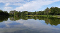
(14) Turn right onto Rue Camille Saint-Saens. After about 50 metres, take thefirst path on the right. Go around the Étang de Trémentines on the right.

(15) Come out onto Rue Maurice Ravel and follow it to the right. Cross Rue Lully on the right-hand side, then walk along the cemetery on the left-hand side. At the car park, turn right into Passage de l'Ouche Michelot. This turns left. Continue south along Rue des Jardins (follow the red or yellow markings). At the end, turn left and you will immediately reach Place du Docteur Fruchaud.

(16) Then turn right. At the end of the square, turn right again and enter Passage de l'Union. Then turn left. Come out onto Impasse Belle Vue and follow it to the left. At the end, turn right onto Rue du Vieux Pont. Turn left onto this street, cross the Èvre and return to the Vieux Pont car park (S/E).

Waypoints

  1. S/E : mi 0 - alt. 348 ft - Vieux Pont car park - barrage sur l'èvre pour moulin à eau
  2. 1 : mi 0.58 - alt. 341 ft - The trail ends at the road.
  3. 2 : mi 1.62 - alt. 341 ft - Chemin de la Chaussée
  4. 3 : mi 1.84 - alt. 322 ft - Fork in the road when leaving the Èvre
  5. 4 : mi 1.98 - alt. 404 ft - Route du Vieux Château
  6. 5 : mi 2.73 - alt. 390 ft - Étang de la Florancière
  7. 6 : mi 3.64 - alt. 446 ft - D 147 road
  8. 7 : mi 4.24 - alt. 436 ft - Road junction near La Bouillée
  9. 8 : mi 5.12 - alt. 492 ft - Junction after La Frouardière
  10. 9 : mi 6.27 - alt. 587 ft - Fork after the D160
  11. 10 : mi 6.88 - alt. 554 ft - Junction
  12. 11 : mi 7.47 - alt. 466 ft - Path parallel to the D 133
  13. 12 : mi 8.19 - alt. 486 ft - Roundabout
  14. 13 : mi 8.48 - alt. 463 ft - Rond-Point de la Route d'Angers
  15. 14 : mi 8.79 - alt. 453 ft - Rue Camille Saint-Saens
  16. 15 : mi 9.14 - alt. 397 ft - Rue Maurice Ravel
  17. 16 : mi 9.52 - alt. 404 ft - Place du Docteur Fruchaud
  18. S/E : mi 9.81 - alt. 348 ft - Vieux Pont car park

Notes

The hike often follows the "Au fil de l'Èvre" route, marked in yellow.

Passing through the D 133, it avoids returning via the D 147, a route that is not very interesting and even dangerous due to the narrowness of the road.

On the way back, it crosses Trémentines.

Reviews and comments

4.6 / 5
Based on 6 reviews

Reliability of the description
4.7 / 5
Ease of following the route
4.5 / 5
Route interest
4.7 / 5
Lopin B
Lopin B
• Edited:

Overall rating : 5 / 5

Date of your route : Apr 03, 2025
Reliability of the description : ★★★★★ Very good
Ease of following the route : ★★★★★ Very good
Route interest : ★★★★★ Very good
Very busy route : No

A lovely walk, partly along the banks of the River Evre. Well-maintained paths and few roads.

Machine-translated

DOMDM
DOMDM

Overall rating : 4.7 / 5

Date of your route : Mar 30, 2025
Reliability of the description : ★★★★★ Very good
Ease of following the route : ★★★★☆ Good
Route interest : ★★★★★ Very good
Very busy route : No

Beautiful route along the banks of the River Evre.
Very muddy terrain between points 10 and 11.
Red markings not very visible at some junctions.

Machine-translated

Cathcat
Cathcat

Overall rating : 5 / 5

Date of your route : Mar 20, 2025
Reliability of the description : ★★★★★ Very good
Ease of following the route : ★★★★★ Very good
Route interest : ★★★★★ Very good
Very busy route : No

Very nice circular loop, with pretty paths and few roads. Still a bit muddy, but manageable.

Machine-translated

chelde
chelde

Overall rating : 4 / 5

Date of your route : Feb 24, 2025
Reliability of the description : ★★★★☆ Good
Ease of following the route : ★★★★☆ Good
Route interest : ★★★★☆ Good
Very busy route : No

Good route

Machine-translated

Kiduf
Kiduf

Overall rating : 5 / 5

Date of your route : Nov 10, 2024
Reliability of the description : ★★★★★ Very good
Ease of following the route : ★★★★★ Very good
Route interest : ★★★★★ Very good
Very busy route : No

A very pretty route along the Evre river, climbing up towards Les Gardes and returning via the path around the Trémentines lake.

Machine-translated

CHANTAL LAFLECHE
CHANTAL LAFLECHE

Overall rating : 4 / 5

Date of your route : Nov 27, 2023
Reliability of the description : ★★★★☆ Good
Ease of following the route : ★★★★☆ Good
Route interest : ★★★★☆ Good
Very busy route : No

BEAUTIFUL ROUTE, TOO BAD THERE'S SO MUCH TARMAC.
Beautiful views.

Worth doing again and again.

Machine-translated

Other walks in the area

For more walks, use our search engine .

The GPS track and description are the property of this route's author. Please do not copy them without permission.