The Castrum Saint-Jean and the Rougiers Balconies

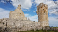
The Castrum Saint-Jean is an iconic site in the village of Rougiers. We climbed up via an unofficial path and descended via a superb balcony path followed by a trail at the bottom of the valley.

Details

20931858
Creation:
Last update:
Last review:
  • Walking
    Activity: Walking
  • ↔
    Distance: 3.62 mi
  • ◔
    Average duration: 2h 25 
  • ▲
    Difficulty: Moderate

  • ⚐
    Back to start: Yes
  • ↗
    Ascent: + 850 ft
  • ↘
    Descent: - 837 ft

  • ▲
    Highest point: 1,975 ft
  • ▼
    Lowest point: 1,161 ft

Photos

Description of the walk

The village of Rougiers is situated on the D1 road, exactly between the villages of Tourves and Nans-les-Pins.
At the bottom of the village, alongside the main road, there is a good car park, which saves you from having to drive through the village’s narrow streets looking for a space.

Please note that the row of parking spaces along the access road to the village is limited to 1½ hours (blue zone).

(S/E) Take Rue de la Rousse, which climbs towards the village centre, and continue straight on towards the castrum, which is clearly visible at the top of the hill.

Follow this street (Rue Sainte-Anne) to the end, where you will find a small road on the left with a 5.5-tonne weight limit (D95 leading to Les Glacières) and, on the right, a dead-end street passing in front of a water tower and marked by a red and yellow sign (GRP°°®°). Turn right.

(1) At the water tower, take the inconspicuous path that opens up to your left. A handwritten sign reading “Medieval site – Chapel” is painted on the concrete wall, with arrows pointing left to indicate this path. Whilst the usual access to the medieval site is via the track that begins as a continuation of the road to the right, we will in fact climb up to the castrum via this small path on the left.

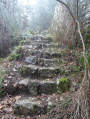
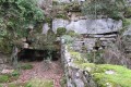
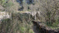
This path climbs through the forest, initially steeply, then becoming gentler. Stay on the ascending section at all times, ignoring the few paths or tracks you encounter on either side. Shortly after passing large Cargneule rocks on the right, the path, following a steep climb, turns sharply right in a hairpin bend until it reaches the castle’s foundations and a fork.

(2) First climb up to the right to a clearing where there is an orientation table.
Then head back down.

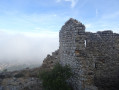
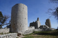
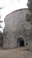
(2) Take the path on the right leading to the chapel (under restoration at the time of our visit) and the ruins of the castrum.
After visiting the ruins and the site, take the forest track heading due south, which first passes a cistern as it turns to the right.

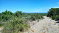
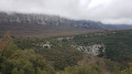
(3) At a bend to the left, take a path on the right that leads into the heath of kermes oak. This clay-and-stone path soon leads to the edge of the cliff. It then becomes a beautiful balcony path offering stunning views of Rougiers, Saint-Maximin and beyond (including glimpses of Montagne Sainte-Victoire and even the snow-capped peaks of the Pre-Alps).
You will soon catch sight of the oppidum of Piégu and the valley through which you will descend on the way back.
The path descends gently into the valley, the perfect spot for a picnic.

(4) After climbing for about a hundred metres, you’ll come across a stone cistern. Head down the valley, initially following the track.

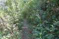
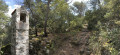
(5) After 200 to 300 m, as the track veers slightly to the right bank, take the path on the left which follows the valley floor closely. This path mostly follows the stream bed exactly (which is also mostly dry). It is mainly rocky, with a few sections requiring you to use your hands to descend. It is often overgrown with thyme laurels; when we passed through, these had been partially cut back to make the path easier to follow.

Gradually, the path levels out and leads into a pine forest where it joins a track. Take this track to the right, skirting the village basin, where you will soon see the sports fields.

(6) Just before the first houses, turn left onto a path that leads to the sports ground, passing between the tennis courts on the right and the football pitch on the left (Chemin de l’Argile) and joins Rue du Clos, which you follow to a large tree-lined square in the centre of the village. Then turn right onto Grand Rue and rejoin Rue de la Rousse, which you took at the start. Follow it to the left to reach the car park (S/E).


Waypoints

  1. S/E : mi 0 - alt. 1,161 ft - Car park on the edge of the village
  2. 1 : mi 0.41 - alt. 1,293 ft - Water tower
  3. 2 : mi 1.28 - alt. 1,877 ft - Towards the information board
  4. 3 : mi 1.56 - alt. 1,955 ft - Entrance to the path on the right
  5. 4 : mi 2.17 - alt. 1,709 ft - Bottom of the valley
  6. 5 : mi 2.35 - alt. 1,535 ft - Path to the left of the track
  7. 6 : mi 3.07 - alt. 1,260 ft - Path on the left towards the sports grounds
  8. S/E : mi 3.62 - alt. 1,161 ft - Return to car park

Notes

This hike was undertaken in early April 2022.

The climb up to the castrum, which is often steep and rocky, as well as the descent into the valley floor, require good scrambling skills, and sturdy hiking boots and a pair of walking poles are essential.

There is no water on this route, but it is mostly shaded and sheltered from the sun for over two-thirds of its length.

It was very windy (Mistral) when we were there. The wind was barely noticeable for most of the route, but very strong at the top of the castrum hill. In this case, make sure you bring a good windbreaker if you plan to spend some time exploring the site.

Worth a visit

Rougiers is a charming village in its own right and well worth a visit.

This circular route could be extended with a climb to the oppidum at Piégu, which is situated on a parallel hill, but in my opinion the oppidum deserves a visit in its own right.

The road starting at the top of Rue Sainte-Anne leads, after about ten kilometres, to the Pivaut ice house, which is as monumental as it is superbly preserved; it is a visit not to be missed.

Reviews and comments

5 / 5
Based on 4 reviews

Reliability of the description
5 / 5
Ease of following the route
5 / 5
Route interest
5 / 5
marylou
marylou

We didn't follow this route because we didn't see the signs at the start. In fact, a sign had been put up in front of the signs (yellow, red and white GR arrow). We were still able to get to Castrum by following another blue-marked route. A beautiful hike that I recommend.

Machine-translated

lagodasse83
lagodasse83

Overall rating : 5 / 5

Date of your route : Dec 02, 2024
Reliability of the description : ★★★★★ Very good
Ease of following the route : ★★★★★ Very good
Route interest : ★★★★★ Very good
Very busy route : No

Thank you for introducing us to Rougiers. We extended the route by doing a round trip to the Castrum, where we had a picnic. The views were stunning and it was completely peaceful.

Machine-translated

claudio.attack
claudio.attack

Overall rating : 5 / 5

Date of your route : May 13, 2024
Reliability of the description : ★★★★★ Very good
Ease of following the route : ★★★★★ Very good
Route interest : ★★★★★ Very good
Very busy route : No

A lovely walk; you can have a picnic at the Castrum. The children had a great time. Be careful of the cliff next to the Castrum.

Machine-translated

stjo
stjo

I see, @genevi83, that you’ve posted a few photos from your hike.
Your photos are lovely, and they really capture the poetic atmosphere of this spot in the mist. I quite like it: any beautiful place is worth seeing in all weathers.

Machine-translated

stjo
stjo

@genevi83 I don’t get what you mean about the cursor: did you need a cursor (GPS, I suppose?) to find the ruins?!! The fog must have been really thick then!

Machine-translated

genevi83
genevi83

Overall rating : 5 / 5

Date of your route : Jan 17, 2024
Reliability of the description : ★★★★★ Very good
Ease of following the route : ★★★★★ Very good
Route interest : ★★★★★ Very good
Very busy route : No

We did this hike in the fog; a faint ray of sunshine broke through but disappeared very quickly. But we didn’t feel cold.
The only downside was that the location marker on the ruins wasn’t accurate, so we had to go back and forth a few times to find our bearings. As that wasn’t working, we followed the description and a little further on the marker re-positioned itself
It was very beautiful, with stunning scenery (well, what we could see through the fog). The descent was a bit of a nerve-wracking experience as the rocks were wet from the fog and really slippery, but we managed it
Towards the end, there was a cave with a fairly small opening; we didn’t dare venture inside. I think I’ll go back with the children so they can have a look.
Thank you for this lovely walk

Machine-translated

rumax
rumax
• Edited:

Overall rating : 5 / 5

Date of your route : Jul 03, 2022
Reliability of the description : ★★★★★ Very good
Ease of following the route : ★★★★★ Very good
Route interest : ★★★★★ Very good
Very busy route : No

This route was walked in the opposite direction to that described.
The climb through the lovely woodland is moderately steep.
From La Chapelle (currently undergoing renovation), the view is magnificent (an early picnic in the shade of the chapel).
The remains of the castrum and the dwellings below are well worth a visit.
The return route follows a path that starts as a balcony trail, then leads through a ravine where a multitude of butterflies flutter, before re-entering a woodland path that is beginning to be overgrown by vegetation.
If you do the hike in the morning, you can also head to Tourves to visit the Gueules Rouges museum or Valbelle Castle, or both.
It’s a lovely little route and very well described; thank you, stjo, for suggesting it.

Machine-translated

Other walks in the area

For more walks, use our search engine .

The GPS track and description are the property of this route's author. Please do not copy them without permission.