The Castillo del Rio circular walk near Aspe

A walk near the village of Aspe and the River Vinalopó, in a wild and stunningly beautiful setting, exploring the Castillo del Río, superb aqueduct bridges carrying water, and various places steeped in history.
If you love adventure, this walk is for you!

Details

n°42967131
Creation:
Last update:
Last review:
  • Walking
    Activity: Walking
  • ↔
    Distance: 6.37 mi
  • ◔
    Average duration: 3h 30 
  • ▲
    Difficulty: Moderate

  • ⚐
    Back to start: Yes
  • ↗
    Ascent: + 702 ft
  • ↘
    Descent: - 722 ft

  • ▲
    Highest point: 1,115 ft
  • ▼
    Lowest point: 518 ft
  • ⚐ Country: Spain
  • ⚐ City: Aspe 
  • ⚑
    Start/End: N 38.343511° / W 0.723586°
  • Hour-by-hour weather

Photos

Description of the walk

The starting point for this walk is on the CV-847, just before you cross the green TGV bridge (or rather, the AVE bridge, which stands for Alta Velocidad Española, the Spanish high-speed train).
To reach this starting point by car, see the ‘Practical Information’ section below.

(S/E) From the tarmac car park, follow the road for 100 metres and take the first path on the left. This path is tarmac for a few metres, then turns into a dirt track.
There is a sign marked ‘Camino Castillo del Rio’ and, if you look up, you can already see the castle in front of you.

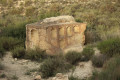
(1) Visit the castle ruins – a round trip – by taking the path on the right and walking up to the top of one of the towers. From there, there’s a stunning view of the surrounding area.
Retrace your steps to rejoin the path you took at the start and continue the walk by heading to the right.
A little further on, head towards the ruined house, but turn left to take the path that runs beneath it.

(2) There is a junction where several paths meet. In fact, you need to take the very narrow path that climbs up opposite. This narrow path will lead onto a wide track, which you should follow by turning right. Then follow this wide path, ignoring any other paths coming from the right or left. The path will narrow and you’ll come to a large gate which, in fact, marks the boundary of a hunting reserve.

(3) At this point, the fence has been deliberately removed to leave a passage for walkers. Go through the gate and head to the right. You’ll then be walking inside the hunting reserve, following the fence.
A little further on, at the junction, take the path on the right and then, a short while later, go through the fence on the right, where it has been deliberately removed to exit the hunting reserve. Then follow this new path, guided by a few cairns. The descent may seem steep in places and you need to be careful as, at times, the path becomes a little unclear.

(4) At the fork, carry on straight ahead. Further on, to continue along the path, head for the boundary marker and, once you reach it, turn left.

(5) Change direction and turn right.

(6) Take a round trip to the viewpoint (Mirador de la Carrière de Miguel Roman). On the way back, turn right and go through the tunnel.

(7) Take the path on the left.

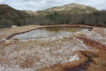
(8) At the signpost, follow the sign for “Puente de los 5 ojos”, i.e. turn right (“puente” means bridge). If you look at a (satellite) map, you’ll see you’re right in the middle of the water. You’re actually on a very narrow path surrounded by water: the view is fabulous, though perhaps a little overwhelming.

(9) Turn left, towards the “Puente de los 4 ojos”, and walk along a concrete path.

(10) Take a short detour to the bunker and, from there, enjoy the view of the “Puente de los 5 Ojos”. Then turn round and head straight on towards the “Puente de los 4 Ojos” viewpoint.

(11) Retrace your steps.

(10) Take the path leading down to the left.

(12) At the end, turn left. You’ll arrive at the foot of the ‘Puente de los 5 Ojos’.

(13) Retrace your steps to the previous fork in the path.

(12) Carry on straight ahead until you reach another junction you passed on the way there.

(9) Turn sharply left onto the road that climbs (do not take the other paths, which are not shown on the map). A short while later, leave the road by turning right, following the direction indicated on the signposts for “mirador” and “castillo del rio”.
Shortly afterwards, take a detour to the right to reach the viewpoint, which offers a view of the area towards the end of the dam, which is overgrown with reeds. The view is impressive, both of the mountains facing you and of this sea of reeds.
Then rejoin the path by heading to the right and follow this path along the end of the dam, keeping the vast expanse of reeds on your right, as well as the River Vinalopó.

(14) You are now at a place known as ‘Puente de hierro’.

(15) You are now at a place known as “La fábrica de luz”. A little further on, on the right, you can see the River Vinalopó up close.

(16) We find ourselves at the foot of the green bridge on the high-speed rail line. Head towards the road and, turning right, you’ll reach the car park at the starting point (S/E).

Waypoints

  1. S/E : mi 0 - alt. 630 ft - Car park on the CV-847
  2. 1 : mi 0.29 - alt. 656 ft - Return journey
  3. 2 : mi 0.84 - alt. 587 ft - Junction
  4. 3 : mi 1.88 - alt. 1,010 ft - Go through the gate. Turn right
  5. 4 : mi 2.46 - alt. 764 ft - Junction
  6. 5 : mi 2.73 - alt. 640 ft - On the right
  7. 6 : mi 2.97 - alt. 627 ft - Signpost
  8. 7 : mi 3.35 - alt. 535 ft - Junction
  9. 8 : mi 3.51 - alt. 528 ft - Signpost
  10. 9 : mi 3.8 - alt. 541 ft - Head towards Puente 4 Ojos. Two-way junction
  11. 10 : mi 3.97 - alt. 581 ft - T-junction at the viewpoint
  12. 11 : mi 4.05 - alt. 571 ft - Mirador 4 Ojos
  13. 12 : mi 4.19 - alt. 541 ft - Common junction (there and back)
  14. 13 : mi 4.36 - alt. 574 ft - The bridge
  15. 14 : mi 5.35 - alt. 561 ft - Iron Bridge
  16. 15 : mi 5.46 - alt. 554 ft - Fabrica de luz
  17. 16 : mi 6.17 - alt. 614 ft - Train bridge.
  18. S/E : mi 6.37 - alt. 630 ft - Back to the car park

Notes

From Alicante city centre, take the A31 motorway (from Calle México), heading towards Madrid.
Take exit 224 for the CV-847 / Aspe / Benidorm / Valencia and carry on straight ahead onto the CV-847 / Aspe. Stay in the left-hand lane to follow the signs for Aspe, then carry on straight ahead.
At the roundabout, take the 3rd exit for the CV-847 / Aspe (and A7 Murcia).
You will then cross over the motorway you have just left and, at the roundabout, take thefirst exit for the CV-847 / Aspe.
On the CV-847, after the golf club and at kilometre 4, when you see the TGV bridge ahead on a straight stretch of road, there are three options for parking:

  • on the left, a fairly large tarmac car park: this is the easiest option
  • a few metres further on, just before the brown ‘Rio Vinalopo’ sign, at the ‘no overtaking’ sign, park on the right in a dirt area at the foot of the sign.
  • Two hundred metres further on, park under the high-speed train bridge on the left.

For your information, from Alicante, the journey by car is about 22 kilometres and takes around twenty minutes.

Worth a visit

Castillo del Rio
The Castillo del Rio is a 12th-century Islamic fortification situated on a small hill at an altitude of 254 metres, on the banks of the River Vinalopó.
It consists of two sets of walls and twelve towers.
The outermost wall was home to a village with dwellings.
As for the upper wall, which was better fortified, it was used by the military and the military governor.
Excavations have unearthed an Arab plough (one of only two found in Spain), which is on display at the Archaeological Museum of Alicante (the MARQ).

The Five-Eyed Bridge
Towards the end of the 18th century, the population of the town of Elche experienced a significant increase, leading to a high demand for water. As local resources were insufficient, it became necessary to seek water a little further afield.
Consequently, on 16 March 1785, Elche Town Council purchased a spring (hence the name Fuente de Barrenas) from a landowner, Mr Barrenas, situated in the municipality of Aspe.
From then on, it was necessary to build an entire water supply network from this spring to Elche.
And on 22 June 1789 at 8.57 pm, for the first time in its history, Elche had a drinking water supply point.
The Puente de los 5 Ojos is the largest of the various aqueducts built and measures 46 metres in length and 17 metres in height.
The five ‘eyes’ in question are the five arches of this bridge.
It has recently been restored.

To find out more about this fascinating history, here is a link to some information (in Spanish):
https://rutasyvericuetos.blogspot.com/20...

Puente de Hierro
At the start of the 20th century, plans to divert and channel the River Vinalopó before it reached the dam were revived.
The aim was to improve irrigation of the fields using this fresh water.
The project was carried out between 1906 and 1910 with the construction of a water diversion canal, a 723-metre section of which cuts through the mountain.
The flow of water into the canal was controlled by a guard stationed in a building constructed as a small tower, which is still clearly visible today.
To access this tower, a metal footbridge was also built to link the path to the tower: hence the name ‘puente de hierro’, meaning ‘iron bridge’.
However, in 1982, a massive flood swept it away about 500 metres from where it still stands, though now hidden by the reeds.

The power station
In the past, there were four flour mills along the River Vinalopó. This is thethird of these mills: it is known as the Caraseta Mill and began operating in 1842.
However, in 1895, the new owner converted the mill and harnessed the power of the water by installing turbines to generate electricity. The neighbouring towns of Aspe, Novelda and Montforte del Cid then signed a contract to provide these towns with a public lighting service. Hence the name ‘light factory’.

Reviews and comments

5 / 5
Based on 1 review

Reliability of the description
5 / 5
Ease of following the route
5 / 5
Route interest
5 / 5
CJCB
CJCB

Overall rating : 5 / 5

Date of your route : Mar 03, 2025
Reliability of the description : ★★★★★ Very good
Ease of following the route : ★★★★★ Very good
Route interest : ★★★★★ Very good
Very busy route : No

A lovely walk for an afternoon. Very good. Thanks to the organiser

Machine-translated

Other walks in the area

For more walks, use our search engine .

The GPS track and description are the property of this route's author. Please do not copy them without permission.