The Bois Defoi from Carlsbourg

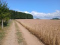
A short, easy family walk. Suitable for pushchairs.

Details

n°3621862
Creation:
Last update:
Last review:
  • Walking
    Activity: Walking
  • ↔
    Distance: 4.90 mi
  • ◔
    Average duration: 2h 35 
  • ▲
    Difficulty: Easy

  • ⚐
    Back to start: Yes
  • ↗
    Ascent: + 364 ft
  • ↘
    Descent: - 335 ft

  • ▲
    Highest point: 1,483 ft
  • ▼
    Lowest point: 1,309 ft

Photos

Description of the walk

(S/E) Start near the Carlsbourg cattle trough on Rue de Vivy.
Ample parking. Follow this street, then take the first right and turn left towards the church.

(1) Walk past the church on the right, coming out onto Rue Joseph Jacques, which you follow to the left, then turn right into Rue des Socquettes and turn right onto the first dirt track, which you follow straight on.

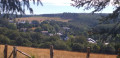
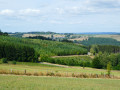
(2) Signposted for the Bois du Prince (altitude 430 m) and a viewpoint over the village. Walk straight through a beech forest and join the tarmac road leading from Carslbourg to Saint-Éloi.

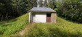
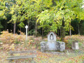
(3). Turn left onto this very quiet road and arrive at the small chapel dedicated to Saint Anthony.

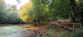
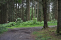
(4) Turn right and walk past the remarkable Douglas firs in the Bois de Defoi. Follow this wide path, which forms a circular route, until you reach the Defoi water reservoir, which supplies the village of Carlsbourg. The water is supplied via the Waillimont pumping station.

(5) Carry on straight ahead, passing the remarkable Vosges pines in the Defoi wood, and you’ll come to a gravel track.

(6) Take this path on the left as you leave the woods, then turn right onto the village path as you come to the end of the gravel track.

(7) Just past the new buildings, take the dirt track on the left and head up towards the meadows.
At this point, the path has been obliterated by farming activity; cut across the meadow to Rue des Ronchis, which you should take on the right.
Turn left onto the path in front of the new buildings and head down towards the Carlsbourg sawmill.

(8) Turn right onto Rue de Vivy towards the village and you’ll arrive at the Carlsbourg cattle trough (S/E).

Waypoints

  1. S/E : mi 0 - alt. 1,319 ft - Cows’ drinking trough on Rue de Vivy
  2. 1 : mi 0.26 - alt. 1,352 ft - Carlsbourg Church
  3. 2 : mi 1.01 - alt. 1,421 ft - Signposted ‘Bois du Prince’
  4. 3 : mi 1.59 - alt. 1,453 ft - Carsbourg / Saint-Éloi Road
  5. 4 : mi 1.81 - alt. 1,463 ft - Saint-Antoine Chapel
  6. 5 : mi 3.16 - alt. 1,470 ft - Defoi Reservoir
  7. 6 : mi 3.63 - alt. 1,398 ft - Gravel track
  8. 7 : mi 3.98 - alt. 1,404 ft - Dirt track
  9. 8 : mi 4.5 - alt. 1,365 ft - Sawmill
  10. S/E : mi 4.9 - alt. 1,319 ft - Cows’ watering trough on Rue de Vivy

Reviews and comments

4.3 / 5
Based on 2 reviews

Reliability of the description
4.5 / 5
Ease of following the route
4 / 5
Route interest
4.5 / 5
residence18
residence18

Overall rating : 5 / 5

Date of your route : Jan 11, 2021
Reliability of the description : ★★★★★ Very good
Ease of following the route : Not used / Not applicable
Route interest : ★★★★★ Very good
Very busy route : No

A lovely walk with the children. Stunning scenery in the snow-covered woods! Highly recommended.

Machine-translated

claude M
claude M

Overall rating : 4 / 5

Date of your route : Sep 13, 2020
Reliability of the description : ★★★★☆ Good
Ease of following the route : ★★★★☆ Good
Route interest : ★★★★☆ Good
Very busy route : No

A pleasant walk, with some remarkable trees.
Well worth a repeat visit.1

Machine-translated

Other walks in the area

For more walks, use our search engine .

The GPS track and description are the property of this route's author. Please do not copy them without permission.