


Please note: check the dates for big game hunting and driven hunts from September to December on ChasseOnWeb, as the forest is then closed to the public.
Chapels and old mills starting from Oizy


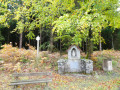
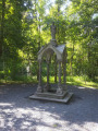
This circular walk, starting from the Oizy Chapel, takes you through the woods to discover fishing ponds, chapels and old mills.
The return route takes you through the countryside and areas of intensive Christmas tree plantations.
A superb walk to enjoy in autumn, when the trees change colour at different rates and mushrooms abound in the undergrowth.
Unfortunately, the Mitauge Mill isn’t very visible… hidden by vegetation on either side.
A key site of the Resistance during the Second World War, the Gros-Fays Mill is much better showcased.
Details
Creation:
Last update:
Last review:
–
–
-
 Activity: Walking
 -
 Distance: 7.75 mi
 -
 Average duration: 4h 25
 -
 Difficulty: Moderate
 -
-
 Back to start: Yes
 -
 Ascent: + 994 ft
 -
 Descent: - 994 ft
 -
-
 Highest point: 1,401 ft
 -
 Lowest point: 833 ft
-
 Country:
Belgium
Country:
Belgium
-
 Area: Massif des Ardennes
 -
 City:
Bièvre
City:
Bièvre -
 Start/End: N 49.888955° / E 5.021209°
 -
 IGN map(s): Ref. 3009SB
 -


 Hour-by-hour weather
Photos
Waypoints
- S/E : mi 0 - alt. 1,322 ft - Notre-Dame de Bon Secours Chapel
- 1 : mi 0.62 - alt. 1,266 ft - Maquis Chapel
- 2 : mi 1.94 - alt. 1,296 ft - Fishing pond
- 3 : mi 2.51 - alt. 1,125 ft - Mitauge Mill
- 4 : mi 4.32 - alt. 928 ft - Route
- 5 : mi 4.69 - alt. 833 ft - Gros-Fays Mill
- 6 : mi 5.9 - alt. 1,260 ft - Neveny
- S/E : mi 7.76 - alt. 1,322 ft - Notre-Dame de Bon Secours Chapel
Notes
Other walks in the area
Baillamont Circular
 Visorando Member
 4.39 mi
+371 ft
-364 ft
2h 20
4.39 mi
+371 ft
-364 ft
2h 20
 Easy
Easy
 Departure from Bièvre (Province de Namur)
An easy, peaceful walk with very few roads.
Crosses the Bois de Flèrifoi and the Bois Les Tranlets, passing not far from the hamlet of "Les Waibes" before finishing with the return through the Bois du Ro.
Let’s take a stroll through the woods towards Vivy
 12.85 mi
+1,486 ft
-1,499 ft
7h 10
Moderate
Departure from Bouillon (Belgique) (Province de Luxembourg)
12.85 mi
+1,486 ft
-1,499 ft
7h 10
Moderate
Departure from Bouillon (Belgique) (Province de Luxembourg)
Let’s take a stroll through the woods whilst the wolf and the hunter are not there…This woodland walk offers lovely views of the countryside, not of the meandering Semois river nearby, but of the surrounding countryside and a few villages: Gros-Fays and Rochehaut, to name but two.The mix of deciduous and coniferous trees, grassy and stony paths, and forest and countryside trails makes for a well-balanced walk that never becomes monotonous.With a 460-metre elevation gain, it is not particularly difficult. Only the final climb from the Moulin de Liresse is a bit of a slog.Away from the beaten track and tourist hotspots, this walk is ideal for recharging your batteries in the forest and making the most of the natural surroundings.
The Saint-Furcy Spring and the Roche Mouselle in a snap
10.27 mi
+948 ft
-942 ft
5h 35
Moderate
Departure from Bièvre (Province de Namur)
This walk in the Namur Ardennes is pure bliss, alternating between countryside and forests, streams, paths and trails.The route combines two major points of interest in the region: the Saint Furcy Spring and the Roche Mouselle Cave.
The Semois near Cornimont
 13.35 mi
+2,365 ft
-2,365 ft
8h 10
13.35 mi
+2,365 ft
-2,365 ft
8h 10
 Difficult
Departure from Bièvre (Province de Namur)
Difficult
Departure from Bièvre (Province de Namur)
Quite a physical challenge due to its length and cumulative elevation gain, this lovely walk, set in magnificent surroundings, also requires a bit of off-trail walking at times to cross certain streams. Nothing too daunting, but you may occasionally need to stray from the paths and climb or descend a little through the countryside. The most challenging part is reaching the banks of the Semois from Rochehaut. The steep path, which is very poorly marked at km 8.5, is more like a trail run route than a hiking trail. Otherwise, it’s simply splendid. You pass the old mills at Liresse and (near) Gros-Fays, next to the footbridge at Frahan and across the one at Mouzaive. There’s just a short stretch of tarmac between Alle and Mouzaive and on the hillside before Gros-Fays.
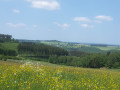
Serenity in the woods around Cornimont.
 5.91 mi
+745 ft
-722 ft
3h 20
Moderate
Departure from Bièvre (Province de Namur)
5.91 mi
+745 ft
-722 ft
3h 20
Moderate
Departure from Bièvre (Province de Namur)
Cornimont is the smallest village in the Bièvre area (46 inhabitants). It is every bit as charming as Gros-Fays, which is on the list of Belgium's most beautiful villages, with its schist stone houses and beech forest.
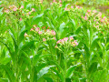
From Cornimont to Rochehaut
 9.98 mi
+1,355 ft
-1,355 ft
5h 45
Moderate
Departure from Bièvre (Province de Namur)
9.98 mi
+1,355 ft
-1,355 ft
5h 45
Moderate
Departure from Bièvre (Province de Namur)
Starting from the pretty chapel at Cornimont, the walk soon enters the forest, skirting the pastures of the hamlet known as ‘Le Give’, before reaching Rochehaut near the brewery (brewing & tasting), the agricultural museum and the wildlife park.The route continues towards the centre of Rochehaut and its viewpoints over the circular Semois loop, Frahan and the footbridge dating from 1926. This is followed by a lovely descent towards the Semois and the old slate quarry beneath the Rocher des Corbeaux. The walk continues along the river (note the tobacco drying shed on the opposite bank) to Ban de Laviot and its campsites, before heading back up into the forest to bypass them on the way to Hour.After 100 metres on tarmac, the walk turns onto a narrow path and climbs up to the Mont d’Aule via forest tracks, before descending gently to the Hamai viewpoint overlooking the Semois valley. From there, the return journey to Cornimont follows a forest track through the countryside to the south-west of the village.
For more walks, use our search engine .
The GPS track and description are the property of this route's author. Please do not copy them without permission.

