Walk to the source of the Ruisseau du Defoi

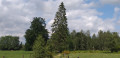
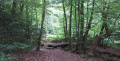
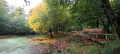
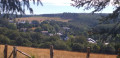
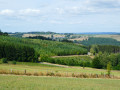
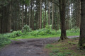
A magnificent walk through the Bois du Defoi, a mix of footpaths and forest tracks… a mix of streams, characteristic trees and sculptures.

Details

n°10501531
Creation:
Last update:
Last review:
  • Walking
    Activity: Walking
  • ↔
    Distance: 5.48 mi
  • ◔
    Average duration: 2h 50 
  • ▲
    Difficulty: Easy

  • ⚐
    Back to start: Yes
  • ↗
    Ascent: + 367 ft
  • ↘
    Descent: - 381 ft

  • ▲
    Highest point: 1,516 ft
  • ▼
    Lowest point: 1,335 ft

Photos

Description of the walk

Car park on the N899 between Paliseul and Bouillon, near the war memorial at the old Nollevaux cemetery.

No signposting

(S/E) Take the road on your left, then follow the forest path alongside the car park, running parallel to the road. You’ll soon come across the First World War memorial on your left. Continue along the forest path for approximately 750 metres. When you reach the road, turn right. On your right, you’ll find the artwork *Le Sablier* with its information panel on theFirst World War.

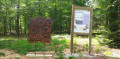
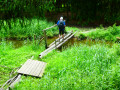
(1) Facing the artwork, look out for the path (not on OSM) starting on your right, near the tree with two signposts. Follow the path and you’ll come across the first information board about the alder. Cross two small bridges, one after the other. You’ll come across further information boards.

(2) Cross one last small bridge. You’ll see the pond on your left. At the wide forest track, continue to the right. Cut across another forest track and head towards the next information board, about maple trees. Then follow the path leading off to the next information board on your left, and follow the trail to the Source du Defoi.

(3) Carry on along the path. Turn left, then cross a faintly marked track. Pass the signpost by the Vosges fir trees. Join a wider track and take it to the right. You’ll reach the orchard. Take the hairpin bend to the left and you’ll come to the Douglas fir and its information panel.

(4) At the junction of the forest tracks, continue to the right. Walk straight on along the main path until you reach the road. Turn right. At the junction, with forest paths on either side, take a short detour to the right to see the artwork *Bleuets et Coquelicots*. Retrace your steps, then continue right along the road until you reach the forest path on your left, marked by a tree labelled P10 at its entrance.

(5) Turn left. Walk straight on for about 1.2 km. At the T-junction, turn right.

Yellow Rectangle Signpost

At the fork in the road, continue to the right. Follow the wide forest track uphill. Discover the artwork *Engrenage* at a place known as *l’Aire Barbecue*. Then continue straight on. Walk past the Defoy water reservoir. At the next junction, continue straight on again.

(6) Walk past the Vosges fir trees and their information board. They can be identified by a small plaque on their trunks. Continue along the wide forest track until you reach the road.

(7) Turn right, walk along the road for 600 m and, at the crossroads with forest paths on either side, turn left. Walk straight on and pass the hamlet known as Bois du Prince.

(8) Carry on straight ahead. The path bends sharply to the right. Continue and pass a clear-cut area that is now overgrown with broom and young birch trees. At the crossroads, go straight on.

No signposting

At the next crossroads, carry on straight ahead. Further on, join another path on your right (not shown on IGN maps).

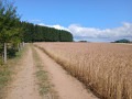
(9) Take a sharp right-hand bend. At the crossroads, turn left. Join a path as you emerge from under the trees. Continue straight on and return to your car park (S/E).

Waypoints

  1. S/E : mi 0 - alt. 1,444 ft - Car park at the war memorial on the N899
  2. 1 : mi 0.66 - alt. 1,348 ft - Path before the Sablier monument
  3. 2 : mi 0.89 - alt. 1,378 ft - Third bridge before the pond
  4. 3 : mi 1.04 - alt. 1,440 ft - Defoi Spring
  5. 4 : mi 1.26 - alt. 1,421 ft - Forest track junction
  6. 5 : mi 1.79 - alt. 1,450 ft - Path with ‘P10’ marked on the tree
  7. 6 : mi 3.09 - alt. 1,473 ft - Vosges fir trees
  8. 7 : mi 3.48 - alt. 1,401 ft - Road
  9. 8 : mi 4.39 - alt. 1,424 ft - Locality: Bois du Prince
  10. 9 : mi 5.12 - alt. 1,427 ft - Hairpin bend to the right
  11. S/E : mi 5.48 - alt. 1,444 ft - Car park at the war memorial on the N899

Notes

You shouldn’t encounter any difficulties along the route.
From (1) to the road after (4) and the track after (5): the paths and tracks are not visible on OSM but are shown on IGN
From (9) to the track before (S/E): the paths and tracks are not visible on IGN but are visible on OSM.
Picnic table at (1).
Bench at the war memorial.
From October to December, please be aware of the hunting season dates.

Worth a visit

During
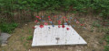
Monument at the former Nollevaux WWI cemetery.
Artworks from the ‘Balade des Poilus’ trail: ‘Le Sablier’, ‘Bleuets et Coquelicots’, ‘Engrenage’ and their explanatory panels.
Information panels on the trees along the route.
Source of the Defoi stream.

Reviews and comments

4 / 5
Based on 2 reviews

Reliability of the description
4 / 5
Ease of following the route
4 / 5
Route interest
4 / 5
Alain May
Alain May

Overall rating : 5 / 5

Date of your route : Jul 20, 2026
Reliability of the description : ★★★★★ Very good
Ease of following the route : ★★★★★ Very good
Route interest : ★★★★★ Very good
Very busy route : No

A lovely walk, with plenty of small information boards telling you about the local flora and fauna, as well as metal plaques depicting the animals you might also come across in the forest.
The only slight downside (but one you’ll quickly forget): at one point between waypoint 8 and waypoint 9, we had to use secateurs to clear a path through the thick growth of stinging nettles and brambles, though this was only for a few metres.
This means that, from now on, for any future walkers venturing there, this path is clear
Enjoy your walk, everyone.

Machine-translated

User 13663425

Overall rating : 3 / 5

Date of your route : Jul 05, 2025
Reliability of the description : ★★★☆☆ Average
Ease of following the route : ★★★☆☆ Average
Route interest : ★★★☆☆ Average
Very busy route : No

Please note: It appears that the end of the route may not be accessible. In any case, we opted for an alternative route approximately 700 metres after point 8 (approximately 300 metres before point 9), as the path ahead was rather blocked: we turned right, then left, before returning to the starting point.

Machine-translated

Other walks in the area

For more walks, use our search engine .

The GPS track and description are the property of this route's author. Please do not copy them without permission.