A circular loop through the Richelais vineyards

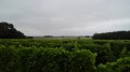
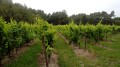
A stone’s throw from the Cité du Cardinal, a short walk through the Richelais vineyards. The walk offers a varied route through the vineyards, through the woods or across the fields.

Details

748928
Creation:
Last update:
Last review:
  • Walking
    Activity: Walking
  • ↔
    Distance: 4.83 mi
  • ◔
    Average duration: 2h 15 
  • ▲
    Difficulty: Easy

  • ⚐
    Back to start: Yes
  • ↗
    Ascent: + 56 ft
  • ↘
    Descent: - 56 ft

  • ▲
    Highest point: 367 ft
  • ▼
    Lowest point: 308 ft
  • ⚐ Country: France
  • ⚐ City: Courcoué (37120)
  • ⚑
    Start/End: N 47.046493° / E 0.381951°
  • ❏
    IGN map(s): Ref. 1724SB, 1824SB
  • Hour-by-hour weather

Photos

Description of the walk

Start on Rue des Sables in the hamlet of Les Bruères. Park at the side of the road, near a large solitary lime tree, at the exit of the hamlet when coming from the D757, or at the entrance when coming from the D58 or the village of La Tour-Saint-Gelin.

Unmarked route
There are a few faded blue signposts or arrows. Do not rely on these very sparse markings for guidance.

(S/E) Turn your back on the houses and head south-east along the small road. At the first junction, turn left towards La Chambaudière. Then take the first left, Rue des Rosiers, and cross the hamlet. At the Fork in the road (gate topped with a weather vane), turn right onto Rue du Chêne. Walk alongside a vineyard on your left.

(1) At the corner of the vineyard, just past the last houses, turn left onto a grassy path that runs alongside the vineyard and then enters a wood. At the end of the path, as you leave the wood, turn right twice and enter the wood again. Continue along the edge of the wood on your right until you reach a crossroads.

(2) Then turn left between the fields (north-west) and continue along the edge of the woods. Next, pass between a vineyard on your left and a wood on your right. Finish up between the fields.

(3) At the T-junction, turn right and walk alongside a vineyard on your right. In a copse, ignore a path branching off to the left and continue north-east. At the houses, the path gives way to a tarmac road.

(4) At the fork in the road, turn left and follow a small road (note a beautiful walnut tree on the right in the middle of a field). Cross a main road (D757), continue straight on towards La Grande Bruère and pass the hamlet of La Simardière.

(5) Shortly after a large house with exposed stonework on the left, at the corner of the garden fence, leave the road and follow a grassy path to the left. At a Fork in the road, turn left, leaving a small wooded area on your right. At the junction that appears immediately, turn left.

(6) At the next fork in the road, turn left (Yellow Cross). Walk south-south-west, alternating between sections deep in the woods and those along the edge. At a T-junction (elevation 105), turn left, leave the woods and continue straight on (south-east) until you reach the D757.

(7) Cross the road and enter the woods again. Ignore a path branching off to the left (not shown on the IGN map). At the next junction (elevation 105), continue straight on. Ignore a path on the left.

(8) At a junction with a grassy track running perpendicular to the left (track not shown on the map; chain blocking access), take the path furthest to the right (south-southeast). Ignore vague paths branching off to the right. At the junction at the edge of the woods, continue straight on, passing a house on your right. You will come out onto a small road; follow it to the left. At the Stop sign, continue straight on through the hamlet to the solitary lime tree (S/E).

Waypoints

  1. S/E : mi 0 - alt. 364 ft - Les Bruères
  2. 1 : mi 0.64 - alt. 344 ft - Start of the path
  3. 2 : mi 0.98 - alt. 318 ft - Crossroads
  4. 3 : mi 1.52 - alt. 348 ft - T-junction
  5. 4 : mi 2.02 - alt. 315 ft - La Bouchardière
  6. 5 : mi 2.72 - alt. 335 ft - La Grande Bruère
  7. 6 : mi 2.99 - alt. 312 ft - Fork in the road
  8. 7 : mi 3.81 - alt. 351 ft - D757 road
  9. 8 : mi 4.15 - alt. 348 ft - Crossroads
  10. S/E : mi 4.83 - alt. 364 ft - Les Bruères

Notes

The walk follows well-maintained paths or quiet country lanes: unless the weather is very wet, good trainers or low-cut walking shoes are sufficient for this walk.

No water sources or shops were spotted along the route.

A detailed map is useful (at the very least the one accompanying this description).

Hike completed by the author on 23 August 2017.

Worth a visit

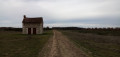
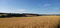
- Vineyard landscapes, pleasant woodland.
- In season, blackberry lovers will find a few inviting bushes.
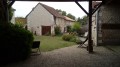
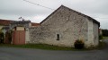
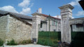
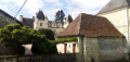
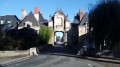
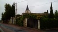
- A few beautiful tuffeau stone houses.

Reviews and comments

4.4 / 5
Based on 4 reviews

Reliability of the description
4.3 / 5
Ease of following the route
4.8 / 5
Route interest
4.3 / 5
Divehoggy
Divehoggy

Overall rating : 4.5 / 5

Date of your route : Nov 12, 2021
Reliability of the description : Not used / Not applicable
Ease of following the route : ★★★★★ Very good
Route interest : ★★★★☆ Good
Very busy route : No

A completely flat walk. Varied, with some lovely unobstructed views, and a bit of tarmac as you pass through a few hamlets. Wide, well-maintained paths. I didn’t see any signposts; I use the app for everything, so I don’t bother reading the description.

Machine-translated

EDERP
EDERP

Overall rating : 4.3 / 5

Date of your route : Feb 24, 2020
Reliability of the description : ★★★★☆ Good
Ease of following the route : ★★★★★ Very good
Route interest : ★★★★☆ Good

Please note: there are no longer any markings on site

Machine-translated

Fayerando
Fayerando

Overall rating : 4 / 5

Date of your route : Mar 17, 2019
Reliability of the description : ★★★★☆ Good
Ease of following the route : ★★★★☆ Good
Route interest : ★★★★☆ Good

A very peaceful, quiet walk with the chance to spot wildlife! Please note that near the start of this walk, a few
of vines have been removed and, as a result, the path is no longer maintained!

Machine-translated

didice37
didice37

Overall rating : 5 / 5

Date of your route : Nov 02, 2018
Reliability of the description : ★★★★★ Very good
Ease of following the route : ★★★★★ Very good
Route interest : ★★★★★ Very good

Easy and enjoyable, with lovely houses and beautiful woodland throughout. Please note: hunting takes place on Thursdays, Saturdays and Sundays, with numerous hunting stands.

Machine-translated

Other walks in the area

For more walks, use our search engine .

The GPS track and description are the property of this route's author. Please do not copy them without permission.