The Belvédère des Dappes

A pleasant route through the Massif des Tuffes to explore the highest point of the Les Rousses alpine ski resort.

Details

3984
Creation:
Last update:
Last review:
  • Snowshoeing
    Activity: Snowshoeing
  • ↔
    Distance: 2.95 mi
  • ◔
    Duration according to the author: 4 hrs 
  • ▲
    Difficulty: Moderate

  • ⚐
    Back to start: Yes
  • ↗
    Ascent: + 935 ft
  • ↘
    Descent: - 935 ft

  • ▲
    Highest point: 4,610 ft
  • ▼
    Lowest point: 3,802 ft

Photos

Description of the walk

(S/E) Set off from the ‘La Pile Dessus’ lodge at the Balancier ski resort.
Cross the road under the bridge and head up to the left towards the woods, keeping to the side of the road. Join the ski run.

(1) Turn right onto one of the paths leading up through the woods.
From there, zigzag your way up, finding the easiest slope to reach the summit trail. Stay in the woods, running parallel to the trail, and emerge at the summit of Les Dappes.

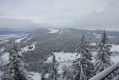
(2). Walk round to the viewpoint on the right, then head back down via theGR® trail, which is a snowshoe trail in winter. Follow it all the way down to the Les Tuffes ski lift.

(3) Cross it and head back up via the Nordic stadium to reach the resort’s main car park; then, under the bridge, head to the lodge (S/E).

Waypoints

  1. S/E : mi 0 - alt. 4,003 ft - Pile Dessus car park
  2. 1 : mi 0.25 - alt. 4,035 ft - Path on the right
  3. 2 : mi 1.06 - alt. 4,488 ft - Belvédère des Dappes
  4. 3 : mi 2.02 - alt. 3,819 ft - Crossing the ski lift
  5. S/E : mi 2.95 - alt. 4,003 ft - Pile Dessus car park

Notes

In winter, when there’s snow, snowshoes are essential.

Worth a visit

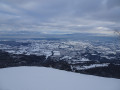
The viewpoint offers a lovely view when the sky is clear; unfortunately for us, that wasn’t the case.
The lodge is close to Les Rousses and the Swiss border. A visit to Fort des Rousses is a must, and on the other side of the border, the little train linking La Cure to Nyons is well worth taking for a lovely trip to explore Lake Geneva.

Always be cautious and plan ahead when you're outdoors. Visorando and the author of this route cannot be held responsible for any accidents occurring on this route.

The GR® and PR® markings are the intellectual property of the Fédération Française de Randonnée Pédestre.

Reviews and comments

3.8 / 5
Based on 3 reviews

Reliability of the description
3.3 / 5
Ease of following the route
3.3 / 5
Route interest
4.7 / 5
Philhou
Philhou

Overall rating : 3 / 5

Date of your route : Aug 08, 2023
Reliability of the description : ★★☆☆☆ Disappointing
Ease of following the route : ★★☆☆☆ Disappointing
Route interest : ★★★★★ Very good
Very busy route : No

Unfortunately, the paths aren’t signposted. You can’t even find the starting point, and there are no GR markings on the ground. It would be better to use the names of the ski runs.

Machine-translated

TAVIAN Anne
TAVIAN Anne

Overall rating : 5 / 5

Date of your route : Jul 13, 2022
Reliability of the description : ★★★★★ Very good
Ease of following the route : ★★★★★ Very good
Route interest : ★★★★★ Very good
Very busy route : Yes

A fairly popular route in summer. You can walk all the way round La Dôle by following the Swiss GR ‘Balcon de la Dôle’ route and starting the descent after the Col de Porte.

Machine-translated

petmj
petmj

Overall rating : 3.3 / 5

Date of your route : Sep 21, 2020
Reliability of the description : ★★★☆☆ Average
Ease of following the route : ★★★☆☆ Average
Route interest : ★★★★☆ Good
Very busy route : No

Unmarked – it’s difficult to find the path up.
The return route via the cross-country ski centre is a bit tricky; we received a friendly remark from some athletes who were training on roller skis.
The view from the summit is magnificent.

Machine-translated

Chechilia
Chechilia
• Edited:

This walk is really designed for snowshoeing. I’m not sure if the initial climb was part of the plan, because we weren’t on a path but right in the middle of the forest, and it was extremely steep – almost like rock-climbing at times! At the viewpoint, the view is absolutely stunning! Afterwards, we didn’t follow the instructions exactly as we wanted to take a detour to make the route longer. If you follow the ski runs, you can’t go wrong. A lovely sunny day, really enjoyable.

Machine-translated

Other walks in the area

For more walks, use our search engine .

The GPS track and description are the property of this route's author. Please do not copy them without permission.