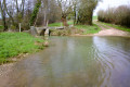
La Marlée washhouse and the Guédelon marshes

Start with a walk through Forterre, taking in the views from the hills, then head into the heart of the Puisaye region, passing through woods and marshes.
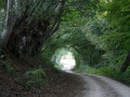
This route begins with exposed sections and ends beneath shady arches. It alternates between light and shade, moving from natural heritage to built heritage.

Details

n°2825853
Creation:
Last update:
Last review:
  • Walking
    Activity: Walking
  • ↔
    Distance: 13.35 mi
  • ◔
    Average duration: 7h 05 
  • ▲
    Difficulty: Difficult

  • ⚐
    Back to start: Yes
  • ↗
    Ascent: + 1,040 ft
  • ↘
    Descent: - 1,040 ft

  • ▲
    Highest point: 1,076 ft
  • ▼
    Lowest point: 705 ft

Photos

Description of the walk

Start from the Treigny motorhome site.

(S/E) Facing the cemetery, turn left. Walk up Rue du Petit Pont. At the junction, with the town hall on your left, take Rue du Professeur Camille Lian for about 50 metres. Turn right and walk down Rue du Moulin (more of an alleyway).

(1) Turn right onto the bridge (Pont des Canards) which spans the Vrille. At the first junction, turn right. Ignore the side paths and cross the stream.

(2) Turn left, follow the D66 uphill for about 150 metres and turn right. At the top of the hill, turn left. Continue straight on along a path through the fields. In the hamlet of Diancy, follow the D66. Just before the junction with it, there is a path on the right-hand side.

(3) Take this path and you’ll reach La Chaume de Perreuse. A glance back reveals views of the Puisaye region to the right, the Loire Valley and the Sancerre area in the centre, and the Morvan hills in the distance.

(4) Walk between the rows of lime trees. At the crossroads (Grande Rue), head up to the left. Walk past the base of the Sully lime tree and continue along this street. When you reach the church on your right, turn left into Rue des Andrieux, which continues as Rue de la Pommeraie. Follow a wide bend to the right, passing houses with inscriptions on their lintels. When you reach Grande Rue, turn left and, at the end, turn left again towards Treigny.

(5) Head down the path on the right, which passes by a remarkable wash house.

(6) At the wash house, carry on until you reach a slightly offset crossroads.

(7) Turn right onto the path which descends at first but then climbs again. Ignore the first path on the right, then the next one on the left and the following one on the right.

Signpost: La Croix Saint-Jean No. 21

(8) Continue north-west. Cut across what looks like a road and carry on in the same direction (La Croix Saint-Jean signpost). At the end of the path, head down towards the cross and the road. Cross the road and continue along the path.

End of the La Croix Saint-Jean No. 21 signposting; follow the ‘Route de l’eau et des bois’ No. 24 signposting

(9) At the ford, turn right. Continue along the valley floor, following the Vrille and its springs, until you reach a cross-valley road.

(10) Take this road on the left. After about 300 metres, just after a path on the left-hand side, turn right. Walk alongside a field and then hedgerows on either side until you cross a road.

(11) Carry straight on to take the path opposite. Climb gently to reach the first houses in Les Perriers.

(12) At the crossroads, turn right and, as you leave the hamlet, leave the tarmac behind by continuing straight on along a dirt track.

(13) Cross the road and head to the right, keeping the tarmac road to your left (the path opposite the finish line is private). Carry on straight ahead, taking care at the junction with the D66.

(14) Turn right and stay on this main track, which descends to the Étang de Chassin.

(15) Cross the road (D955) with care to go up the path opposite, which ends at a road (D66).

(16) Turn left and follow this road for about 200 metres. Leave this road and turn onto the first small dirt and sand track on the left. At the end of this track, a footbridge takes you across the marsh and the old leat of the Moulin Cognot. Walk back up between the houses.

(17) At the junction with the D955, cross with care and take the path opposite (greenhouses on your right). You’ll reach La Guénerie.

(18) Turn right onto the path leading to Crot Maçon. Cross the service road and continue straight on, ignoring the few paths on both the right and left as you go.

(19) At the junction of five paths (including a fairly wide forest track), ignore the first path on the right and take the forest track, veering slightly to the right (south-west).

(20) At the end of this forest track, for the final stretch, head down to the left. The road is quite shaded, forming a beautiful canopy of trees in places. Pass Les Pautrats (you’re on the right track), Bourg sans Paille and Les Martins on either side.

(21) Pass the entrance to Ratilly Castle on your right and continue down this tarmac road.

(22) In the hamlet of Les Jolivots, at the cross on the left, take the path leading off to the left (Rue de la Déplaisance). Carry on straight ahead to return to the Treigny motorhome site (S/E).

Waypoints

  1. S/E : mi 0 - alt. 755 ft - Treigny motorhome site
  2. 1 : mi 0.27 - alt. 738 ft - La Vrille - La Vrille
  3. 2 : mi 0.93 - alt. 715 ft - Junction: turn left
  4. 3 : mi 1.86 - alt. 948 ft - The hamlet of Diancy. The D66 road lies below.
  5. 4 : mi 2.68 - alt. 1,070 ft - Les Chaumes de Perreuse
  6. 5 : mi 3.15 - alt. 1,033 ft - Path leading down to the right
  7. 6 : mi 3.41 - alt. 912 ft - Lavoir de la Marlée
  8. 7 : mi 3.95 - alt. 827 ft - Crossroads of four paths
  9. 8 : mi 4.58 - alt. 919 ft - A three-way junction of five paths forming a ‘goose’s foot’ pattern
  10. 9 : mi 5.43 - alt. 751 ft - Ford on the Vrille, shortly after its source - La Vrille
  11. 10 : mi 6.07 - alt. 801 ft - Leads onto a road
  12. 11 : mi 6.66 - alt. 860 ft - Leads onto a road
  13. 12 : mi 7.16 - alt. 945 ft - The hamlet of Les Perriers
  14. 13 : mi 7.61 - alt. 951 ft - Ends at a crossroads
  15. 14 : mi 8.12 - alt. 984 ft - Turn right, heading due north along the main path
  16. 15 : mi 8.57 - alt. 883 ft - Dirt track opposite
  17. 16 : mi 8.96 - alt. 965 ft - Road, on the left
  18. 17 : mi 9.8 - alt. 810 ft - Crossing the D955 (bends) - Passerelle du Moulin Cognot
  19. 18 : mi 10.45 - alt. 955 ft - Turn right onto the dirt track
  20. 19 : mi 11.35 - alt. 899 ft - Forest track opposite
  21. 20 : mi 11.57 - alt. 961 ft - Junction: turn left
  22. 21 : mi 12.44 - alt. 892 ft - Château de Ratilly
  23. 22 : mi 12.75 - alt. 823 ft - At the cross, turn left onto Rue de la Déplaisance
  24. S/E : mi 13.35 - alt. 758 ft - Treigny motorhome site

Notes

Good quality walking boots are recommended; the paths are varied and can be completely different depending on the season.
Toilets and drinking water are available at the starting point.
This walk is not suitable for horses.
The village has several food shops and plenty of accommodation, including options for groups.
Please note: the trail markings are provided for orientation purposes only; under no circumstances should they be relied upon as the sole guide.

Worth a visit

Places to see along the way include the old houses of Perreuse, Ratilly Castle and the village of Treigny.

Reviews and comments

4.7 / 5
Based on 1 review

Reliability of the description
5 / 5
Ease of following the route
5 / 5
Route interest
4 / 5
Stéphanie R.
Stéphanie R.

Overall rating : 4.7 / 5

Date of your route : Aug 16, 2022
Reliability of the description : ★★★★★ Very good
Ease of following the route : ★★★★★ Very good
Route interest : ★★★★☆ Good
Very busy route : No

A lovely walk, quite long but without any technical difficulties, apart from the footbridge near the Guédelon marsh, which is in a state of disrepair in places and overgrown with brambles as you approach the Moulin Cognot, making it tricky to cross. This route offers a fine insight into the region’s heritage, particularly its architectural heritage… a must for lovers of old buildings! The Marlée washhouse is remarkable; the light falls on it in a very poetic way. In Perreuse, the avenue of lime trees offers a pleasant welcome, and the village church is well worth a look (do pop inside – it features a beautiful mural). The villages and hamlets along the way boast some lovely old houses, which make you forget the minor inconveniences of the tarmac. And the stretches through the forest are a welcome change in summer, and no doubt in other seasons too (be careful, though, as some sections are likely to be quite damp). This forest is beautiful, without a doubt.

Machine-translated

Caroline Thies
Caroline Thies

Hello, I think this walk must be brilliant; I can’t wait to go on it.
Kind regards
C. T.

Machine-translated

marmo89
marmo89

It will be used in 2020 for Heritage Days

Machine-translated

Other walks in the area

For more walks, use our search engine .

The GPS track and description are the property of this route's author. Please do not copy them without permission.