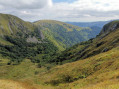
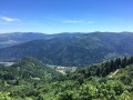
Schiessrothried and Altenweiher lakes and the Rainkopf small pass

This hike is challenging, featuring scree slopes, steep gradients and slightly exposed sections. It therefore requires sure-footedness, good physical fitness and dry weather, with no snow or ice. In return, it not only offers the chance to enjoy superb and varied views but also provides access to several dense, damp and rather enchanting forests on the Alsatian side. Two lakes offer a change of scenery and even the chance to go for a swim.

06/02/2023: Hiking prohibited until further notice by municipal order, due to a rock and stonefall on theGR®531.

Details

n°3724124
Creation:
Last update:
Last review:
  • Walking
    Activity: Walking
  • ↔
    Distance: 10.02 mi
  • ◔
    Average duration: 6h 40 
  • ▲
    Difficulty: Difficult

  • ⚐
    Back to start: Yes
  • ↗
    Ascent: + 2,382 ft
  • ↘
    Descent: - 2,356 ft

  • ▲
    Highest point: 4,295 ft
  • ▼
    Lowest point: 3,035 ft

Photos

Description of the walk

Park in the car park around the inn at the foot of the Hohneck.

(S/E) A few metres to the left of the inn, take the tarmac road leading to the Hohneck. Very soon, turn right onto the small path that climbs towards the Wormspel Pass.

(1) Follow the small path marked with a Blue Triangle, which descends quite steeply to the junction with the path leading to Lake Schissrothried.

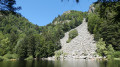
(2) Turn left to reach the lake and cross the dam.

(3) Then return to the previous junction.

(2) Turn left onto the path marked with a Blue Rectangle; this is theGR®531. Begin a winding ascent; atthe second bend, continue left to reach the viewpoint. Return to theGR®, continue left and, via a steep path, reach a plaque marking the climbing site.

(4) Pass the plaque commemorating a fatal accident below the Spitzkopf (scree slope). You will then reach a stream.

(5) Cross the small bridge, then numerous other streams, staying on theGR® the whole time.
Cross another stream. The vegetation becomes very dense.
Reach the summit of the Kerbholz, where there is a building offering a superb view.

(6) Leave theGR® here and turn right onto the Blue Cross-marked path towards Lake Altenweiher. You’ll soon reach the junction with the forest track leading directly to the Kastelberg inn.

(7) Cross this path and continue along the Blue Cross-marked trail. The path is occasionally a little exposed, but the forest is superb. You’ll reach the shore of Lake Altenweiher.

(8) Walk round the lake and you’ll find yourself at the end of the dam, on the right bank at the junction with a new path. Turn right onto the path marked with a Yellow Cross. Begin a new, fairly steep ascent with numerous hairpin bends. You’ll then emerge onto an easier section leading to the Rainkopf small pass.

(9) Follow theGR®5alternative route to the right along the ridge. Pass a Club Vosgien mountain hut and then a farmhouse inn. At the fork, turn right onto the path marked with a Blue Rectangle, part of theGR®531. Further on, you’ll come to an X-shaped junction.

(10) Leave theGR® here and turn left onto the path marked with a Yellow Cross, which you will follow to the end. This path soon crosses a forest track.

(11) Turn left and follow the path known as the ‘Sentier des Névés’, still marked with a Yellow Cross; walk along the edge of the forest until you reach a crossroads before the Spitzkoepfe cliff.

(12) Walk to the start of the cliff and back. Back on the ridge, turn right towards the Col du Wormspel.

(1) Turn left to return to the car park at the foot of the Hohneck (S/E).

Waypoints

  1. S/E : mi 0 - alt. 4,075 ft - Car park near the inn at the foot of the Hohneck
  2. 1 : mi 0.19 - alt. 4,193 ft - Col du Wormspel (1275m)
  3. 2 : mi 1.16 - alt. 3,123 ft - Lake crossroads
  4. 3 : mi 1.41 - alt. 3,051 ft - lac de schiessrothried
  5. 4 : mi 2.34 - alt. 3,422 ft - Commemorative plaque at the foot of the Spitzkopf
  6. 5 : mi 2.65 - alt. 3,360 ft - Bridge in the Ammenthal
  7. 6 : mi 3.24 - alt. 3,530 ft - Kerbholz
  8. 7 : mi 3.61 - alt. 3,488 ft - Junction with a forest track
  9. 8 : mi 4.79 - alt. 3,048 ft - Altenweiher
  10. 9 : mi 6.97 - alt. 3,911 ft - Rainkopf Small Pass
  11. 10 : mi 7.91 - alt. 4,019 ft - Junction
  12. 11 : mi 8.42 - alt. 4,219 ft - Junction
  13. 12 : mi 9.43 - alt. 4,255 ft - Junction with the path to Spitzkopf
  14. S/E : mi 10.02 - alt. 4,081 ft - Car park near the inn at the foot of the Hohneck

Notes

Due to the presence of scree, you must wear good high-top walking boots.
Three inns offer refreshments: the Firsmiss Inn, the Kastelberg Inn (though this is on the shortcut) and the inn at the foot of the Honeck (at the car park where the walk starts).
At Kerbholz, a shortcut is possible: take the blue rectangular trail to the Kastelberg inn, then follow the Yellow Cross back to the Névés trail. The length of the walk is reduced from 16 km to 9 km.

Worth a visit

(1) Wormspel Pass: the view is magnificent, with the Hohneck to the left and the rocky ridge of the Spitzkopf to the right. This view changes on the descent, giving way to a dense, damp forest. You’ll encounter this type of forest again later, with its mosses, ferns and dead trees.
(3) Schiessrothried Lake dam: information about the lake.
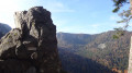
(4) Viewpoint: offers both a superb vantage point and an example of the granite spires found on the Spitzkopf. Opposite the path leading to the viewpoint, you can take a short round trip along the path leading to the Spitzkopf climbing area, as far as the information sign.
(5) A plaque commemorating an accident, below the highest peak of the Spitzkopf.
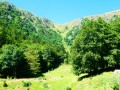
Between (5 and) 7:: : A superb forest replaces the rugged scree slope, with a small bridge and streams.
(8) It is possible to walk round Lake Altenweiher. The climb up to the ridge is quite steep but passes through a beautiful forest and past ruins at the Pierreywasen site (chaumes).
(9) At Kerbholz: a wide and superb view.
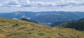
(11) On the ridges and along the superb Névés path, there are more magnificent views.
(12) The round trip near the Spitzkopf rocks allows you to see these granite spires (known as ‘gendarmes’) up close.

Always be cautious and plan ahead when you're outdoors. Visorando and the author of this route cannot be held responsible for any accidents occurring on this route.

The GR® and PR® markings are the intellectual property of the Fédération Française de Randonnée Pédestre.

Reviews and comments

5 / 5
Based on 1 review

Reliability of the description
5 / 5
Ease of following the route
5 / 5
Route interest
5 / 5
NicooSch
NicooSch

Overall rating : 5 / 5

Date of your route : Aug 06, 2022
Reliability of the description : ★★★★★ Very good
Ease of following the route : ★★★★★ Very good
Route interest : ★★★★★ Very good
Very busy route : No

The views are magnificent and the few technical sections make this a really enjoyable hike.
For me, it’s definitely one of the best hikes I’ve ever done in the Vosges!
The route and directions are clear; you’ll have no trouble following the path.
There were very few people on this route until we reached the ridges, and even then it wasn’t crowded. Yet we were there on a Saturday in early August.
You do need to be reasonably fit to enjoy it to the full and not find the walk a struggle.
I’d highly recommend this hike and will definitely be doing it again!

Machine-translated

Other walks in the area

For more walks, use our search engine .

The GPS track and description are the property of this route's author. Please do not copy them without permission.