


Refine your search for walks in Lacs du Malrif
Lacs du Malrif walks


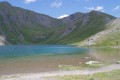
 Malrif Lakes
 Visorando Member
 6.44 mi
 +2,621 ft
 -2,628 ft
 5h 15
 Moderate
 Departure from Aiguilles (Hautes-Alpes)
Beautiful mountain lakes and magnificent landscapes.
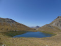
Abriés - Aiguilles
 8.56 mi
+3,501 ft
-3,793 ft
7h 00
Moderate
Departure from Abriès (Hautes-Alpes)
The seventh and final stage takes you past the Malrif lakes under the ridge separating Queyras and Briançonnais.
Tour du Queyras
56.34 mi
+22,976 ft
-22,575 ft
7 days
Moderate
Departure from Château-Ville-Vieille (Hautes-Alpes)
The Tour du Queyras, labelledGR®58, is adaptable. The route described, starting from Château Queyras and completed in a group in September 2008, will take you through this natural park, skirting and climbing some 3,000 metres. You will discover the beautiful villages of this park with their well-known names: Ceillac, Saint Véran, Abriés... What's more, in summer the weather is almost always fine. The bright blue sky the next day will quickly make you forget the storm of the previous evening.
Walks near Lacs du Malrif
Along the Guil d’Aiguilles to Ristolas
7.81 mi
+797 ft
-528 ft
4h 15
Moderate
Departure from Aiguilles (Hautes-Alpes)
A walk starting from the town hall in Aiguilles, following the River Guil to Ristolas and finishing in Abries.
The balcony path between Aiguilles and Ville-Vieille
 6.59 mi
+1,591 ft
-1,854 ft
4h 25
Moderate
Departure from Aiguilles (Hautes-Alpes)
The walk mostly follows a ridge above the Guil valley between Aiguilles and Ville-Vieille. We recommend returning via the free shuttle bus, which runs between Château-Queyras and L’Échalp.
Refuge des Fonts de Cervières – Andrea Tornior Bivouac
 9.76 mi
+4,888 ft
-3,291 ft
8h 45
 Difficult
Departure from Cervières (Hautes-Alpes)
A fairly alpine stage of the Queyras Transfrontière, featuring the ascent of a magnificent 3,000-metre peak: Le Grand Glaiza.
The start of this stage is accessible by car via Cervières on the D902 from Briançon, then the D89T through Cervières.
Valpréveyre Campsite – La Monta Campsite
9.33 mi
+4,032 ft
-4,656 ft
7h 50
 Very difficult
Departure from Abriès (Hautes-Alpes)
Stage 4
From the charming Valpréveyre campsite, a long climb through the mountain pastures to the Col d’Urine, followed by a descent that is initially rough but then becomes easier, leading to the Jervis mountain hut. From there, a magnificent climb to the Col Lacroix, before a descent through increasingly wooded terrain back to the La Monta campsite
Valpréveyre - Lago Verde
 5.32 mi
+4,180 ft
-1,736 ft
6h 05
Difficult
Departure from Abriès (Hautes-Alpes)
First stage of Circuit Franco-Italian border "Queyras in Val Pellice" punctuated by passages through three interesting passes: Malaure, Bouchet and Vampréveyre.
Lodge du Grand Rochebrune – Lodge le Teppio
 9.80 mi
+2,635 ft
-3,176 ft
6h 50
Difficult
Departure from Château-Ville-Vieille (Hautes-Alpes)
This stage follows part of theGR®® 58, then takes a route offthe GR®® to climb to the Col d’Izoard. Admittedly, this ascent is via the road, but on a day when vehicles are banned, allowing you to enjoy this lunar landscape with its monoliths. The return journey takes you through a deserted ravine. The limestone landscapes of this stage are nothing like those encountered since the start of the Tour du Queyras, which is characterised by slate.
Chateau Queyras - Montbardon
 5.97 mi
+2,717 ft
-2,169 ft
5h 05
Moderate
Departure from Château-Ville-Vieille (Hautes-Alpes)
This is the first stage of the tour and is an adaptation as the route is not on theGR®58, but it allows you to visit the castle that dominates the Guil pass.
(Please note) The Montbardon stopover lodge (Le Cadran Solaire) has been closed since 2018, so the best option from Château Queyras is to go directly to Ceillac via the Col Fromage.
(Important note): See this website mentioning the reopening of this lodge for summer 2023.
From the hamlet of La Monta to the village of Abriès
8.16 mi
+3,100 ft
-3,488 ft
6h 25
Difficult
Departure from Ristolas (Hautes-Alpes)
This stage of the Queyras circuit can also form part of the Mont Viso circuit. For walkers travelling by train, a bus departs from Mont-Dauphin Guillestre station and serves the village of Abriès-Ristolas.
La Monta Mountain Hut – Abriès Campsite
 8.69 mi
+3,114 ft
-3,543 ft
6h 40
Difficult
Departure from Ristolas (Hautes-Alpes)
Thisfourth stage is a variant ofthe GR® route, setting off from the Refuge de la Monta and heading to the Abriès winter caravan site. The hike begins with a challenging section through larch forests to reach the Crêtes de Peyra-Plata and then the Crêtes de Gilly. The path follows a beautiful ridge line offering views to the south of the Grand Queyras, Le Viso, the Crêtes de Taillante and the Ristollas Valley, and to the north of the Tête du Pelvas, the Bric Bouchet, the Bric Froid, the Grand Glaiza and the Pic de Roquebrune.