From the hamlet of La Monta to the village of Abriès

This stage of the Queyras circuit can also form part of the Mont Viso circuit. For walkers travelling by train, a bus departs from Mont-Dauphin Guillestre station and serves the village of Abriès-Ristolas.

This walk is part of a multi-day hike: Tour du Mont Viso en 7 jours

Details

71386872
Creation:
Last update:
Last review:
  • Walking
    Activity: Walking
  • ↔
    Distance: 8.16 mi
  • ◔
    Average duration: 6h 25 
  • ▲
    Difficulty: Difficult

  • ⚐
    Back to start: No
  • ↗
    Ascent: + 3,100 ft
  • ↘
    Descent: - 3,488 ft

  • ▲
    Highest point: 8,494 ft
  • ▼
    Lowest point: 5,069 ft

Description of the walk

Red and white markings: GR®58Tour du Queyras

(S) On leaving the lodge, follow the GR® as it climbs north-east.

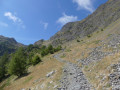
(1) At the junction of several paths, cross the stream and continue the climb, which becomes steeper. After a circular bend to the right, then a circular bend to the left, the path heads north.

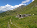
(2) Pass the Bergerie du Pelva on your right 200 metres ahead and continue to follow the GR®; the slope becomes less steep. At the junction with a path on the left, continue climbing, then follow the Crête de Peyra Plata.

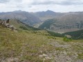
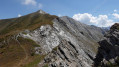
(3) Pass the Sommet de la Lauzière (2,576 m) on your right after 200 metres and continue to follow the Crête de Peyra Plata, then the Crête de Gilly until you reach the vicinity of the top of a ski lift.

(4) At the junction with the GR® variant coming from the hamlet of Ristolas, head down the path to the right until you reach a fork.

(5) Do not take this fork – the GR® variant turns right – but continue straight down, then take the left-hand bend.

(6) Cross the meadows to reach a track; take this to the left.

(7) Then leave this path further on and continue across the meadows to the D441 road, in the village of Abriès-Ristolas.

End of red and white markings

(8) Take the departmental road to the left for about 300 metres to the Place du Glacis, in the centre of the village (E).

Waypoints

  1. S : mi 0 - alt. 5,466 ft - Refuge de la Monta
  2. 1 : mi 0.21 - alt. 5,630 ft - Cross the stream
  3. 2 : mi 1.53 - alt. 7,215 ft - Bergerie du Pelva
  4. 3 : mi 2.87 - alt. 8,399 ft - Sommet de la Lauzière (2576 m)
  5. 4 : mi 3.88 - alt. 7,759 ft - GR alternative route junction - Collette de Gilly
  6. 5 : mi 4.43 - alt. 7,195 ft - Junction for the GR alternative route
  7. 6 : mi 5.41 - alt. 6,450 ft - Junction
  8. 7 : mi 6.14 - alt. 6,394 ft - Across the meadows
  9. 8 : mi 8 - alt. 5,112 ft - D441 road
  10. E : mi 8.16 - alt. 5,069 ft - Abriès village centre - Guil (rivière)

Notes

The bus stop for Mont-Dauphin is at the end of the walk on Place du Glacis

Always be cautious and plan ahead when you're outdoors. Visorando and the author of this route cannot be held responsible for any accidents occurring on this route.

The GR® and PR® markings are the intellectual property of the Fédération Française de Randonnée Pédestre.

Reviews and comments

4.7 / 5
Based on 1 review

Reliability of the description
5 / 5
Ease of following the route
4 / 5
Route interest
5 / 5
User 21449164

Overall rating : 4.7 / 5

Date of your route : May 19, 2025
Reliability of the description : ★★★★★ Very good
Ease of following the route : ★★★★☆ Good
Route interest : ★★★★★ Very good
Very busy route : No

A walk undertaken in September 2024 in the rain. The climb is steep, but once on the ridges it’s fairly easy and well signposted, with a stunning view of both sides of the valley
You can carry on to Valpreyverre to reach the campsite, or head back down to Abries – the hamlet of Le Roux is of no interest.

Machine-translated

Other walks in the area

For more walks, use our search engine .

The GPS track and description are the property of this route's author. Please do not copy them without permission.