


cyril h

 Visorando Member
 Premium user
 - Location: Aix-en-Provence (13100|13090|13540)
- Gender: man
Sign up:
Published route(s)
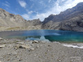
 Lac des Neuf Couleurs below Brec de Chambeyron
 9.46 mi
 +3,179 ft
 -3,182 ft
 7h 05
7h 05
 Difficult
 Departure from Saint-Paul-sur-Ubaye (Alpes-de-Haute-Provence)
Hike leading to the Lac des Neuf Couleurs surrounded by the Aiguille de Chambeyron, the Brec de Chambeyron and the Tête de la Fréma, just a stone's throw from the French-Italian border.The hike includes high-altitude lakes, rivers, waterfalls, animals depending on the time of day and your luck (marmots, chamois, etc.), scree slopes, and more.
Col de Marinet from Maljasset
 10.60 mi
+3,009 ft
-3,005 ft
7h 30
Difficult
Departure from Saint-Paul-sur-Ubaye (Alpes-de-Haute-Provence)
10.60 mi
+3,009 ft
-3,005 ft
7h 30
Difficult
Departure from Saint-Paul-sur-Ubaye (Alpes-de-Haute-Provence)
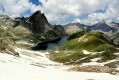
On the agenda: flowers, marmots, mountain lakes (those of Marinet), waterfalls, streams and rivers, snow and two passes (Marinet and Mary). There are some beautiful patches of snow on the trail leading from the last Marinet lake and the nearby bivouac to the Marinet pass (2,800 m) and then to the Mary pass. There are views of Italy from the trail between the two passes. There are quite a few marmots in the Mary valley, which can be seen in the early morning and late afternoon.
The Crupillouse Lakes
 8.47 mi
+4,304 ft
-4,304 ft
7h 40
Difficult
Departure from Champoléon (Hautes-Alpes)
8.47 mi
+4,304 ft
-4,304 ft
7h 40
Difficult
Departure from Champoléon (Hautes-Alpes)
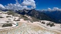
In July, head for the Crupillouse lakes: small high-altitude lakes that are still frozen, alternating between earth and stone. The trail crosses three streams and snowfields and sometimes climbs in tight switchbacks from 1,400 to 2,600 metres.
Watched over by chamois, the arrival at the lakes is a reward for the fairly long climb.
The thawed sections were magnificent colours.
Towards Lalatcha Lake
 8.83 mi
+4,295 ft
-4,291 ft
7h 50
Difficult
Departure from Crévoux (Hautes-Alpes)
8.83 mi
+4,295 ft
-4,291 ft
7h 50
Difficult
Departure from Crévoux (Hautes-Alpes)
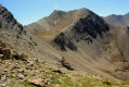
Head for the summit overlooking Lake Lalatcha.
The summit is nearly 2,900 metres above sea level and overlooks the surrounding area, including the climb up to the Col de Vars from the Ubaye Valley.
Bric de Rubren via the Mongioia Pass and the Salsa Pass
 18.01 mi
+5,118 ft
-5,092 ft
10 hrs
18.01 mi
+5,118 ft
-5,092 ft
10 hrs
 Very difficult
Departure from Saint-Paul-sur-Ubaye (Alpes-de-Haute-Provence)
Very difficult
Departure from Saint-Paul-sur-Ubaye (Alpes-de-Haute-Provence)
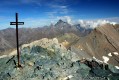
This is a beautiful circular of just under 30 km, crossing the Ubaye several times and taking hikers to one of the highest peaks in the Ubaye at 3,340 m.
The view from the top is magnificent and stretches far into the distance.
At the foot of the Bric is the high-altitude lake of Mongioia at 3,080 m.
Return to the starting point via the Pas de Salsa and Lac du Loup.
Sainte-Baume
 8.26 mi
+1,713 ft
-1,709 ft
5h 15
8.26 mi
+1,713 ft
-1,709 ft
5h 15
 Moderate
Departure from Plan-d'Aups-Sainte-Baume (Var)
Moderate
Departure from Plan-d'Aups-Sainte-Baume (Var)
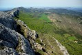
Walk along the Sainte-Baume ridge after visiting the Marie-Madeleine cave.
Around the Malrif Lakes
 7.91 mi
+3,468 ft
-3,468 ft
6h 40
Difficult
Departure from Aiguilles (Hautes-Alpes)
7.91 mi
+3,468 ft
-3,468 ft
6h 40
Difficult
Departure from Aiguilles (Hautes-Alpes)
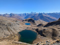
Alpine pastures in bloom, lakes, a ridge with a magnificent view!
A beautiful hike for the start of the season!
La Mortice from Sainte-Catherine
 14.28 mi
+4,216 ft
-4,186 ft
10h 15
Difficult
Departure from Vars (Hautes-Alpes)
14.28 mi
+4,216 ft
-4,186 ft
10h 15
Difficult
Departure from Vars (Hautes-Alpes)
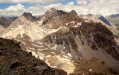
Heading towards La Mortice and its three small peaks at over 3,000m.
Magnificent views from this ridge after passing the small Lac des Neuf Couleurs on the way up.
Lake Apsoi
 10.63 mi
+3,839 ft
-3,839 ft
8h 15
Difficult
Departure from Larche (Alpes-de-Haute-Provence)
10.63 mi
+3,839 ft
-3,839 ft
8h 15
Difficult
Departure from Larche (Alpes-de-Haute-Provence)
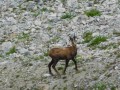
A lovely circular walk to the Italian Lake Apsoi, starting not far from the Col de Larche.
Pic de Bertagne from Saint-Pons Park
 10.98 mi
+3,094 ft
-3,087 ft
7h 45
Difficult
Departure from Gémenos (Bouches-du-Rhône)
10.98 mi
+3,094 ft
-3,087 ft
7h 45
Difficult
Departure from Gémenos (Bouches-du-Rhône)
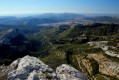
On the way to Pic de Bertagne from Parc de Saint-Pons via the south side. The return journey will be via La Glacière and the abbey.
Towards the Lignin Lakes
 11.05 mi
+2,667 ft
-2,664 ft
7h 25
Difficult
Departure from Colmars (Alpes-de-Haute-Provence)
11.05 mi
+2,667 ft
-2,664 ft
7h 25
Difficult
Departure from Colmars (Alpes-de-Haute-Provence)
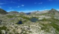
A beautiful hike starting at the Pont de la Serre by the Lance pools and leading to the Lignin Lakes through woods and alpine pastures.
Towards Lac de Pelouse from Lac des Peatlands
 6.87 mi
+1,900 ft
-1,896 ft
4h 50
Moderate
Departure from Jausiers (Alpes-de-Haute-Provence)
6.87 mi
+1,900 ft
-1,896 ft
4h 50
Moderate
Departure from Jausiers (Alpes-de-Haute-Provence)
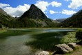
This hike starts at the beautiful Lac des Sagnes and ends at Lac de Pelouse, passing through woods (full of raspberries when we were there) and mountain pastures (with flocks of sheep and their canine guardians), where you may be lucky enough to spot lots of chamois.
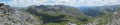
Pas de la Cavale from Larche
 10.32 mi
+2,618 ft
-2,602 ft
7h 00
Difficult
Departure from Larche (Alpes-de-Haute-Provence)
10.32 mi
+2,618 ft
-2,602 ft
7h 00
Difficult
Departure from Larche (Alpes-de-Haute-Provence)
This is a pleasant hike, starting off easy and leading to Lac du Lauzanier. Hikers will encounter many marmots, lakes and waterfalls, ending with a beautiful view from Pas de la Cavale.
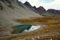
Lakes of Sainte-Anne, Rouites and Miroir with the Tête de Girardin
 12.26 mi
+4,114 ft
-4,124 ft
7 hrs
Very difficult
Departure from Ceillac (Hautes-Alpes)
12.26 mi
+4,114 ft
-4,124 ft
7 hrs
Very difficult
Departure from Ceillac (Hautes-Alpes)
A beautiful loop allowing you to visit these different lakes as well as the Tête de Girardin.
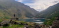
Towards Lac d'Oô
 4.50 mi
+1,470 ft
-1,457 ft
3h 20
Moderate
Departure from Oô (Haute-Garonne)
4.50 mi
+1,470 ft
-1,457 ft
3h 20
Moderate
Departure from Oô (Haute-Garonne)
A lovely walk gradually ascending towards the artificial Lac d'Oô and the large waterfalls that feed it.
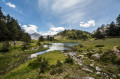
Towards Lac de l'Île
 4.88 mi
+1,066 ft
-1,056 ft
3h 10
Moderate
Departure from Vielle-Aure (Hautes-Pyrénées)
4.88 mi
+1,066 ft
-1,056 ft
3h 10
Moderate
Departure from Vielle-Aure (Hautes-Pyrénées)
A short, picturesque walk to a small lake with an island in the heart of the mountains.
You are entering the Néouvielle National Nature Reserve, which is protected by regulations. Please respect these (see practical information).
Towards the Col de Longet
 17.00 mi
+2,651 ft
-2,644 ft
12 hrs
Very difficult
Departure from Saint-Paul-sur-Ubaye (Alpes-de-Haute-Provence)
17.00 mi
+2,651 ft
-2,644 ft
12 hrs
Very difficult
Departure from Saint-Paul-sur-Ubaye (Alpes-de-Haute-Provence)
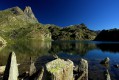
A beautiful hike towards Lac de Longet and its eponymous pass. TheGRP® "Petit tour du Bric de Rubren" will take you to the pass and its many lakes, following the Ubaye river.
Sainte-Victoire via the Grand Couloir and the Pas du Clapier
 4.87 mi
+2,316 ft
-2,303 ft
4h 15
Difficult
Departure from Puyloubier (Bouches-du-Rhône)
4.87 mi
+2,316 ft
-2,303 ft
4h 15
Difficult
Departure from Puyloubier (Bouches-du-Rhône)
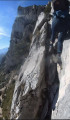
Short, challenging hike in the Baudino refuge area via the Grand Couloir (chain/cable passages) and descent via the Pas de Clapier after enjoying the views from the Plan de la Crau
Sentier Marcel Estruch and Grotte aux Œufs via Saint-Pilon
 9.31 mi
+2,930 ft
-2,933 ft
7 hrs
9.31 mi
+2,930 ft
-2,933 ft
7 hrs
 Extremely difficult
Departure from Plan-d'Aups-Sainte-Baume (Var)
Extremely difficult
Departure from Plan-d'Aups-Sainte-Baume (Var)
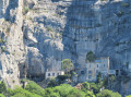
A beautiful, challenging hike that combines many of the features of Sainte-Baume: undergrowth, ledges, chain passages, a visit to a cave, ridges, etc.
"A protected species, the peregrine falcon, nests on the Béguines cliff and may be disturbed. Avoid using this trail between February and June to ensure its protection."
The Viraysse Battery as seen from Fouillouse
 14.03 mi
+3,747 ft
-3,734 ft
9h 45
Difficult
Departure from Saint-Paul-sur-Ubaye (Alpes-de-Haute-Provence)
14.03 mi
+3,747 ft
-3,734 ft
9h 45
Difficult
Departure from Saint-Paul-sur-Ubaye (Alpes-de-Haute-Provence)
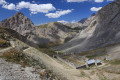
Head for the Viraysse Battery from Fouillouse.
Rivers, marmots, military structures (barracks, batteries, forts) and small lakes accompany walkers throughout the hike.
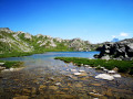
The Blanchet and Longet lakes from the Agnel refuge
 11.82 mi
+4,219 ft
-4,190 ft
9h 05
Very difficult
Departure from Molines-en-Queyras (Hautes-Alpes)
11.82 mi
+4,219 ft
-4,190 ft
9h 05
Very difficult
Departure from Molines-en-Queyras (Hautes-Alpes)
A physically demanding hike starting from the Refuge Agnel, passing a total of five passes and offering views of a dozen lakes in these magnificent areas. It starts in Queyras and returns there after a loop through Haut-Ubaye and Italy.
This hike can be completed in two days (refuges, bivouac).