


Refine your search for walks in Lac du Génépy (2940m)
Lac du Génépy (2940m) walks


 Lac du Génépy
 Visorando Member
 9.35 mi
 +2,956 ft
 -2,956 ft
 6h 50
6h 50
 Difficult
 Departure from Aussois (Savoie)
Circuit above Aussois between pine trees and snowfields.
Pointe de la Gorma
 Tourism professional
 8.83 mi
+4,511 ft
-4,491 ft
8h 00
8.83 mi
+4,511 ft
-4,491 ft
8h 00
 Very difficult
Departure from Aussois (Savoie)
Very difficult
Departure from Aussois (Savoie)
High-altitude hike beneath the imposing Dent Parrachée. The climb to 3,100 m is very pleasant, and there are several flat sections where you can rest. Things get tougher beyond that, after crossing the remains of the Labby Glacier, due to loose and unstable schist. Access to Pointe de la Gorma (3,396 m) is via an easy ridge.
Walks near Lac du Génépy (2940m)
From the Fond d'Aussois Refuge to the Saut Refuge via the Pointe de l'Observatoire
 9.33 mi
+4,724 ft
-5,443 ft
8 hrs
Very difficult
Departure from Aussois (Savoie)
9.33 mi
+4,724 ft
-5,443 ft
8 hrs
Very difficult
Departure from Aussois (Savoie)
From the Refuge du Fond d'Aussois to the Refuge du Saut, the route passes via the Col d'Aussois (2,914 m) with the option to climb the Pointe de l'Observatoire (3,015 m) before descending into the valley via the Ritort farm, then the Col Rouge (2,730 m).
Refuge de la Fournache - Refuge de l'Orgére
 5.91 mi
+2,336 ft
-3,750 ft
4h 45
Difficult
Departure from Aussois (Savoie)
5.91 mi
+2,336 ft
-3,750 ft
4h 45
Difficult
Departure from Aussois (Savoie)
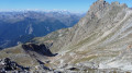
The final stage of this fabulous route from the Refuge de la Fournache to the Refuge de l'Orgére, via the Col de la Masse. The ascent of this pass is difficult due to the steep gradient. The end of the ascent and a good part of the descent are very technical. The view from the pass is absolutely exceptional; you will be able to see the Écrins and the Thabor massif.
Map of Amont – Roc de la Pêche mountain hut
 9.99 mi
+3,852 ft
-4,390 ft
7h 55
Difficult
Departure from Aussois (Savoie)
9.99 mi
+3,852 ft
-4,390 ft
7h 55
Difficult
Departure from Aussois (Savoie)
The walk begins with a gentle, rural route to the Fond de l’Aussois mountain hut, followed by a steep climb to the Col de l’Aussois.
Peclet-Polset Refuge - Merlets Lakes Refuge
 9.26 mi
+3,114 ft
-3,314 ft
7h 00
Difficult
Departure from Pralognan-la-Vanoise (Savoie)
9.26 mi
+3,114 ft
-3,314 ft
7h 00
Difficult
Departure from Pralognan-la-Vanoise (Savoie)
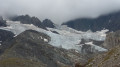
This second stage links the Peclet Polset Refuge to the Lacs Merlets Refuge via the Col du Soufre. You walk alongside the great Gebroulaz Glacier before reaching the Refuge du Saut. Next comes the ascent of the Col de Chanrouge and the arrival at the Lacs Merlets.
This stage takes you off the usual route through the Vanoise National Park. The landscapes are very wild. You’ll find plenty of edelweiss here.
Refuge du Roc de la Pêche – Refuge Porte de l’Orgère
 8.90 mi
+2,986 ft
-2,930 ft
6h 40
Difficult
Departure from Pralognan-la-Vanoise (Savoie)
8.90 mi
+2,986 ft
-2,930 ft
6h 40
Difficult
Departure from Pralognan-la-Vanoise (Savoie)
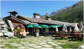
Hike between the Vanoise and Maurienne regions: from the Refuge du Roc de la Pêche to the Refuge Porte de l’Orgère via the Col de Chavière.
From Chalet Clou to Les Prioux
 9.11 mi
+2,710 ft
-4,144 ft
6h 35
Difficult
Departure from Pralognan-la-Vanoise (Savoie)
9.11 mi
+2,710 ft
-4,144 ft
6h 35
Difficult
Departure from Pralognan-la-Vanoise (Savoie)
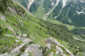
Fourth day of a four-day route in the Vanoise massif.
A very beautiful mountain route passing through the Petit and Grand Cirques du Marchet.
Aussois - Valfréjus
 12.42 mi
+3,225 ft
-2,923 ft
8h 30
Difficult
Departure from Aussois (Savoie)
12.42 mi
+3,225 ft
-2,923 ft
8h 30
Difficult
Departure from Aussois (Savoie)
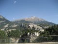
Étape de la Grande Traversée des Alpes d'Aussois (Vanoise) à Valfréjus (Maurienne).
Refuge de l'Arpont - Refuge de la Fournache
 10.62 mi
+2,533 ft
-2,365 ft
7h 05
Difficult
Departure from Termignon (Savoie)
10.62 mi
+2,533 ft
-2,365 ft
7h 05
Difficult
Departure from Termignon (Savoie)
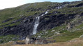
Stage7 of this journey takes you from the Refuge de l’Arpont to the very welcoming Refuge de la Fournache. This stage skirts around the Dent Parrachée. This is the last time you will see the Vanoise glaciers. This trail, which is at times technical and challenging due to its elevation gain, overlooks the Maurienne Valley, Val Cénis and, on the other side, Italy. You will also catch a glimpse of the Thabor, before arriving at the bottom of Aussois, with its two lakes and the Aussois dam.
From the Refuge de l'Arpont to the Refuge de l'Orgère
 17.46 mi
+3,816 ft
-5,043 ft
11h 20
Difficult
Departure from Termignon (Savoie)
17.46 mi
+3,816 ft
-5,043 ft
11h 20
Difficult
Departure from Termignon (Savoie)
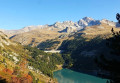
This tenth stage completes the crossing of the Vanoise massif. From the Refuge de l’Arpont, the GR®5 descends to the hamlet of Le Mont, crosses the Combe d’Enfer, climbs the flank of the Crête de Belle Place and crosses the valley of the Ruisseau de Bonne Nuit to reach the ruins of the hamlet of La Loza. It follows the contour of a rocky ridge like a balcony and descends via a few hairpin bends towards a ravine, then continues almost level through the Bellecôte valley. The path passes beneath the chairlifts of the Aussois ski resort and runs alongside the Plan Sec and La Fournache mountain huts. It skirts around Lac du Plan d’Amont and runs along the upper edge of Lac du Plan d’Aval before crossing the Col du Barbier. It climbs towards the Barbier chalets and descends to the hamlet of l’Orgère to reach the Refuge de l’Orgère.
From the hamlet of Les Prioux to Lac du Rateau
 6.02 mi
+4,019 ft
-1,617 ft
6h 15
Difficult
Departure from Pralognan-la-Vanoise (Savoie)
6.02 mi
+4,019 ft
-1,617 ft
6h 15
Difficult
Departure from Pralognan-la-Vanoise (Savoie)
First day of a 4-day route in the Vanoise massif.
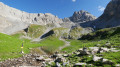
A very pleasant climb along the ‘100-bend’ path to reach the summit of the Petit Mont Blanc and its orientation table. A lovely end to the day in the Combe du Rateau.