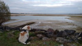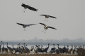
Lake Der-Chantecoq and the Crachefer Dam

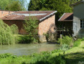
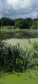
A pleasant walk along the dykes of Lac du Der, starting from Sainte-Marie-du-Lac. Covering 48 km², it is one of the largest artificial lakes in Europe. Spot the local wildlife (birds, swans in particular, and common cranes in season). The Crachefer Embankment (northern basin) offers superb panoramic views whilst you enjoy the breathtaking scenery over the water.

Details

n°110960288
Creation:
Last update:
Last review:
–
  • Walking
    Activity: Walking
  • ↔
    Distance: 6.78 mi
  • ◔
    Average duration: 3h 10 
  • ▲
    Difficulty: Easy

  • ⚐
    Back to start: Yes
  • ↗
    Ascent: + 66 ft
  • ↘
    Descent: - 66 ft

  • ▲
    Highest point: 469 ft
  • ▼
    Lowest point: 423 ft

Photos

Description of the walk

Der Village Museum car park.

(S/E) Leave the car park towards a roundabout; on the other side, cross the central car park. Take the road – with a restaurant on the left – and follow it until you reach a blue barrier. Take the path on the right which climbs up onto the embankment and carry on.

(1) You’ll reach a roundabout; take the first road on the right to reach the small blue barrier, with a car park on the right. Carry on and turn right onto the Crachefer Embankment.

(2) At the end, follow the footpath into the forest, walk past a campsite and arrive at a junction with a road on the embankment.

(3) Follow the road on the dyke, which is shared exclusively by cyclists and pedestrians, until you reach the D13a (elevation 143).

(4) Turn right carefully onto the D13a for 200 m, then turn left and continue along this unpaved track until you reach a junction, elevation 139.

(5) Turn right and follow this unpaved track, ignoring the paths on either side. At the end, walk a few metres to the right, then carefully follow the D13a to reach the roundabout, and then the car park (S/E).

Waypoints

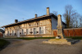
  1. S/E : mi 0 - alt. 456 ft - Der Museum Village
  2. 1 : mi 1.63 - alt. 469 ft - Towards the roundabout - Lac du Der-Chantecoq
  3. 2 : mi 2.61 - alt. 449 ft - Forest track
  4. 3 : mi 3.36 - alt. 466 ft - Road on the embankment - Camping de la forêt
  5. 4 : mi 4.57 - alt. 466 ft - D13a
  6. 5 : mi 4.95 - alt. 453 ft - Crossroads
  7. S/E : mi 6.78 - alt. 456 ft - Der Museum Village

Worth a visit

Other walks in the area

For more walks, use our search engine .

The GPS track and description are the property of this route's author. Please do not copy them without permission.