Circular route around the southern part of Lake Der, starting from Giffaumont

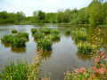
Walk starting from Giffaumont harbour, then following the southern basin and its birds, returning via the village in bloom (in season) and the Grand Der sea wall. Yellow/black and yellow/blue signposting.

Details

1489603
Creation:
Last update:
Last review:
  • Walking
    Activity: Walking
  • ↔
    Distance: 5.97 mi
  • ◔
    Average duration: 2h 50 
  • ▲
    Difficulty: Easy

  • ⚐
    Back to start: Yes
  • ↗
    Ascent: + 131 ft
  • ↘
    Descent: - 112 ft

  • ▲
    Highest point: 525 ft
  • ▼
    Lowest point: 410 ft

Photos

Description of the walk

Park in the car park at the Giffaumont Casino.

(S/E) Follow the yellow and blue signposts, head towards the Tourist Office to the east and walk past the shops, then past the harbour master’s office, the harbour and the sports centre.

(1) Turn right before the iron footbridge and walk along the beach, then head into the woods until you reach the road leading to the rowing basin; follow the tarmac path alongside it back to the car park.

(2) Turn right onto the cycle path, then right again and stay on the cycle path. Continue to the junction at the edge of the forest.

(3) Turn left along the road until you reach the roundabout. Cross the road carefully, then continue left until you reach the water tower.

(4) Take the path branching off to the right – this is the Chemin de la Tour. Pass the pumping station and continue to the RD13 or Rue du Lac. Cross carefully and carry on straight ahead to reach Rue du Bois.

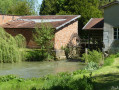
(5) Turn right and carry on straight through the village until you cross the D13 again. Cross here carefully once more. Pass the flower-filled wash house (you can take a detour to the right into the botanical garden, which is superb in summer) and the cemetery.

(6) Turn left onto Rue de Chantecoq, with its pretty half-timbered houses and the town hall. Continue to the junction with Rue de la Croix.

(7) Turn right, then turn left at the junction with Rue du Lac, heading towards the embankment.

(8) Climb up onto the sea wall via the steps and turn right onto theGR®14Bcycle path.
Be careful here: make sure you keep to the left, as many cyclists do not always have bells. Continue along the sea wall until you reach the Casino car park on your right (S/E).


Waypoints

  1. S/E : mi 0 - alt. 446 ft - Casino car park
  2. 1 : mi 0.8 - alt. 463 ft - Turn right towards the beach
  3. 2 : mi 2.12 - alt. 459 ft - Turn right towards the cycle path
  4. 3 : mi 2.89 - alt. 502 ft - Turn left towards the roundabout
  5. 4 : mi 3.26 - alt. 518 ft - On the right, the dirt track leading downhill
  6. 5 : mi 4.08 - alt. 423 ft - On the right: Rue du Bois
  7. 6 : mi 4.69 - alt. 423 ft - Turn left onto Rue de Chantecoq
  8. 7 : mi 4.87 - alt. 433 ft - On the right: Rue de la Croix
  9. 8 : mi 5.17 - alt. 453 ft - Turn right onto the cycle path
  10. S/E : mi 5.97 - alt. 446 ft - Casino car park

Notes

Sturdy shoes, water, walking stick.
Toilets near the tourist office at the harbour, behind the harbour master’s office, near the UFOLEP sports hall and at the rowing basin.
Plenty of places to eat.
Shelters at the harbour, the rowing basin and in the village.

Worth a visit

Lake Der is well worth a visit, with beaches, a casino, campsites, lodges and guesthouses nearby.
A prime birdwatching spot all year round, with migratory birds in autumn.
LPO Champagne-Ardennes in Chantecoq at the Ferme des Grands Parts (exhibitions).
Half-timbered churches and the Musée du Der in Sainte-Marie-du-Lac.

Always be cautious and plan ahead when you're outdoors. Visorando and the author of this route cannot be held responsible for any accidents occurring on this route.

The GR® and PR® markings are the intellectual property of the Fédération Française de Randonnée Pédestre.

Reviews and comments

4.3 / 5
Based on 3 reviews

Reliability of the description
4.3 / 5
Ease of following the route
5 / 5
Route interest
3.7 / 5
User 16724759

Overall rating : 5 / 5

Date of your route : Nov 10, 2025
Reliability of the description : ★★★★★ Very good
Ease of following the route : ★★★★★ Very good
Route interest : ★★★★★ Very good
Very busy route : No

This hike is very enjoyable, especially in autumn.

Machine-translated

virgule
virgule

Hello,

I’m just putting in my two cents, as this is a criticism that’s sometimes levelled at my routes.

If we suggest a route, it’s because we find it interesting. We don’t all have the same interests, of course. Some people like the physical challenge, others enjoy nature, or the trees, wildlife and flora, and some, in ‘tourist mode’, want to see the sights.

Personally, I love beautiful trees. So, often, on my routes, there aren’t any ‘views’. Anyone in ‘tourist mode’ can find out if there’s a little train to take a ride on. They pass through places where there are views.

I know the shores of Lac du Der. When it’s quiet there, it’s a marvellous spot.

Machine-translated

courjus52
courjus52

Hello, if you found it boring, it’s because you don’t know how to look properly. Between point 1 and point 2, there are plenty of birds in the trees and hedges lining the rowing lake, and a few more on the water.
Between point 4 and point 5, the same applies to the hedges lining the path, with views of the countryside and cows in the meadows, and perhaps, as a bonus, deer down below, near the edge of the woods.
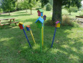
Between point 5 and point 6, you pass through the village with its many half-timbered houses, as you do between points 6 and 7. At point 6, there is a flower-filled wash house and an educational trail on the right, featuring a remarkable sculpture carved into an old oak tree.
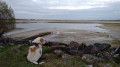
And from point 8 to the end of the route, there are views of the lake and a cycle path.
Your sunglasses must be too dark. Change them and listen to the birdsong.
Kind regards.

Machine-translated

I0NA
I0NA
• Edited:

Overall rating : 3.3 / 5

Date of your route : Jul 05, 2023
Reliability of the description : ★★★★☆ Good
Ease of following the route : ★★★★★ Very good
Route interest : ★☆☆☆☆ Very disappointing
Very busy route : No

Horrible!
We were bored out of our wits; this walk was completely uninteresting. We didn’t see a thing.

Machine-translated

YvanEpi
YvanEpi

Hello courjus52

Thank you so much for your link and your advice – and I absolutely love mushrooms...!

Machine-translated

henri57
henri57 ★

Hello,

@courjus52

Thank you for following up.

From what I can see, you’re not using Visorando on your smartphone, which explains the confusion.
It’s a brilliant tool,

See you soon

Machine-translated

courjus52
courjus52

Good evening, YvanEpi,
I’ve corrected point 7 as you suggested, but I haven’t changed anything in point 9 regarding the path with the red post, as both paths follow the same route.
From what I can see, you’re not using Visorando on your smartphone, which explains the confusion.
It’s a brilliant tool; here’s the link to the user guide – just copy and paste the link.
https://www.visorando.com/article-mode-d-...

In my walking club, I teach members how to use it – it’s brilliant, even for mushroom picking.
Kind regards.

Machine-translated

YvanEpi
YvanEpi

Hello courjus52,

I must indeed have got the hike wrong when selecting one for comment; the one I was referring to, which took place on 24 April 2019, is titled ‘The sources of Lac du Der, the river and the old canal’....
My mistake....

Machine-translated

courjus52
courjus52

Hello YvanEpi,
Thank you for your feedback, but this must not be the right walk – I’ve checked the waypoints again, and on the 7th there’s no bridge or canal, and the 9th doesn’t exist...
Kind regards.

Machine-translated

YvanEpi
YvanEpi

Overall rating : 4.7 / 5

Date of your route : Apr 24, 2019
Reliability of the description : ★★★★☆ Good
Ease of following the route : ★★★★★ Very good
Route interest : ★★★★★ Very good

Hello

A really lovely and interesting route. Well done to courjus52 for his choice and route planning

A few details should be added to avoid any confusion -> in capital letters and underlined, with the reason given in brackets.
(We didn’t have the IGN TOP25 map with us on this walk and used the map attached to the route description)

Point 7:
Turn right at a right angle, TAKING THE ROAD AFTER THE HOUSE(there is a risk of confusion with a footpath called the ‘Chemin Pédestre du Canal’); cross the iron canal bridge over the river and continue straight on. Cross the tarmac path......> until you reach the turn-off. Go under it and carry on straight ahead – DIRECTLY IN FRONT OF YOU, CHANGE SIDES OF THE CANAL – (Risk of confusion -> There is a path on each side of the canal and you change sides at this point)
Point 9:
Cross the bridge and turn immediately right (downhill), walk 100 metres and turn left onto the path (AT THE SECOND RED POST), THEN TURN RIGHT AFTER A FEW DOZEN METRES AT THE NEXT PATH, WHICH YOU FOLLOW PARALLEL TO THE CANAL, IT WIND THROUGH THE WOODS_(There is actually a first red post before you’ve covered the 100m; then, after a few dozen metres, you’ll join a path in the woods which you must follow to the right, roughly parallel to the canal)

Well done again to courjus 52 for this walk – highly recommended

Machine-translated

Other walks in the area

For more walks, use our search engine .

The GPS track and description are the property of this route's author. Please do not copy them without permission.