Country:

 City:
City:


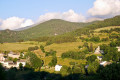
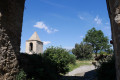
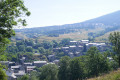
(S) Accommodation: “Les Ramiers”. Turn left onto Avenue des Érables for a few metres, then immediately right onto Rue des Sorbiers until the tarmac ends.
The route described is signposted in yellow. Follow signs for Bolquère. The path descends steadily.
Join Avenue de Cerdagne.
Caution: Heavy traffic.
Continue down this avenue. You’ll reach the Grand Rue de Bolquère. Cross it. There is no pedestrian crossing.
(1) Fork in the road. Turn left. Keep to the right-hand side of the Grand Rue. Pass the grocery shop on your right.
Caution: you must cross to the other side of the road. A wide, recently built footbridge allows you to cross the Rec de Bolquera, alongside the road.
(2) Fork in the path. Turn left onto theGR®10Tour de Cerdagne. Red and white markings.
(3) Junction. Turn right onto theGR®. Pass under the EDF high-voltage power line. Head down towards the road. Join the D 10. Turn left onto the left-hand side. Pass the electrified line of the ‘yellow train’. Possible stop.
Caution: Motor traffic.
(4) Road junction. Head straight ahead. No pedestrian crossing.
Caution: Very heavy traffic.
(5) Road and track junction. Head right. Leave the red and white markings.
Follow the Tour de Cerdagne, marked with red and yellow signs. Pass under the extra-high-voltage power line.
(6) Fork in the path. Head straight ahead. Leave theGRP® and its red and yellow markings. Follow the beautiful Roman road.
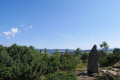
Follow the yellow markings. After 100 m, turn right into the pasture to see the dolmen and take in the Cerdagne landscape. The ‘Yellow Train’ runs across this vast plain. Return to the path and continue.
(7) Fork in the path. Turn left onto the Roman road, following the yellow markings. The path descends. Cross the Riu d’Eina via a footbridge. The path climbs again. Pass the altitude of 1,565 m. Join the D 29. Turn right and walk for 100 m.
Caution: Motor traffic.
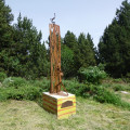
(8) Junction. Turn left, heading uphill. Leave the road. After 80 m, turn left to see the menhir (El Port). Return to the path and continue the climb towards the highest point, turning due east.
A new solar power station is under construction below, on the right-hand side.
Pass under the extra-high-voltage power line. Head down to the village, following the path that runs to the right of the mobile phone mast.
Cross the Riu d’Eina again via the road bridge. Arrive at Eyne, where you can get something to eat and drink.
Turn right onto the D 29. Join theGRP® Tour de Cerdagne trail. You’ll reach the left-hand bend on the D 29.
(9) Fork in the path. Turn right onto the Camin del Campanar, climbing up above the road. Head up towards the top of the village. You’ll reach the top of the village, above the church on Carrer de l’Églesia. Turn right; the cemetery is on your right, then turn left onto Carrer Gironella. Before heading down towards the stream, look for a wide path running alongside a building on your right. No signposting.
See Note in practical information.
(10) Fork in the path. Head straight ahead. Follow the red and white markings ofthe GR®36. Pass the points with an altitude of 1673m and 1753m. Continue to follow theGR®36. Walk past the accommodation on your left. You’ll reach the mobile phone masts.
(11) Crossroads of tracks and paths. Head straight ahead along the track, due east. Leave theGR®36. Scattered yellow markings.
(12) Crossroads. Turn right onto the track leading uphill. You’ll reach a car park with motor vehicles. Espace Cambre d’Ase.
(13) Crossroads of ski runs. Head left, due north. The run soon turns north-east.
(14) Fork in the path. Take the left-hand path downhill. Pass through a wooden gate. The path follows the Rec del Moli on the left bank. Yellow markings.
(15) Fork in the path. Turn right. Red and white markings forthe GR®36. The path descends very steeply.
(16) Fork in the path. Turn right. Leave the red and white markings ofthe GR®36.
Please note: be sure to stay on this private track, which is open to walkers.
I chose this path because the approach to the village is much more scenic.
See practical information 1.
In Planès:
Note: For those who started this route by taking the ‘yellow train’, you must follow the start of the first stage to get down to the station (E).
The €1 bus also takes you back to Villefranche-de-Conflent and Perpignan.

 Visorando Member
 Easy
Easy 
 Very difficult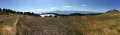
 Moderate