Arrondaz Plateau from Valfréjus

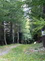
The ascent is very shaded by Le Seuil and Les Bovenières. The descent is via La Challe and the Sentier des Ânes.

Details

24136740
Creation:
Last update:
Last review:
  • Walking
    Activity: Walking
  • ↔
    Distance: 5.11 mi
  • ◔
    Average duration: 4h 15 
  • ▲
    Difficulty: Moderate

  • ⚐
    Back to start: Yes
  • ↗
    Ascent: + 2,218 ft
  • ↘
    Descent: - 2,205 ft

  • ▲
    Highest point: 7,274 ft
  • ▼
    Lowest point: 5,082 ft

Description of the walk

Park in the large car park near the tourist office.

(S/E) Walk along the Place des Bergers, keeping to the left-hand side of the square. Just before you reach the cable cars, take the metal steps on the left, join the road and cross it. A few metres further down, follow the sign on the right for “Arrondaz”.

(1) Shortly after entering the woods, leave the fairly wide track and take the path on the left towards Charmasson and the hamlet of Le Seuil. Continue through the woods, still climbing: there are mountain bike tracks here.

(2) When you reach the road, turn left and carry on.

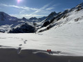
(3) Ignore the bridge on the left spanning the Torrent du Grand Vallon and go straight on, passing right next to an old quarry. A few metres further on, you’ll come across signposts and a path that winds through the woodland to the Arrondaz plateau. Carry on to the cable car station (views of the Roc Rouge, the Maurienne, the Vanoise and Punta Bagna).

(4) To find your way back, follow the Pigniers ski run more or less, skirting the ski lift and then heading north.

(5) Look for the well-marked path which starts on the left near a copse of trees. You’ll emerge further down onto the ski run.

(6) Head down to the left for about 50 metres and, at the first snow cannon on the right, take the path into the forest. It is much easier and more pleasant than the ski run, which you’ll come across again. Continue down for just over 300 metres.

(7) Take another path – this time clearly signposted – on the left. Pass under the Arrondaz cable car and follow a few hairpin bends before emerging onto the Route du Seuil. Turn right and walk for about 50 metres.

(8) Take the path on the left.

(1) Continue to the left and follow the same route back to the car park (S/E).

Waypoints

  1. S/E : mi 0 - alt. 5,085 ft - Tourist Office car park
  2. 1 : mi 0.35 - alt. 5,289 ft - Junction of the circular loop
  3. 2 : mi 0.69 - alt. 5,574 ft - Road junction
  4. 3 : mi 1.03 - alt. 5,699 ft - Junction
  5. 4 : mi 3 - alt. 7,270 ft - Upper station of the - Ttélécabine d'Arrondaz
  6. 5 : mi 3.26 - alt. 7,116 ft - Start of the path
  7. 6 : mi 3.56 - alt. 6,686 ft - Ski run
  8. 7 : mi 3.91 - alt. 6,220 ft - Path on the left
  9. 8 : mi 4.53 - alt. 5,466 ft - Path on the left
  10. S/E : mi 5.11 - alt. 5,082 ft - Tourist Office car park

Notes

The cable car operates on certain days (Monday, Tuesday and Wednesday during summer 2023), so you can choose to take just the uphill journey or just the downhill journey.

Worth a visit

From the plateau, you can continue on foot to Punta Bagna (a track suitable for vehicles). Allow a good two hours, but the view is exceptional! Mont Blanc, the Écrins, the Vanoise, Mont Thabor, etc. There are two orientation boards.

An easier option is to head to the Petit Vallon chairlift by taking the track that starts with an ascent behind the gondola lift’s arrival point: this also offers a lovely view (Belledonne, Vanoise, Mont Thabor). It takes about 30 minutes to walk there.

In summer, the Valfréjus Tourist Office organises a free ‘landscape interpretation’ activity from the Arrondaz plateau. Booking is essential.

Reviews and comments

5 / 5
Based on 2 reviews

Reliability of the description
5 / 5
Ease of following the route
5 / 5
Route interest
5 / 5
User 14673093

Overall rating : 5 / 5

Date of your route : Aug 24, 2025
Reliability of the description : ★★★★★ Very good
Ease of following the route : ★★★★★ Very good
Route interest : ★★★★★ Very good
Very busy route : No

Magnificent hike.
The climb through the woods is very easy and cool. However, it can be a little difficult with children, in which case it is better to take the cable car up and walk down through the woods.
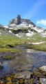
The Arrondaz plateau offers exceptional views of the surrounding mountains.

Machine-translated

daniel.nicolas18
daniel.nicolas18

Overall rating : 5 / 5

Date of your route : Aug 17, 2023
Reliability of the description : ★★★★★ Very good
Ease of following the route : ★★★★★ Very good
Route interest : ★★★★★ Very good
Very busy route : No

A brilliant hike

Machine-translated

Other walks in the area

For more walks, use our search engine .

The GPS track and description are the property of this route's author. Please do not copy them without permission.