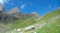
Circular route via La Chapelle and the Rocher de Saint-Pierre in Valloire

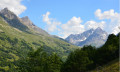
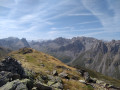
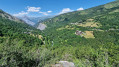
A circular walk above Valloire with beautiful views.

Details

n°54593443
Creation:
Last update:
Last review:
  • Walking
    Activity: Walking
  • ↔
    Distance: 1.63 mi
  • ◔
    Average duration: 1h 10 
  • ▲
    Difficulty: Easy

  • ⚐
    Back to start: Yes
  • ↗
    Ascent: + 495 ft
  • ↘
    Descent: - 505 ft

  • ▲
    Highest point: 5,164 ft
  • ▼
    Lowest point: 4,669 ft

Description of the walk

Park at the La Borgé car park.

(S/E) Walk up onto the pavement and follow the Route du Galibier. Turn left to cross the car park and rejoin the road.

(1) Turn left to cross the footbridge over the Torrent de la Valloirette, then continue straight on for about 600 m.

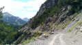
(2) Turn left to follow the white track for 200 m, then turn left onto the path towards the Chapelle Saint-Pierre and head towards it.

(3) Follow the path on the left, which winds its way for 300 m to the Rocher Saint-Pierre. Take the steps with care: via ferrata – hold onto the steel cables for 100 m.

(4) Turn right and follow the path down for 200 m. At the junction, turn left and continue downhill to the Rond-point de la Vache.

(5) Turn left onto the pavement, cross the footbridge over the Valloirette and you’ll immediately reach the La Borgé car park (S/E).

Waypoints

  1. S/E : mi 0 - alt. 4,705 ft - La Borgé car park - Valloirette (rivière)
  2. 1 : mi 0.15 - alt. 4,747 ft - Footbridge
  3. 2 : mi 0.63 - alt. 4,895 ft - Turn left at the fork
  4. 3 : mi 0.83 - alt. 5,020 ft - Chapelle Saint-Pierre (Valloire)
  5. 4 : mi 1.1 - alt. 5,131 ft - Rocher Saint-Pierre
  6. 5 : mi 1.56 - alt. 4,678 ft - Roundabout
  7. S/E : mi 1.63 - alt. 4,705 ft - Arrival at the La Borgé car park - Valloirette (rivière)

Notes

Take a bottle of water, good walking shoes, walking poles and weather-appropriate clothing.
Check the weather forecast: avoid this hike in wet conditions (slippery rocks).
No shelter.

Worth a visit

Visit Valloire; information is available from the Tourist Office.

Reviews and comments

4.7 / 5
Based on 1 review

Reliability of the description
5 / 5
Ease of following the route
4 / 5
Route interest
5 / 5
User 21773509

Overall rating : 4.7 / 5

Date of your route : Aug 06, 2025
Reliability of the description : ★★★★★ Very good
Ease of following the route : ★★★★☆ Good
Route interest : ★★★★★ Very good
Very busy route : No

Excellent for getting back into hiking
gradual climb, no particular difficulty and nice scenery

Machine-translated

Other walks in the area

For more walks, use our search engine .

The GPS track and description are the property of this route's author. Please do not copy them without permission.