Country:

 City:
City:


Before the Payolle Lake dam, turn right onto the road to La Hourquette d’Ancizan. Park your car at the first junction on this road to La Hourquette d’Ancizan.
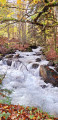
(S/E) Do not cross the Ruisseau d’Artigou. Follow a road heading due south which quickly turns into a track suitable for vehicles. Follow this track.
(1) At a right-hand bend in this track, carry straight on, heading due south, along a wide path that climbs. 100 metres further on, at the next fork, continue straight ahead along the path, which climbs up the left bank of the Ruisseau d’Artigou.
(2) Cross the Route de la Hourquette. Continue straight on, due south, along a well-marked track. Stay on the same bank. You’ll reach the spring water collection points by the roadside.
(3) You’ll come to the Route de la Hourquette at a road bridge. Continue along this road, heading due south for 100 m. At the right-hand bend, head straight on, due south, continuing to climb along the left bank of the little Ruisseau d’Artigou.
(4) At around 1,450 m, head due west, continuing to follow the stream on the left bank. Climb up through the mountain pastures. At around 1,700 m, head due south, following the numerous paths leading to Lac d’Arou.
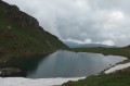
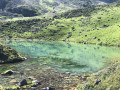
(5) On reaching Lac d’Arou (1,786 m), a well-deserved break is in order.
As you set off again from the lake, look out for the very sparse yellow markings. Take a path heading north-east, which is clearly marked on the ground. Cross the Ruisseau d’Artigou. The well-marked path, heading due east, remains more or less flat as it winds from one valley trough to the next. Stay on the yellow markings.
(6) This will take you to the car park at the Hourquette d’Ancizan (1,564 m). Head down this road to the left, heading north for 150 m.
(7) Turn right onto a well-marked path that climbs due north. After 150 m, you’ll reach a pass with signposts.
(8) Carry on straight ahead, continuing to climb due north. Stay on the ridge as you continue to climb. The path heads north-east and passes beneath Cap de Sarrat Termé (1,613 m) and Broucouze (1,654 m). The path, which heads north-east, passes another pass (altitude 1,602). It takes you to the summit, still following the grassy ridge.
(9) You’ll reach the top of Plo del Naou (altitude 1,754 m). A triangulation point marks the spot. Now follow the yellow markings. The ridge path now descends. It passes between two forests that meet. Pass the altitude 1,605 m, where there are numerous paths and tracks.
(10) 150 m further on, at around 1,600 m, turn left at the fork.
Leave the yellowmarkings. Turn left, heading due west, towards a track.
(11) You’ll reach another track called Chemin de la Cabane. Cut across this track (altitude 1403) and continue straight on. The path descends very steeply. It follows a ridge through the heart of the forest. The path leads you to a flat mountain pasture.
(12) Head right towards Lac de Payolle. Cross the Adour de Payolle (river).
Follow the lakeshore to the left; before you reach the dam, turn left. The cars are 300 m away (S/E).



 Visorando Member

 Easy
Easy 
 Difficult