


Refine your search for walks in Ancizan
Ancizan walks


 From Ancizan to Fréchet-Aure
 Visorando Member
 5.60 mi
 +984 ft
 -1,083 ft
 3h 25
 Moderate
 Departure from Ancizan (Hautes-Pyrénées)
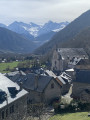
Third stage of the Ténarèze. From Ancizan, follow the GR® 105 north-east, crossing summer pastures and beech woods with views of the Pic du Midi de Bigorre. After Cadéac, the trail leads to Arreau, the former capital of the Aure Valley. Then take the old railway line (now disused), a flat path lined with ferns, to Fréchet-Aure. This balcony village, listed as one of the "Most Beautiful Villages in France", offers a panorama of the Pyrenees and a preserved pastoral heritage.
Lançon - Gouaux - Grézian loop
 Association / Club / Walk leader
 6.77 mi
+1,696 ft
-1,706 ft
4h 35
Moderate
Departure from Lançon (Hautes-Pyrénées) (Hautes-Pyrénées)
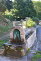
This is a beautiful hike, the first part of which takes you through lovely pine forests. You can then admire a superb panorama of the Aure valley on the south side, not to mention the highlight of the show, an incomparable view of the Arbizon.
Pic de Montfaucon from the Hourquette d'Ancizan
8.42 mi
+3,983 ft
-3,980 ft
7h 20
 Difficult
Departure from Ancizan (Hautes-Pyrénées)
On a mountain often overlooked in favour of its neighbour, the Arbizon, or the 3,000-metre peaks of the Néouvielle, this hike offers stunning views. The route through the mountain pastures to Lac d’Arou and then over scree to the summit requires good experience of walking on ground that gives way easily underfoot. Please take full note of the comments regarding the mountainous terrain.
This hike should only be undertaken when there is no snow!
Circular from the Hourquette d'Ancizan
 8.01 mi
+1,946 ft
-1,949 ft
5h 25
Moderate
Departure from Ancizan (Hautes-Pyrénées)
An easy hike that takes you on a circular route around the Hourquette. Dominant position 70% of the time, some beautiful views, passage at Lac d'Arou (where the cows bathe) and crossing of a few streams.
Important: for this hike, it is best to use "Open Street Map Rando", which offers more trails than IGN. However, it is impossible to get lost as all the landmarks are visible while walking and serve as reference points.
Granges de Grascouéou from Agos
 6.29 mi
+3,114 ft
-3,107 ft
5h 35
Moderate
Departure from Vielle-Aure (Hautes-Pyrénées)
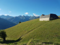
Magnificent view of the barns, extensive panorama of the Rioumajou Valley, Lustou, the Louron peaks, Hourgade and the village of Saint-Lary-Soulan. On the other side, view of the Plat d'Adet and the Aulon Valley.
The “Ambivalence” structure and Pla de Cros as seen from the church in Bordères-Louron
 3.32 mi
+1,591 ft
-1,591 ft
2h 55
Moderate
Departure from Bordères-Louron (Hautes-Pyrénées)
Starting from the car park in front of the church in Bordères-Louron, this accessible circular walk offers lovely sights all along the route.
After the first climb, you’ll reach the architectural structure “Ambivalence”, created by students from the Toulouse School of Architecture: an unusual seating area with a view over the valley, marking the entrance to the Montious Massif Regional Nature Reserve. You can then enjoy the panoramic view of the highest peaks in the Pyrenees and make use of the picnic tables.
From village to village in Bordères-Louron
 7.54 mi
+2,746 ft
-2,726 ft
5h 50
Difficult
Departure from Bordères-Louron (Hautes-Pyrénées)
A lovely walk taking you from Bordères-Louron to Ris, Cazaux-Debat and Ilhan.You’ll cross from the southern slope to the northern slope, following some lovely stony paths.There are several lovely viewpoints along the route.This hike should be undertaken in the absence of rain and heavy snowfall.The walk is classified as difficult, as some basic navigation skills are required, for example between points (2) and (3).
Jézeau Circular Route
5.31 mi
+1,696 ft
-1,706 ft
3h 55
Moderate
Departure from Jézeau (Hautes-Pyrénées)
This circular route starting from Jézeau follows a clearly signposted path. The ascent features varying gradients with some fairly steep sections, but nothing technical or complicated. The return is much easier along a very wide path with superb views of the Pyrenees. The alternative route takes you through a horse paddock: see the Practical Information section for guidance on how to behave on this part of the route.
Cap de Pède
2.98 mi
+1,194 ft
-1,194 ft
2h 25
Moderate
Departure from Aulon (Hautes-Pyrénées) (Hautes-Pyrénées)
A short hike for an afternoon in the forest before reaching the summit with excellent views.
Soum de Coste Oueillère
 6.70 mi
+3,550 ft
-3,533 ft
6h 10
Difficult
Departure from Ancizan (Hautes-Pyrénées)
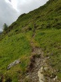
A lovely summit accessible from Les Granges de Camoudiet, returning via the Petit Lac d’Arou.
A circular hike on unmarked paths.
A good sense of direction, map-reading skills and the .gpx track will be useful on this route.
Best undertaken when there is no fog.
Mont Fevoll or Pic de Crabe circular loop
 7.66 mi
+2,349 ft
-2,339 ft
5h 35
Moderate
Departure from Ancizan (Hautes-Pyrénées)
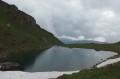
A lovely circular walk which takes you from the Cabanes de Camoudiet up to the Pic de Crabe via the ridge, past Lac d’Arou, where you can admire the high peaks.
To complete this circular loop, you need to know how to navigate.
The GPX track may prove useful
Crête de Bidour depuis Lac de Payolle
 7.89 mi
+2,234 ft
-2,257 ft
5h 35
Moderate
Departure from Ancizan (Hautes-Pyrénées)
Cette Crête de Bidour permet de descendre au Col d'Aspin depuis le Plo Del Naou et d'admirer la Vallée d'Arreau.
En certaines périodes estivales, la zone de Payolle et les crêtes du Bidour sont assez fréquentées. Il est bon de démarrer la randonnée tôt.
Lake Arou from Payolle
9.80 mi
+2,854 ft
-2,854 ft
7h 00
Moderate
Departure from Ancizan (Hautes-Pyrénées)
A walk starting from Lake Payolle towards Lake Arou.
Lac de Montarrouye
 9.46 mi
+2,625 ft
-2,651 ft
6h 40
Moderate
Departure from Ancizan (Hautes-Pyrénées)
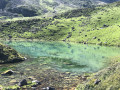
A short walk through the wilderness, passing close to Courtaou d'Artigussy and Les Esclozes. A few leytès (traditional milk coolers) and building ruins bear witness to the area's former pastoral activity.
Courtaou and Cabane des Esclozes
 5.34 mi
+869 ft
-869 ft
3h 15
 Easy
Departure from Ancizan (Hautes-Pyrénées)
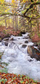
A lovely, easy hike from the Payolle campsite. This hike can be done on snowshoes.
Le Courtaou near Les Esclozes has been restored. The Les Esclozes hut is maintained. A water supply channel is operational.
This place was once an important settlement, as evidenced by the number of collapsed huts and barns.
The route appears to correspond tothe PR® (no. 19), which is clearly marked in the opposite direction to the description.
More walks in Ancizan
Select a point of interest below: