Mont Fevoll or Pic de Crabe circular loop

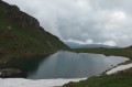
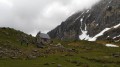
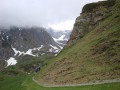
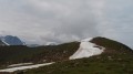
A lovely circular walk which takes you from the Cabanes de Camoudiet up to the Pic de Crabe via the ridge, past Lac d’Arou, where you can admire the high peaks.
To complete this circular loop, you need to know how to navigate.
The GPX track may prove useful

Details

124768
Creation:
Last update:
Last review:
  • Walking
    Activity: Walking
  • ↔
    Distance: 7.66 mi
  • ◔
    Average duration: 5h 35 
  • ▲
    Difficulty: Moderate

  • ⚐
    Back to start: Yes
  • ↗
    Ascent: + 2,349 ft
  • ↘
    Descent: - 2,339 ft

  • ▲
    Highest point: 6,266 ft
  • ▼
    Lowest point: 4,514 ft

Photos

Description of the walk

From Campan, follow the Col d’Aspin road (D918). On reaching “Payolle”, turn right (D113) after the holiday camp buildings (elevation 1,083 m), crossing a narrow bridge. After 200 m, you’ll reach “Aux Quatre Véziaux” (campsite on the left). Continue along the D113. Follow this straight road for 1.5 km as it runs alongside the “Pelouse Saint-Jean”. Before the dam, turn right (at 1,125 m), continuing to follow the D113, known as the “Route de la Hourquette d’Ancizan”. Take the first bend to the right, then another to the left, and continue south on this road for 2 km until the next bend to the left.
Park in this open area. Do not drive towards the Cabanes de Camoudiet.

(S/E) Walk towards the “Cabanes de Camoudiet” along this stretch of road.

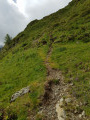
(1) At the end of this road, cross the bridge (which leads to the huts) and cross the Camoudiet Stream, heading due north. Descend slightly and cross another stream. Climb back up for 100 m and turn left, heading north-west. Climb up through the mountain pasture, keeping to the left-hand side of the spur. Continue climbing steeply north-west towards the ridges, simply following the (old) fence posts which indicate there is a drop-off on your right. There is a track that allows you to follow this ridge, avoiding the rocky outcrops and boulders. Continue along the path, which veers slightly westwards, to reach the point with an altitude of 1843. Leave the ridge heading due north on your right.

(2) Turn left, heading due west, following a path clearly marked on the ground in this area of the Pla de l’Arcouade. After 600 m, head due south, following a marked path that skirts a small hillock on the left (altitude 1871). The path now descends to reach the Pla des Bouhouèrès area (altitude 1,799). Continue climbing through the mountain pasture, still heading due south, towards the hillock known as Pic de Crabe or Mont Fevoll (altitude 1,916).

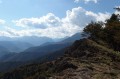
(3) You can stop here to admire the scenery (the Arbizon, Mont Faucon, the Hourquette d’Anzizan, the Gaoube valley, etc.). Head due south towards a path that winds down in hairpin bends and leads to the Col Crabe (altitude 1,870 m) below.

(4) Head south-east along a path that runs along the hillside (ignore all paths leading uphill). This path then descends gently (altitude 1,845). Now head due east to the point at altitude 1,768.

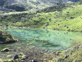
(5) After 1.5 km, the path turns right, heading due south. You’ll spot a small lake below on the left. Continue due south until you reach Lac d’Arou, which lies below you. Head down towards the lake.

(6) Walk round it via its source and climb up to the hut (which is always locked). Another break in this area is very pleasant; you are at the foot of some great peaks.
Stay on the right bank of the Ruisseau d’Artigou and head down north-east to join a very well-marked path with yellow markings coming from the Hourquette d’Ancizan.

(7) From here, the path heads due east, continuing to descend. You’ll reach the Clot de Pourtillou. The path veers right (south-east) for 150 m to cross a torrent, passing La Coume Talamet.

(8) Continue left (north-east) for 500 m before turning right (due east). You can see the Hourquette d’Ancizan.

(9) Caution: no signposting or marked path. At the junction of paths (alt. 1,600 m), head down to the left into the mountain pasture, heading due north-west.

(10) Cross the Coume Talamet stream again and, after a bend to the left, head up towards the south-west, following sheep tracks. After 400 m, head down towards another stream. Follow it along the right bank, heading for the D113 road bridge.

(11) Cross the bridge on the left, head due west, and cut across the hairpin bend in the road ahead. After 200 m, climb (due north) through the forest along a steep track on the left, running parallel to the road. After a 500 m climb, emerge from the forest.

(12) Turn left and head back down towards the south-west, heading for the road below. Reach the road and return to your car.

Waypoints

  1. S/E : mi 0 - alt. 4,642 ft - Parking at the bend
  2. 1 : mi 0.18 - alt. 4,747 ft - Mountain huts
  3. 2 : mi 1.28 - alt. 6,083 ft - Highest point
  4. 3 : mi 2.45 - alt. 6,266 ft - Pic de Crabe or Mont Fevoll
  5. 4 : mi 2.66 - alt. 6,129 ft - Col de Crabe
  6. 5 : mi 3.63 - alt. 5,791 ft - On the right
  7. 6 : mi 4.06 - alt. 5,876 ft - Lac d’Arou
  8. 7 : mi 4.42 - alt. 5,636 ft - Crossroads
  9. 8 : mi 5.41 - alt. 5,315 ft - Creux
  10. 9 : mi 5.87 - alt. 5,236 ft - Junction
  11. 10 : mi 6.23 - alt. 4,905 ft - Stream
  12. 11 : mi 6.96 - alt. 4,514 ft - Bridge
  13. 12 : mi 7.38 - alt. 4,823 ft - To the left
  14. S/E : mi 7.66 - alt. 4,652 ft - Parking at the bend

Notes

At Les Granges de Camoudiet there is a water source, an open hut and a lean-to.
Below the Col de Crabe, on your left as you head towards Lac d’Arou, there is a hut.
You will need the route description, the .gpx track, the map and a compass. An altimeter may be useful.
Basic mid-mountain kit may be necessary if the weather changes.
2 litres of water, rainwear, a light fleece and a snack.

Worth a visit

From Payolle, you can climb the Col d’Aspin, well known to cyclists.
There are plenty of hikes of varying difficulty suitable for everyone.
Payolle

Reviews and comments

3.6 / 5
Based on 5 reviews

Reliability of the description
3.4 / 5
Ease of following the route
3.2 / 5
Route interest
4.2 / 5
lemarcheur65
lemarcheur65 ★

Hello Enguerrand260

You wrote:

The Pic de Crabe doesn’t exist! It’s actually the Col de Crabe via the Pla de l’Arcouade.

The Pic de Crabe (1,916 m) (3) is north of the Col de Crabe (1,870 m), even though it isn’t marked on the IGN map.
Some maps show the Col de Crabe (1,799 m) to the north of this peak!
At the summit of the Pic de Crabe, there is (was) a plaque marked ‘Mont Favoll 1916 m’
The real name is probably Mont Favoll?

Machine-translated

Enguerrand260
Enguerrand260

Overall rating : 4 / 5

Date of your route : Nov 19, 2023
Reliability of the description : ★★★★☆ Good
Ease of following the route : ★★★☆☆ Average
Route interest : ★★★★★ Very good
Very busy route : No

The Pic de Crabe doesn’t exist! It’s actually the Col de Crabe via the Pla de l’Arcouade.
The path marked at point 9 does not exist. As for the signpost after point 1, don’t hesitate to carry on further up before turning off due south.
Beautiful views over the valley. It’s not a 360° view, but it’s well worth the effort.

Machine-translated

rambau
rambau

Hike not yet completed.

Best regards

Machine-translated

midupont
midupont

Overall rating : 4.3 / 5

Date of your route : Oct 20, 2016
Reliability of the description : ★★★★☆ Good
Ease of following the route : ★★★★★ Very good
Route interest : ★★★★☆ Good

An interesting walk offering beautiful views of summer pastures; it’s not particularly difficult, though you’ll need to be able to find your way, at least roughly, in foggy conditions.

Machine-translated

peyoh
peyoh

Overall rating : 4 / 5

Date of your route : Sep 11, 2015
Reliability of the description : ★★★★★ Very good
Ease of following the route : ★★★☆☆ Average
Route interest : ★★★★☆ Good

Enjoy the walk – the guide states that, from the Col de Crabe, you shouldn’t take the paths that lead uphill. It’s a shame I didn’t read the guide before setting off.
The Pic de Crabe is also known as the Bédouret
See you soon

Machine-translated

gilles.hubert6
gilles.hubert6

Hello everyone,
First of all, thank you to lemarcheur65 for adding a few notes following the comments I made about this route, particularly the advice to keep well to the left of the rocky outcrop at the start of the walk;
However, I would still like to point out that this walk takes place amidst magnificent scenery, enhanced by the presence of various animals (cows, horses, sheep, vultures, etc.), and I cannot agree with the suggestion that this walk is uninteresting or of only moderate interest. The La Hourquette d’Ancizan plateau offers magnificent views over the mountain pastures, and the first part of the route, along the ridges, allows you to admire the lovely site of Payolle, the Gaoube Valley and, of course, the Pic du Midi.
If I’d described the reliability of the route description and mapping as ‘average’, it’s because of the slightly tricky start we experienced and the lack of landmarks on the ground; some hikes require a compass and altimeter, and this is one of them.
Well done once again to those who post these walks, much to the delight of those who use them.......

Machine-translated

gazok54
gazok54 ★

Yes, that’s right, rebk – our fellow hiker lemarcheur65 is spot on. This walk is almost entirely off-trail, and that’s clear to see when you look at the route. In the mountains, you should always prepare thoroughly for your walk and never overestimate your abilities. I’m not saying you don’t have them, but in this case you failed to appreciate the difficulty.
For this sort of hike, you need to be able to read a map properly and have a compass – or, better still, a GPS or the Visorando smartphone app – so you can work out where you are. Otherwise… you’ll get lost and end up disappointed.
It’ll go better next time.

Machine-translated

rebk
rebk

Overall rating : 2 / 5

Date of your route : Aug 26, 2015
Reliability of the description : ★☆☆☆☆ Very disappointing
Ease of following the route : ★★☆☆☆ Disappointing
Route interest : ★★★☆☆ Average

Can't find the route... what a let-down!

Machine-translated

gazok54
gazok54 ★
• Edited:

Hello, and thank you, gilles.hubert6, for your comment.
The author of this walk will no doubt be able to provide the necessary details about the starting point so that future walkers don’t make the same mistake as you.
One thing is certain: if you’ve done the route in the wrong direction, it’s impossible to appreciate the quality of the description.
With a 1:25,000 scale map, there’s no getting round it. However, when you’re planning your walk, you can easily zoom in on a specific area and take a screenshot, which you can then paste into Word, for example.

Machine-translated

gilles.hubert6
gilles.hubert6

Overall rating : 3.7 / 5

Date of your route : Jul 29, 2015
Reliability of the description : ★★★☆☆ Average
Ease of following the route : ★★★☆☆ Average
Route interest : ★★★★★ Very good

The route description right at the start of the walk was a bit vague, so much so that we found ourselves on the wrong side of the ridge we were meant to tackle and follow – we should have gone left, not right; it was then a real struggle to get to the other side of the ridge because of the steep slope to the right of it.

Furthermore, the scale of the route map (1:25,000) made it difficult to find our bearings, despite having an IGN map with us; it must be said that there are no paths (except on the final section of the route after the lake) and no signposting.
We should have printed the map at a scale of 1:10,000 to see all the details of the route.

For example, point “1843”, which is clearly marked on the map, is very difficult to locate on the ground.
The same goes for the Pic de Crabe (1,916 m), which is hard to spot on the ground.

Once you reach the mountain pasture (ridge on the right), the scenery is truly magnificent, but I’d still advise taking a compass and an altimeter, as you tend to follow the tracks left by animals, which aren’t necessarily the right ones

Thanks all the same to those who posted this walk.

Machine-translated

Other walks in the area

For more walks, use our search engine .

The GPS track and description are the property of this route's author. Please do not copy them without permission.