Country:

 City:


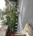
When approaching Murol via the D5, just before reaching the village, park at the rest/picnic area on the right-hand side of the road, with a view of Murol Castle. Information boards for the Auvergne Volcanoes Park and on Murol “worth discovering”. Alternating parking at Lac Chambon beach between (3) and (4).
(S/E) Continue south along the rest area, then follow the path on the right signposted “Dent du Marais pied du rocher, Lac Chambon”. Old Yellow Disc markings. Stay on this forest path.
(1) Follow the path as it turns left, ignoring a dead-end path opposite. Pass at the foot of the Dent du Marais and walk alongside the rocks that have fallen from it. Continue along the access path to a house with a pond and look out for a hiking signpost.
(2) Carry on straight towards Roche Blanche. You’ll come to a small road near some houses. Turn right and you’ll reach the Roche Blanche signpost at a crossroads. Follow the signs for Lac Chambon, taking the path with steps that descends to the left.
(3) Cross the D5 carefully and head straight ahead to find a signpost. Follow the signs for ‘La Plage’, taking the path along the shore of Lac Chambon. Stay by the lake, ignoring the other paths; pass a large car park (an alternative starting point for this walk), cross the Couze Chambon, and walk along the beach.
(4) Opposite the Auberge de la Plage, turn left and you’ll immediately come to a signpost. Continue towards ‘Croix des Sparts’, leaving the lakeside behind. You’ll soon be walking along a small road between a wooded slope and a campsite.
(5) At the ‘Croix des Sparts’ signpost, leave the road and turn left towards another signpost a few metres away. At this signpost, look to your right for the memorial stone honouring Victor Charreton, a painter and sculptor from the Murol School. Then follow the signs for Le Tartaret. About 100 metres further on, take the second path on the left, marked with a Yellow Cross, which features a fitness trail.
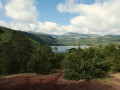
(6) At the junction of the paths, turn left following the sign for ‘Sommet du Tartaret’ for a round trip. The path climbs to a beautiful viewpoint overlooking Lake Chambon and the hills of the Mont Dore valley to the west.
(7) Head back down and, at the junction, carry on straight ahead along the path on the right (still on the fitness trail), which leads down from Le Tartaret. Further on, join a path at the ‘Le Tartaret’ signpost. Carry on to the left towards Jassaguet. Take care further on not to miss the path with steps that descends to the right. Pass a picnic area on your right below, and after a flight of steps you’ll reach a road in Murol, the D5.
(8) Cross it carefully and, opposite, take a flight of steps leading down slightly to the left. You’ll come to a road; follow it to the right until you reach the Escalier de Jassaguet, which you should climb to the right. At the top, there’s a fountain and a viewpoint over the village; follow the road straight ahead as it descends. At the Stop sign, turn right, then left onto Rue de l’Abbé Boudal to reachthe Church of Saint-Ferréol. The interior is very colourful; the murals were painted over a period of thirty years by Abbé Boudal, founder of the Murol School of Painting. After your visit, walk past the church on your left to reach a street (there’s a covered washhouse on the right, though it’s no longer in use).
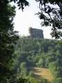
(9) Here I suggest a round trip to the hamlet of Les Ballats, which has some beautiful old houses, following the course of the Couze Chambon. To do this, turn right and follow the Chemin de la Couze, which runs below and to the left of the cemetery. The small road approaches the Couze and crosses the river via a bridge. At a fountain, turn right and you’ll come to another bridge over the Couze. Carry on a little way along the other side and you’ll have a view of Murol Castle, which overlooks the hamlet.
(10) Retrace your steps to reach the rear of the church.
(9) Carry on along the road, keeping the church on your left. At the end of the street, cross the Couze via a bridge, which features a fountain. On the other side, turn right to find the entrance to the Museum of the Murol School of Painting. You’ll also find the ‘Le Levat’ signpost. Take the street to the left of the museum, towards Ferréol, following the yellow signposts. Walk past the entrance to the Prélong Municipal Park (where you can take a stroll; the sculpture ‘L’Homme Couché’ is at the very end). At the junction near the ‘Ferréol’ signpost, with the Croix Saint-Ferréol on your right, veer slightly left towards ‘Le château’. You’ll pass a large picnic area on your left and arrive at the ticket office and shop at Murol Castle. You’ll also find the ‘Le château’ signpost.
(11) Turn left onto the path towards Fougère, which is signposted GR® (red and white). At the Fork in the road, marked ‘Fougère’, head up to the left towards Les Bernades. You’ll reach the D5; follow it carefully to the left until you reach the rest area and car park (S/E).
 Visorando Member
 Moderate