


 Country:

 City:
City:


Park in the small car park by the cemetery. Coming from the D5, turn right onto the D617 towards Beaune-le-Froid, drive through the village centre and then, at the exit, opposite a cross, turn left onto the small road (signposted ‘Cimetière’), drive down the access road to the cemetery on the left (two or three parking spaces at the cemetery entrance).
(S/E) Head back up to the road and follow it to the right to quickly reach the ‘Le Pont’ signpost. Turn left towards Près de la Croix. Pass a small cross, and at the junction marked ‘Près de la Croix’, head straight on towards Croix de Barbat. You will soon reach this new signpost (a small stone cross) and follow the road to the right towards Coujat.
(1) At the Coujat signpost, continue straight on towards Pré Soubre, carefully following the road (D617) to the left (a fairly long stretch of road; see Practical Information). From the road, you have a fine view to the north-west of the Puys de la Védrine and Baladou.
(2) Further on, turn left onto Chemin de Berlaire. Pass a farm and continue to Champsiaux (a few metres past the junction, you’ll see an abandoned farm and a renovated outbuilding with an old Saint-Nectaire cheese cellar). Turn right onto the road just before the sign marking the entrance to Champsiaux.
(3) At the Le Pré Soubre signpost, turn left towards Champ de la Roche. You will need to cross a first cattle grid to enter a sheep pasture. Several cattle grids, some of which are unnecessary, will be encountered further down the slope. In the meadow, follow the fence on your right. However, before the steeper descent, I recommend veering left, towards the middle of the meadow’s slope, for a view of Lake Chabom and the valley. Shortly into the descent, leave the path (which ends shortly afterwards in a meadow) and follow the track straight ahead. Further down, it joins another path which you should follow to the left. You will come to an orientation table (and an information board about this viewpoint on the Côte de Rouère).
(4) Continue along the path and further on you’ll reach the Champ de la Roche signpost. Take the path on the left, which is quite steep but short, to reach the D996 road (under construction until July 2026 just further down). Cross the road and follow the path opposite to reach a street in Chambon at a hiking signpost.
(5) Turn right towards La Cure and cross the bridge over the Couze de Surains (fountain). Look for the Pont chez Mareuge signpost. Continue straight on along this street (Route du Mont Dore), ignoring Rue des Forges on your left. Stay on this street as it turns left, leaving a square with a fountain on your left, and continue along the street (which becomes Rue des Anciens Combattants) until you reach Saint-Étienne Church. A very pretty Romanesque church, with murals in the chancel and a beautiful cross on the forecourt. Go round the church to the right (fountain), then rejoin Rue des Anciens Combattants and head towards the bridge on the right (below on the right, a covered wash house).
(6) At the junction with Route du Lac, on the other side of the bridge, head towards the cemetery entrance, on the left-hand side across Route du Lac. Walk up through the cemetery to the highly distinctive round Romanesque chapel. Then retrace your steps back to the junction and cross Route du Lac again.
(6) Continue along this road towards Lac Chambon and Murol (information sign for the chapel), then take the first road on the right, towards the campsite, Chemin de Pétary. You will walk alongside the Couze de Chaudefour.
(7) At the Pont de Pétary signpost, follow the signs for Les Vergnes along a path. At the Fork in the road, keep left. You will arrive at some ponds. Head left to walk alongside the ponds on your right. You’ll reach a hiking signpost (information board) and follow the signs for La Mouta. Ignore a path branching off to the left and you’ll arrive on the D996.
(8) Cross the road carefully and follow the Chemin de Fougerousse opposite, a small road that becomes a track further on. You will arrive in Varennes. Follow the road straight ahead, following the signs for the Varennes Ruins. At the junction of several streets, there is a wash house and a fountain down on the right; continue towards the Varennes Ruins via Rue Centrale. Take care not to miss Rue du Four, which is a hairpin bend to the left. It leads to a junction.
(9) Turn left to immediately find the remains of the feudal motte of Varennes (information board, self-guided tour), then continue following the red and white markings of the GR®30 (until otherwise indicated). At the La Mouta signpost, turn left to quickly reach another crossroads and follow the path to the right towards the Dent du Marais.
(10) At the next Fork in the road, keep to the right and follow the GR®.
(11) Viewpoint at the Dent du Marais, and the signpost of the same name. Continue towards Varennes, keeping uphill. You’ll pass other viewpoints over the lake, Murol and its castle. At the Varennes signpost junction, turn right towards La Garde. You’ll soon reach this signpost. Turn left towards Les Luges, leaving the GR® route.
(12) At the junction with the Les Luges signpost, turn left towards Le Creux du Mortier, and at the junction with this signpost, turn right towards Le Pont. Before reaching this signpost, turn right to reach the cemetery and the car park (S/E).
 Visorando Member
 Easy
Easy 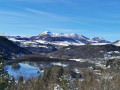
 Association / Club / Walk leader
