
Visorando Visorando
Visorando Visorando
  •  Tools 
    • Walking route planner
    • Import a GPX file
  • Walks
  • Help ↗
  • Visorando Premium
  • Sign up
  • Log in
Loading…
  1. Visorando
  2. M13I9C3H8

M13I9C3H8

M13I9C3H8
Visorando Member
Premium user

Sign up: 22 Apr 2017

Published routes 4

Published route(s)

  • List
  • Map

Walking La Pliou – Lac du Crozet – Col de la Pra – Croix de Belledonne
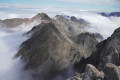
La Pliou - Lac du Crozet - Col de la Pra - Croix de Belledonne
↔12.58 mi ↗+5,292 ft ↘-5,292 ft ◔10h 25 ▲Very difficult
⚑Departure from La Combe-de-Lancey (Isère)
A lovely hike in the Belledonne massif leading to the Croix de Belledonne, following a route with a significant elevation gain. The route takes in the beautiful Lac du Crozet and the equally stunning Lacs du Doménon. It is possible to split the hike into two stages, spending the night at the very pleasant Refuge de la Pra.
Download PDF  PDF Download GPX  GPX

Walking Lac Blanc and Col de la Sitre circular route from La Souille

Lac Blanc et Col de la Sitre en boucle depuis la Souille
↔7.92 mi ↗+4,534 ft ↘-4,534 ft ◔7h 35 ▲Difficult
⚑Departure from Saint-Mury-Monteymond (Isère)
A walk leading to Lac Blanc and then on to the Col de la Sitre through a very open landscape of waterfalls.
Download PDF  PDF Download GPX  GPX

Walking Le Grand Colon

↔5.39 mi ↗+3,166 ft ↘-3,166 ft ◔5h 15 ▲Moderate
⚑Departure from Revel (Isère) (Isère)
A fairly short hike starting from the Baraque des Carriers car park, but very interesting and moderately difficult, with a beautiful view from the summit. A lovely moment shared at the summit with a ibex.
Download PDF  PDF Download GPX  GPX
Back to top
  • Privacy policy
  • Contact
  • Manage my cookies
  • Visorando community

Download the app now and go on an adventure!

App storeApp Store
Google playGoogle Play

Checking services status…© 2026 Visorando
 Loading…