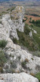
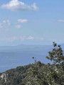
The Obieu Valley from Conhilac-Corbières

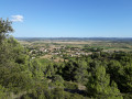
If you have an hour or two to spare in Conhilac-Corbières – at the end of the day, for example – this quick walk offers a lovely view over the Obieu valley, which is in fact the route from Toulouse to the Mediterranean for the motorway, the train and so on, with the Pyrenees in the background. The walk takes you past a field of wind turbines, giving you the chance to see for yourself the impact of this type of development.

Details

2330906
Creation:
Last update:
Last review:
  • Walking
    Activity: Walking
  • ↔
    Distance: 2.20 mi
  • ◔
    Average duration: 1h 20 
  • ▲
    Difficulty: Easy

  • ⚐
    Back to start: Yes
  • ↗
    Ascent: + 351 ft
  • ↘
    Descent: - 348 ft

  • ▲
    Highest point: 617 ft
  • ▼
    Lowest point: 262 ft

Photos

Description of the walk

The walk starts from the Place du Lavoir, situated in the heart of the village, set back slightly from the main road, the D6113.
This walk follows a route signposted in yellow. A rough map is displayed on a wall opposite the wash house.

(S/E) From this square, follow Rue de la Passerelle for 150 metres, then turn right onto Chemin des Oliviers. This section, within the village, is of little interest.
After 200 metres, turn left onto Chemin des Amandiers. At the end of this path, start climbing the hill opposite.

(1) When you reach the crossroads, turn left to reach the viewpoint.

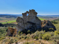
(2) Roc du Mignounet. A magnificent view over the valley; in good weather, the Pyrenees are visible in the distance. From there, continue to follow the yellow markings to return almost to the fork in the path.

(1) Continue left along the circular path through the heath. This section, which is partly shaded, is very pleasant.

(3) After going round the hill, you’ll reach the foot of the wind farm. It’s interesting to see for yourself the noise levels, for example.
From there, head down to the village below by following the D165 road.
Alternative route: follow the yellow markings to go round the small hill of “Lausine” and join the D165.

(4) Continue down the D165 towards the village, heading for the Place du Lavoir (S/E).

Waypoints

  1. S/E : mi 0 - alt. 266 ft - Place du Lavoir
  2. 1 : mi 0.57 - alt. 551 ft - Junction leading to the viewpoint
  3. 2 : mi 0.66 - alt. 614 ft - Viewpoint. Roc du Mignounet
  4. 3 : mi 1.49 - alt. 463 ft - Wind farm
  5. 4 : mi 1.84 - alt. 361 ft - Junction with the D165
  6. S/E : mi 2.2 - alt. 269 ft - Place du Lavoir

Notes

A short, easy walk.
No special equipment required.
There is a pub and a grocery shop in the village.
The water from the wash house is not drinkable, but there is a source of drinking water nearby.

Reviews and comments

4.7 / 5
Based on 2 reviews

Reliability of the description
5 / 5
Ease of following the route
4.5 / 5
Route interest
4.5 / 5
b-attitude11
b-attitude11

Overall rating : 4.7 / 5

Date of your route : May 31, 2021
Reliability of the description : ★★★★★ Very good
Ease of following the route : ★★★★★ Very good
Route interest : ★★★★☆ Good
Very busy route : Yes

A pleasant walk with a superb view of the Corbières from the Roc du Mignonnet, complete with a picnic area.
The return journey is, thankfully, along a shaded road.

Machine-translated

mfz26
mfz26

Overall rating : 4.7 / 5

Date of your route : Aug 12, 2019
Reliability of the description : ★★★★★ Very good
Ease of following the route : ★★★★☆ Good
Route interest : ★★★★★ Very good

Machine-translated

Other walks in the area

For more walks, use our search engine .

The GPS track and description are the property of this route's author. Please do not copy them without permission.