A circular walk through the Manchet Valley starting from Val d’Isère

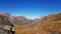
The Manchet Valley circular hike from the centre of Val d’Isère is an accessible hike that allows you to explore one of the most beautiful natural areas. Set amongst rivers, mountain pastures and majestic peaks, this route offers magnificent panoramic views all along the way. Ideal for a family outing or a contemplative stroll, this circular hike invites you to fully enjoy the tranquillity and unspoilt beauty of the mountains.

Details

99276854
Creation:
Last update:
Last review:
  • Walking
    Activity: Walking
  • ↔
    Distance: 3.08 mi
  • ◔
    Average duration: 1h 40 
  • ▲
    Difficulty: Easy

  • ⚐
    Back to start: Yes
  • ↗
    Ascent: + 285 ft
  • ↘
    Descent: - 285 ft

  • ▲
    Highest point: 6,276 ft
  • ▼
    Lowest point: 5,991 ft

Description of the walk

(S/E) From Place Jacques Moufflier, take Rue de l’Eau Vive opposite. At the end, turn right onto Rue Noël Machet, then keep left onto Rue des Lèches to reach the Charles-Diebold Sports Park.

(1) Enter the park and head to the right. At the end, continue to the left towards the Solaise chairlift. Pass between the various chairlifts and keep straight on along Rue de la Face. Continue along Rue du Joseray until you reach Le Châtelard.

(2) Carry on in the same direction until you reach the left-hand bend. Carry on straight ahead, then keep left towards the sports grounds.

(3) Pass the sports grounds and turn left twice to follow the road.

(4) Cross the road by turning left, then immediately right, and then immediately left again. Then carry on straight on until you reach La Légettaz.

(5) Keep straight ahead before continuing to the left. Pass under the Solaise cable car, then under the chairlifts, until you reach a junction.

(6) Turn right towards the church. Then turn left onto the Montée du Bellevue. At the bottom, keep left and return to the starting point (S/E).

Waypoints

  1. S/E : mi 0 - alt. 5,991 ft - Place Jacques Moufflier - Isère (rivière)
  2. 1 : mi 0.16 - alt. 6,010 ft - Charles Diebold Sports Park
  3. 2 : mi 0.89 - alt. 6,171 ft - Le Châtelard
  4. 3 : mi 1.5 - alt. 6,270 ft - Manchet Sports Park
  5. 4 : mi 1.74 - alt. 6,260 ft - Route - Calabourdane (ruisseau) - Affluent de l'Isère
  6. 5 : mi 2.4 - alt. 6,220 ft - La Légettaz
  7. 6 : mi 2.85 - alt. 6,043 ft - Crossroads
  8. S/E : mi 3.08 - alt. 5,991 ft - Place Jacques Moufflier

Worth a visit

The Manchet Valley is one of Val d’Isère’s must-see spots. The path is ideal for family walks. Parents can relax on the terrace of the restaurant (3) L’Art de Mets whilst the children let off steam in this unique mountain setting, thanks to the many activities on offer at the Parc des Sports. You can continue the walk to the bottom of the valley: you’ll pass a small ruined hamlet consisting of six chalets and a chapel. Climb a little further to admire the panoramic views and a waterfall. In the evening, take your little ones on a 30-minute walk from the Manchet chairlift towards the Arsellaz farm – bookings only. Don’t forget your torches or headlamps for the return journey!

Other walks in the area

For more walks, use our search engine .

The GPS track and description are the property of this route's author. Please do not copy them without permission.