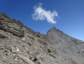
From Val d’Isère to Tignes via the Pas de la Tovière and back

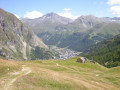
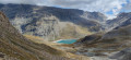
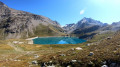
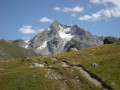
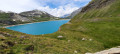
Val d’Isère offers a wide range of hiking options starting from the resort, in both winter and summer. We reached Tignes by following theGR®5for the most part, climbing through the wide-open spaces of the valley and the Tovière plateau, from where you can see many familiar peaks, such as the Rocher de Bellevarde, the Grande Sassière, the Dôme de la Sache, and even Mont Blanc.

Details

8017670
Creation:
Last update:
Last review:
  • Walking
    Activity: Walking
  • ↔
    Distance: 10.01 mi
  • ◔
    Average duration: 6h 45 
  • ▲
    Difficulty: Moderate

  • ⚐
    Back to start: Yes
  • ↗
    Ascent: + 2,467 ft
  • ↘
    Descent: - 2,477 ft

  • ▲
    Highest point: 7,480 ft
  • ▼
    Lowest point: 5,889 ft

Photos

Description of the walk

Coming from Bourg-Saint-Maurice, as soon as you’ve crossed the gorges upstream of Lake Chevril, you’ll arrive in Val d’Isère via the La Daille neighbourhood.
You’ll find the Funival funicular station on your right. Park in the car park serving the station, the Plaine de la Daille car park.

(S/E) Head towards the Funival and cross the bridge over the River Isère.

(1) Once across the bridge, turn left onto the left bank of the Isère and follow the path running alongside it.

(2) After about 400 m, ignore a path on your left that leads across the Isère via a footbridge and continue towards the Coves power station.
The footbridge may no longer exist, as major works have taken place in this area since our visit in 2009, when there was still a large grassy car park serving as a motorhome area.

(3) Just before the power station, take a path that climbs to the right. After a double hairpin bend, this path approaches the Chemin des Coves track.

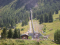
(4) Stay on the path as you move away from the track. Cross an area where water is running off (possibly resurgences), then shortly afterwards the path passes beneath the funicular line. Continue, crossing the Étroits larch forest.

(5) Approach the ski run and follow it for a few dozen metres, first crossing a chairlift (Les Étroits) and then the Daille gondola lift, before crossing two ski runs in succession, passing close to the Trifollet mountain restaurant.

(6) Cross the Tovière stream via a footbridge made of planks laid edge-to-edge, and head uphill opposite until you reach the GR®.

(7) Turn left onto the GR®.

(8) Pass close to the Tovière chalet (partially in ruins). Continue straight on along theGR®, whichclimbs up the Tovière valley, following a dry stream (at least in summer).

(9) You’ll pass close to a ruined hut, then walk alongside the Tovière altiport.

(10) Halfway along the altiport run, at the Chalets Supérieurs de la Tovière, carry on straight ahead. The path curves to the left and reaches the end of the altiport run.

(11) At the end of the runway, near a hut, turn right and head uphill towards the rocky landscape of the Pas de la Tovière.

(12) Once you have crossed the Pas de la Tovière, theGR® descends and then winds to the right; follow it. You will soon pass a rock-fill structure, built to protect the buildings at Lavachet from rockfalls. Continue towards the Rosset chairlift.

(13) After passing under the Rosset chairlift, turn left and pass under the Tovière gondola lift, then take one of the paths running alongside the lake.
You can walk right alongside the lake, crossing several wetlands and peat bogs via footbridges or wooden walkways. Then cross the Retort, a stream flowing down from Val Claret. This will take you back to the Lavachet neighbourhood, between the lake and the road.

(14) After passing the municipal swimming pool, just before the Tovière cable car station, cross a bridge and you’ll find yourself near the tennis courts. Go round them on the left and you’ll arrive at the start of the Rosset chairlift.

(13) Cross over the chairlift and rejoin theGR®5, heading in the opposite direction.

(15) Then take the path on the right which cuts across the hairpin bend of the
GR® 5.

(12) Head up towards the Pas de la Tovière and cross it.

(11) Carry on straight ahead towards the chalets.

(10) This time, keep left, heading towards the Croix de Combefolle.

(16) At the Croix de Combefolle, there is a picnic area, panoramic views and an orientation map. Take the path heading due south and rejoin theGR® at a ruined chalet.

(9) Follow theGR® to the left as you descend the Tovière valley to the Chalet de la Tovière.

(8) Above the chalet, carry on straight ahead along the GR®.

(7) This time, carry on straight ahead, staying on the same path, until it crosses the Tovière stream after a circular bend to the right.

(17) Cross the stream via a footbridge, then follow it along the right bank until you reach the Daille cable car station. Go round the station on the left and you’ll find yourself on the left bank of the Isère.

(1) At the Funival station, cross the bridge and return to the car park where you started (S/E).

Waypoints

  1. S/E : mi 0 - alt. 5,902 ft - Plaine de la Daille car park
  2. 1 : mi 0.06 - alt. 5,899 ft - Funival station bridge
  3. 2 : mi 0.33 - alt. 5,909 ft - Path on the right
  4. 3 : mi 0.51 - alt. 5,922 ft - Path on the right
  5. 4 : mi 0.66 - alt. 6,010 ft - Turn right – Do not take the track
  6. 5 : mi 1.39 - alt. 6,483 ft - Turn right to follow the track
  7. 6 : mi 1.7 - alt. 6,591 ft - Footbridge over the Tovière stream
  8. 7 : mi 1.8 - alt. 6,644 ft - Common junction for out-and-back route. GR 5
  9. 8 : mi 2.14 - alt. 6,955 ft - Tovière Valley
  10. 9 : mi 2.72 - alt. 7,274 ft - Common junction (out and return)
  11. 10 : mi 3 - alt. 7,349 ft - Superior Chalets at La Tovière
  12. 11 : mi 3.17 - alt. 7,444 ft - End of the altiport
  13. 12 : mi 3.93 - alt. 7,093 ft - Large downhill hairpin bend
  14. 13 : mi 4.49 - alt. 6,860 ft - Rosset chairlift
  15. 14 : mi 5.94 - alt. 6,844 ft - La Tovière cable car
  16. 15 : mi 6.41 - alt. 6,932 ft - Common junction for out-and-back route
  17. 16 : mi 7.8 - alt. 7,185 ft - Combefolle Cross
  18. 17 : mi 9.51 - alt. 6,145 ft - Crossing the Tovière stream
  19. S/E : mi 10.01 - alt. 5,902 ft - Plaine de la Daille car park

Notes

This route presents no difficulties for keen walkers. There are no navigation issues either, as you can always follow theGR® signposts if necessary.

If you do this walk in summer, you will almost certainly find the streams dry (including the Tovière), particularly as this is a karst landscape.

As for the starting point, in 2009 we set off from an open area used as a motorhome park, opposite the Coves factory. Since then, extensive and significant works have taken place in this area, and we have opted to designate the Funival car park as the starting point, thereby making the final section of our 2009 route (Funival – Coves) the start of this version of the route.

Worth a visit

Possible alternatives to this walk:
- Return from Tignes-Le Lavachet via the nature trail, climbing back up to the Combefolle cross – but this involves a steep descent followed by a climb of around 300 metres.
- Return from Tignes-Le Lavachet along the left bank of Lake Chevril, arriving directly at La Daille – advantages: it’s all downhill with no further ascent, but there’s a very long, almost level stretch along the lake, and you can also see the magnificent Salin waterfalls along the way.

Furthermore, when we did this walk, we were unaware of the Vallée Perdue, which is a spectacular canyon carved out of gypsum by the Tovière stream. It is a geomorphological feature that would have been well worth including in the route as follows: follow the stream upstream from the point (6) to the Tommeuses chairlift station, then rejoin theGR® via a track that leads to the eastern end of the altiport.

We’ll visit it on our next trip to Val d’Isère.

Always be cautious and plan ahead when you're outdoors. Visorando and the author of this route cannot be held responsible for any accidents occurring on this route.

The GR® and PR® markings are the intellectual property of the Fédération Française de Randonnée Pédestre.

Reviews and comments

4.1 / 5
Based on 3 reviews

Reliability of the description
4 / 5
Ease of following the route
4 / 5
Route interest
4.3 / 5
Bobby59
Bobby59

Overall rating : 4 / 5

Date of your route : Aug 18, 2022
Reliability of the description : ★★★☆☆ Average
Ease of following the route : ★★★★☆ Good
Route interest : ★★★★★ Very good
Very busy route : Yes

It’s a shame about the start of the walk, as most of the interesting paths are actually taken up by mountain bike descents.

I’d recommend the route through the Vallée Perdue – it’s really lovely.
Overall, the views are superb and this walk is definitely worth a look!

Machine-translated

stjo
stjo

I don’t know about you, but I think that the development of mountain bike resorts has seriously damaged the landscape. At least when it comes to downhill mountain biking, with those tracks that look like scars on the mountain slopes. Anyway, personally, I wouldn’t call that mountain biking; it should have a different name, because for me, mountain biking is more about exploring nature by bike whilst showing the utmost respect for the environment.

Machine-translated

Florent92
Florent92

Overall rating : 4 / 5

Date of your route : Aug 10, 2022
Reliability of the description : ★★★★☆ Good
Ease of following the route : ★★★★☆ Good
Route interest : ★★★★☆ Good
Very busy route : No

A lovely walk to explore the area around Val d’Isère and Tignes.
In fact, on the way there, the paths described are now reserved for mountain bikes and strictly off-limits to pedestrians. I took the Chemin des Côves from point 4 to point 8 (turn right and cross the stream via a bridge to reach it); I should have taken the GR5 straight away, as this path is of little interest.
On the way back, I opted instead for the Chemin des Combes on the outskirts of Tignes (heading down to Lake Chevril) and through the Gorges de la Daille for a change of scenery and different views.

Machine-translated

danielfr40
danielfr40

Overall rating : 4.3 / 5

Date of your route : Sep 02, 2021
Reliability of the description : ★★★★★ Very good
Ease of following the route : ★★★★☆ Good
Route interest : ★★★★☆ Good
Very busy route : Yes

Thank you for this route description – a lovely walk with the added bonus of seeing horses, which we did from Tignes, staying there, following the same route as you.
We did encounter a few issues due to changes made after your visit.
The path you took to climb up from Val d’Isère has been converted into a downhill mountain-bike route, which is off-limits to pedestrians.
We took the parallel ascending track, which was less pleasant, especially in full sun.
On the descent back to Val d’Isère, at point 7, I couldn’t find your path – no doubt my own mistake – so I took a track halfway between your descending path and the one going uphill.
The track was under construction, diverting me onto a very steep path running alongside a dry stream. A magical setting amidst rocky outcrops and almost cave-like, colourful formations. Thanks to my mistake and the roadworks, I’d recommend
a few people around but not too many in early September
Thanks again

Machine-translated

Other walks in the area

For more walks, use our search engine .

The GPS track and description are the property of this route's author. Please do not copy them without permission.